Download
3D Flyover
Add to list
More
32.6 km
~6 hrs 45 min
145 m
Multi-Day
“A long, gentle loop of sandy forest and heathered “bergs” on the quiet Sallandse Heuvelrug.”
You’ll be walking a big, gentle circuit across the southern half of Nationaal Park Sallandse Heuvelrug (Overijssel, Netherlands), linking a string of low “bergs” (Holterberg, Noetselerberg, Prengenberg/Sprengenberg area) and the quieter edges around Hegejanskamp. Although the route is long at ~33 km / ~20.5 mi, the terrain is mostly rolling and forgiving, with only about ~100 m / ~330 ft of total ascent spread out over the day—think sandy forest tracks, heathland paths, and wide management roads rather than sustained climbs. (en.wikipedia.org)
A practical, well-served place to start (and easy to navigate back to after a long loop) is Buitencentrum Sallandse Heuvelrug, Grotestraat 281, 7441 GS Nijverdal—a major visitor hub with parking, facilities, and multiple trail spurs feeding into the ridge. (staatsbosbeheer.nl)
Getting to the start (car + public transport)
By car: Set your navigation to Grotestraat 281, 7441 GS Nijverdal (Buitencentrum Sallandse Heuvelrug). There’s free parking and it’s designed as a primary access point for walkers. (staatsbosbeheer.nl)
By public transport: Take the train to NS Station Nijverdal, then connect locally (the visitor center notes access via the station with regional transit). From the station area, it’s a short hop by bus/taxi or a warm-up walk depending on your exact connection and chosen approach. (staatsbosbeheer.nl)
For on-trail navigation, load the loop in HiiKER and keep an eye on the many intersecting sandy tracks—this park has a dense path network where it’s easy to drift onto a parallel trail if you’re chatting or moving fast.
What the route feels like (by sections)
0–6 km / 0–3.7 mi: Forest approach and “ridge” warm-up
From the Nijverdal side, you typically ease into the landscape through mixed woodland and broad tracks that gradually rise onto the Salland ridge. Underfoot is often firm sand or compacted forest road; after wet weather, expect puddled depressions and soft patches where bikes and horses have churned the surface. The “climbing” here is subtle—short rollers rather than anything that spikes your heart rate.
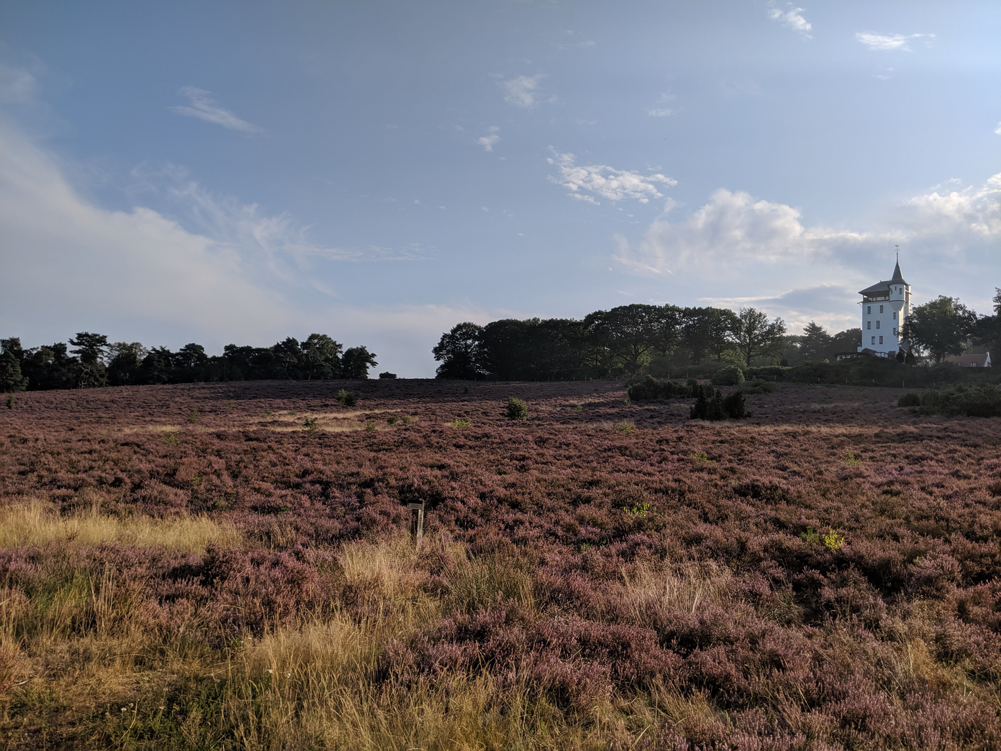
6–16 km / 3.7–10 mi: Heathland windows and the Holterberg/Noetselerberg character
As you gain the higher, drier ground, the scenery opens into heath interspersed with pine and deciduous stands, with long, airy sightlines when you cross open stretches. This is the signature Sallandse Heuvelrug feel: a mosaic of heather fields and forest blocks on an ice-age-formed ridge. (sallandseheuvelrug.nl)
If you’re timing this in late summer, heather can be at its most vivid; in cooler months, the same expanses feel bigger and more exposed to wind.
16–25 km / 10–15.5 mi: Prengenberg/Sprengenberg area and the long, easy miles
Mid-loop is where the distance starts to matter more than the elevation. You’ll likely spend extended time on straighter forest lanes and quieter connectors—great for steady pacing, but it’s also where people underestimate hydration and foot care because the terrain feels “easy.” Plan a brief stop every hour or so to check hotspots on your feet; sandy grit can work into socks and create blisters over a 20-mile day.
25–33 km / 15.5–20.5 mi: Hegejanskamp edges and the return
The final third tends to feel more secluded as you skirt less-visited edges and then funnel back toward the busier access points near Nijverdal/Holten. Expect more shared-use track sections near popular nodes; stay alert for faster cyclists on wider paths, especially on weekends.
Landmarks and meaningful places nearby
If you choose to add a short detour (or simply note it for another visit), the area around Holten is known for the Canadian War Cemetery (Canadese Begraafplaats Holten)—

Surfaces
Asphalt
Unknown
Sand
Concrete
Ground
Dirt
Comments and Reviews
User comments, reviews and discussions about the Holterberg, Prengenberg, Noetselerberg and Hegejanskamp Loop, Netherlands.
average rating out of 5
0 rating(s)