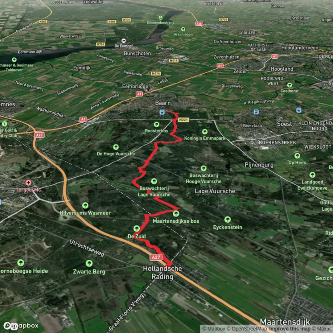
Hollandsche Rading to Baarn via Oertijd Route and Trekvogelpad
Download
Preview
Add to list
More
11.1 km
~2 hrs 15 min
20 m
Point-to-Point
“Wander from village to palace through whispering woods, ancient sands, and stories etched in royal landscapes.”
Starting from the small village of Hollandsche Rading, this 11 km (about 6.8 miles) route follows a gentle, nearly flat path through the heart of the Utrechtse Heuvelrug region, connecting the Oertijd Route with the renowned Trekvogelpad. The trailhead is conveniently located near the Hollandsche Rading train station, making it easily accessible by public transport from Utrecht or Amsterdam. For those arriving by car, parking is available near the station and along Vuurse Dreef.
Getting Oriented and Setting Out
The hike begins in a landscape shaped by ancient geological forces, with the Oertijd Route offering interpretive signs that highlight the area's Ice Age history. The terrain here is predominantly sandy heathland and mixed woodland, with the elevation gain negligible—less than 10 metres (about 33 feet) across the entire route. Navigation is straightforward, but for added confidence, hikers can use HiiKER to follow the route and stay on track.
Woodlands, Wildlife, and Historical Layers
After leaving Hollandsche Rading, the path quickly immerses you in the serene forests of the Utrechtse Heuvelrug. This region is known for its biodiversity, with chances to spot roe deer, foxes, and a variety of woodland birds, especially woodpeckers and songbirds. The Trekvogelpad, or "Migratory Bird Path," is aptly named, as it traces the routes of migratory birds across the Netherlands. Spring and autumn are particularly rewarding for birdwatchers.
At approximately 4 km (2.5 miles), the trail passes near Lage Vuursche, a picturesque village famous for its historic pancake houses and the stately Drakensteyn Castle, the private residence of Princess Beatrix. While the castle itself is not open to the public, the surrounding woodlands are rich with history and folklore.
Transition to Baarn and Notable Landmarks
Continuing north, the route gradually transitions from dense forest to more open parkland as you approach Baarn. Around the 8 km (5 mile) mark, you’ll notice the landscape opening up, with glimpses of the stately Soestdijk Palace in the distance—a former royal residence with beautifully landscaped gardens. The final stretch into Baarn is lined with ancient beech avenues and passes through the Baarnse Bos, a landscaped forest that once served as a royal hunting ground.
Finishing in Baarn
The hike concludes near Baarn train station, providing easy onward connections by train or bus. Baarn itself is a charming town with several cafés and bakeries, perfect for a post-hike treat. The entire route is well-marked, family-friendly, and suitable for all fitness levels, with no significant climbs or technical sections. For navigation and trail updates, HiiKER offers detailed maps and waypoints to ensure a smooth journey from start to finish.

Surfaces
Unknown
Sand
Unpaved
Dirt
Asphalt
Gravel
Comments and Reviews
User comments, reviews and discussions about the Hollandsche Rading to Baarn via Oertijd Route and Trekvogelpad, Netherlands.
average rating out of 5
0 rating(s)