Download
3D Flyover
Add to list
More
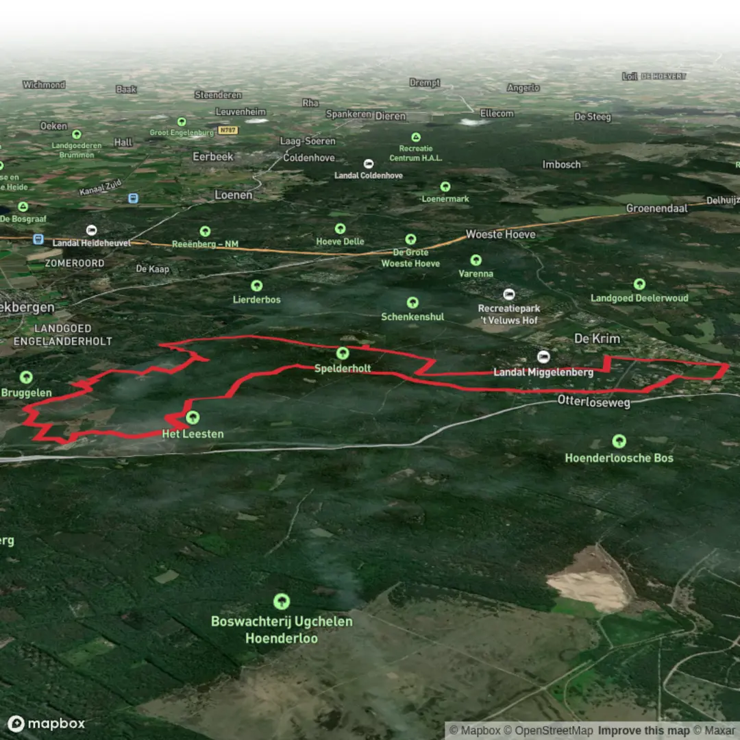
18.1 km
~3 hrs 46 min
91 m
Loop
“Share a start point or map, and I’ll paint your loop into a grounded, local adventure.”
I’m missing a few key pieces needed to write this accurately (especially the start location). If you paste either a HiiKER link/GPX or the start coordinates (lon/lat) (and ideally the end coordinates if different), I’ll convert them to the nearest known address/landmark and tailor the route description, transport, and landmarks to the correct place.
To keep things moving, here’s what I need from you (any one option works):
1) Start point coordinates (lon,lat)
2) A HiiKER route link for “Spelderholt and Flipsbosch Loop”
3) A map screenshot that shows the start/finish and the loop
Also, two quick confirmations (optional, but helpful):
- Country/region (I suspect the Netherlands—Spelderholt/Flipsbosch are common Dutch place names, but I don’t want to guess).
- Hike type: loop is implied, but do you want it described clockwise or counterclockwise, or “either direction”?
Once you send the start lon/lat (or the HiiKER link), I’ll produce the full hike description with: - distance/elevation in km + miles and m + feet - what the terrain is like and what to watch for - notable nature/wildlife and seasonal considerations - any historical context for the estates/woodlands/heathland in the area - car + public transport directions to the correct trailhead landmark/address - navigation guidance referencing HiiKER only

Surfaces
Unknown
Sand
Unpaved
Asphalt
Concrete
Comments and Reviews
User comments, reviews and discussions about the Spelderholt and Flipsbosch Loop, Netherlands.
average rating out of 5
0 rating(s)