Download
3D Flyover
Add to list
More
19.6 km
~3 hrs 56 min
13 m
Point-to-Point
“A gentle Veluwe wander of pine hush, heath-sky pauses, and arrow-straight rides—best for steady-paced walkers.”
This is a mostly level, forest-and-heathland ramble across the central Veluwe, linking Hoenderloo with the quiet woodlands around Rijzenburg via Pampelse Bossen, Middenzand, and the long, straight forest rides of Deelense Straal. Expect easy underfoot conditions (sand paths, compacted forest tracks, and occasional heathland singletrack), very little elevation change (effectively 0 m / 0 ft of sustained climbing), and a steady rhythm of scenery rather than big viewpoints.
Distance & ascent: ~20 km / 12.4 mi
Elevation gain: ~0 m / 0 ft (minor undulations only)
Difficulty: Easy (distance is the main factor)
Getting to the start (Hoenderloo)
Nearest well-known start point: the village center around Hoenderloo, Netherlands, close to Miggelenbergweg / Krimweg and the main village amenities (cafés, small shops). A very common, practical landmark to aim for is the Hoenderloo entrance area of Nationaal Park De Hoge Veluwe (near the village edge), even if your exact start is on a public path outside the park boundary.
By public transport (typical approach): - Travel to Apeldoorn (major rail hub for the area), then take a regional bus toward Hoenderloo. From the Hoenderloo stop(s), it’s usually a short walk to the trail network at the village edge. - Service patterns can vary by season/day; check the latest bus times before you go.
By car: - Drive to Hoenderloo and park in village parking areas or designated trailhead lots near the forest edge. If you choose a lot near the national park entrance, confirm whether it’s intended for park visitors and whether fees apply.
If you’re navigating on the day, load the route in HiiKER and keep an eye on where public paths meet any restricted areas—this region has a mix of open-access forest tracks, managed nature reserves, and military/controlled zones.
What the trail is like (surface, wayfinding, and pacing)
From Hoenderloo you’ll quickly be on classic Veluwe terrain: wide sandy tracks under pine and mixed woodland, with occasional softer sand patches that can slow pace slightly. Because the route is largely flat, it’s ideal for steady walking—plan your day around distance rather than climbs.
Wayfinding is generally straightforward because many sections follow long, straight forestry lanes (especially around Deelense Straal), but the trade-off is that junctions can look similar. In low-contrast forest (especially in overcast weather), it’s easy to take the “wrong straight line.” Use HiiKER at intersections and confirm you’re on the correct ride before committing—some parallel tracks run for kilometers.
Pampelse Bossen: deep Veluwe woodland (approx. first 5–7 km / 3–4.5 mi)
Soon after leaving Hoenderloo, the route settles into Pampelse Bossen, a quiet, managed forest landscape typical of the Veluwe. Expect: - Tall conifers and mixed stands with a soft, needle-strewn floor - Sandy, well-draining paths that stay walkable even after rain (though puddles can form in wheel ruts) - Occasional openings where you’ll feel the wind more and see the forest structure—straight rows in places, more natural regeneration in others
Wildlife is often most active early and late in the day. In this part of the Veluwe, hikers commonly watch for: - Red deer (often near edges and clearings) - Roe deer - Wild boar (more likely to be heard or seen as disturbed ground and rooting) Keep dogs leashed where required; boar can be defensive if surprised, especially if there are young.
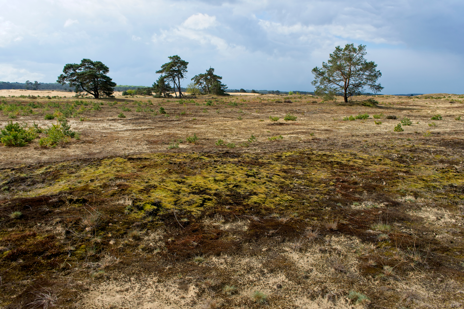
Middenzand: heath, sand, and big-sky moments (approx. middle 6–8 km / 3.7–5 mi)
As you transition toward Middenzand, the feel opens up. “Zand” in local place names often hints at sandy soils and open patches, and you’ll notice more: - Heathland edges and lighter woodland - Broader sandy stretches where footing can become looser - A more open horizon in places—subtle, but a welcome change from enclosed forest
This is a good section to plan a short break: it’s flatter, often brighter, and you’re more likely to find a dry spot off the main track. In warm weather, these open sandy/heath areas can feel surprisingly hot and exposed compared with the forest—bring sun protection even on a “forest hike.”
Deelense Straal: long straight forest rides and the Deelen area (approx. next 5–7 km / 3–4.5 mi)
Deelense Straal refers to a long, straight “straal” (a straight lane/ride) cutting through the forest—classic Veluwe forestry geometry. This section is easy walking and easy on the lungs, but it can feel repetitive, so it helps to: - Break it into chunks using junctions as milestones in HiiKER - Watch for subtle turns where a smaller path peels off the main ride
You may notice more signs of land management here: straight rides for access, habitat work, and occasional closures. Parts of the broader Deelen region are associated with controlled land uses (including areas with restrictions), so respect signage and stay on the mapped public route.
Approaching Rijzenburg (final 3–5 km / 2–3 mi)
Near Rijzenburg, the route typically

Surfaces
Unknown
Ground
Asphalt
Unpaved
Gravel
Comments and Reviews
User comments, reviews and discussions about the Hoenderloo to Rijzenburg via Pampelse Bossen, Middenzand and Deelense Straal, Netherlands.
average rating out of 5
0 rating(s)