Download
3D Flyover
Add to list
More
22.7 km
~4 hrs 43 min
114 m
Loop
“Drift through three Veluwe moods—estate lanes, working pines, and hushed rises—at your own pace.”
This is a long, low-relief Veluwe forest loop that strings together three distinct “moods”: the quiet, slightly higher ground around Braamberg, the dense production-and-nature mosaic of the Ugchelsche Bosch, and the estate landscape of Spelderholt with its castle setting and wildlife infrastructure. At roughly 23 km / 14.3 mi with about 100 m / 328 ft of total ascent, it’s physically Easy for most hikers, but the distance makes it a solid half-day to full-day outing depending on pace and stops.
A practical place to treat as the start is by Parc Spelderholt (Kasteel/Hotel Spelderholt), Spelderholt 9, 7361 DA Beekbergen, Netherlands, a well-known landmark on the edge of the woods between Beekbergen and Hoenderloo. (landelijk.socialekaartnederland.nl)
Getting to the start (car + public transport)
- By car: Navigate to Spelderholt 9, 7361 DA Beekbergen. There is on-site parking associated with the hotel/estate facilities; availability can vary with events, so arrive early on weekends and school-holiday periods. (parcspelderholt.nl)
- By public transport: The nearest larger rail hub is Apeldoorn; from there, regional buses serve Beekbergen. From Beekbergen village you’ll typically have a short taxi ride or a longer walk to reach the estate entrance at Spelderholt. (Use HiiKER to pin the exact start point and choose the most convenient approach on foot from your bus stop.)
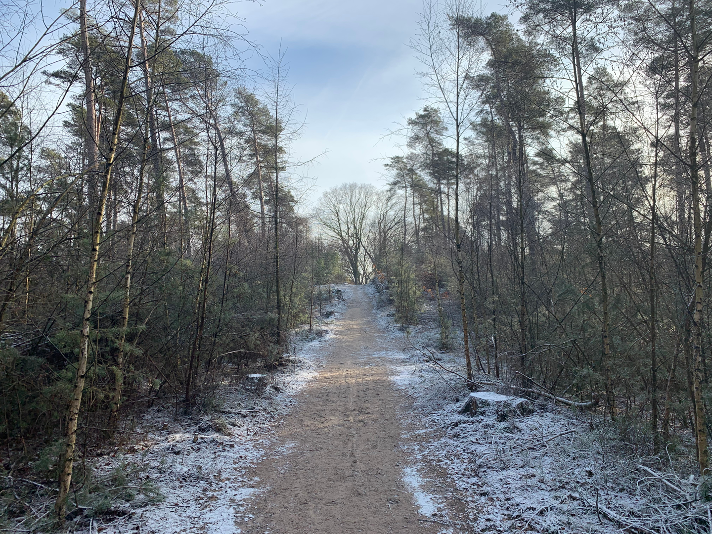
Expect mostly wide forest tracks and estate lanes with occasional narrower sandy paths. After rain, some sections hold water in wheel ruts; in dry spells, sandy stretches can feel softer underfoot.
What the route feels like, section by section
0–5 km / 0–3.1 mi: Estate edges into deep Veluwe woodland
Leaving the Spelderholt estate area, you quickly trade manicured grounds for working forest. The terrain is gently rolling rather than flat—small rises and dips that add up to the loop’s modest ~100 m / 328 ft of gain. Underfoot you’ll see a mix of compacted track and sandier patches typical of the Veluwe’s nutrient-poor soils.
This early part is often your best chance to spot wildlife sign: hoof prints in soft sand, rooting marks from wild boar, and well-worn game trails cutting across the main track. Dawn and dusk are prime times; in the middle of the day you’re more likely to hear movement than see it.
5–13 km / 3.1–8.1 mi: Ugchelsche Bosch—production forest with growing nature value
As you settle into the Ugchelen–Hoenderloo forestry landscape, the character becomes a patchwork: straighter forestry lines, blocks of conifers, and older mixed stands where oak and beech start to dominate. Staatsbosbeheer manages large parts of the Veluwe with a dual focus on forestry and nature, and this area is specifically noted as a place where nature and timber harvest “go hand in hand.” (staatsbosbeheer.nl)
What to look out for here: - Forestry operations: You may encounter temporary diversions, stacked logs, or heavy machinery tracks. Give working areas a wide berth and follow any posted closures. - Navigation at junction density: This is where multiple forest roads intersect at odd angles. If visibility is low (fog, dusk), keep HiiKER handy and confirm you’re taking the correct spur before committing—many tracks look nearly identical for the first few hundred meters. - Birdlife: Mixed woodland supports woodpeckers and songbirds; edges and clearings can be active with raptors cruising overhead.
13–18 km / 8.1–11.2 mi: Braamberg area—subtle high ground and quieter corridors
Around Braamberg you’ll notice slightly more “up-and-over” movement—still gentle, but enough to change the feel from purely level strolling. These small rises can be breezier and drier, and the forest often feels quieter away from estate activity. If you’re pacing the day, this is a good place for a longer break: you’re past the midpoint, and the remaining distance is manageable even if you slow down.
**18–23 km / 11.2–14.3 mi: Return via Spelder

Surfaces
Unknown
Sand
Concrete
Asphalt
Ground
Grass
Gravel
Dirt
Comments and Reviews
User comments, reviews and discussions about the Braamberg, Ugchelsche Bosch and Spelderholt Loop, Netherlands.
average rating out of 5
0 rating(s)