Download
3D Flyover
Add to list
More
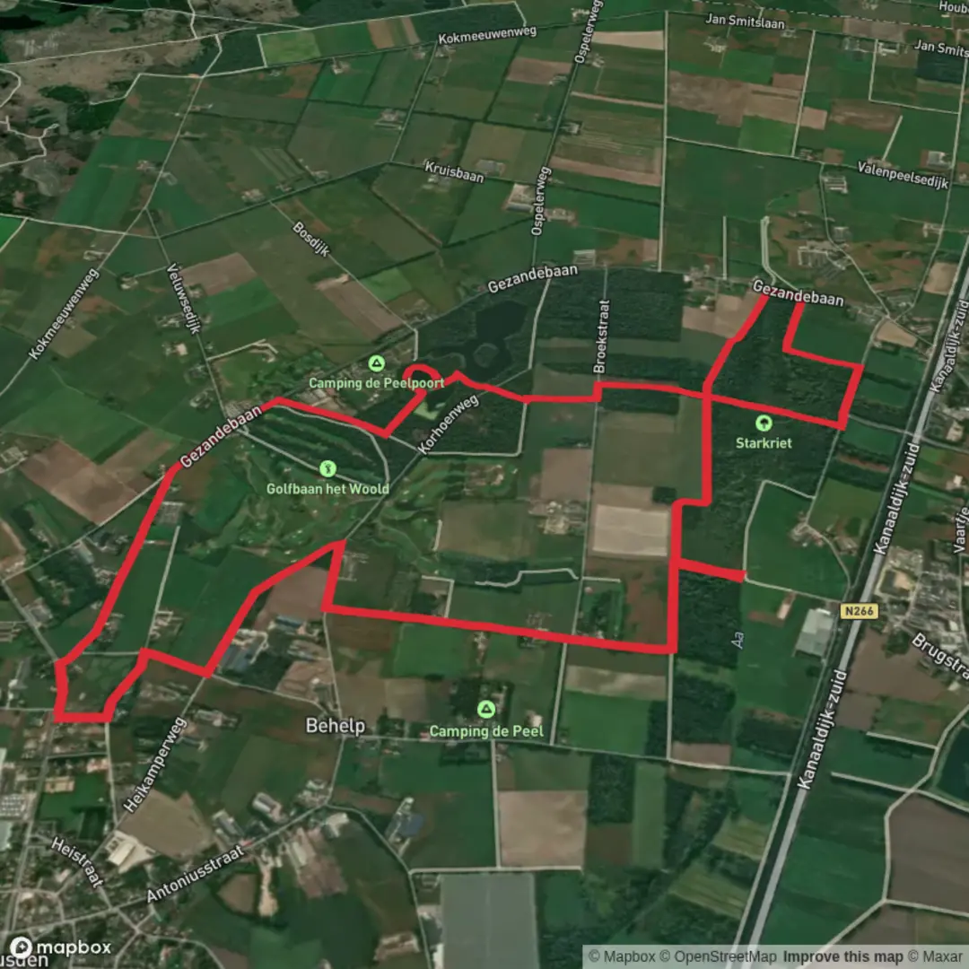
10.7 km
~2 hrs 8 min
0 m
Loop
“Winding from ancient ramparts to whispering wetlands, this loop paints Heusden’s countryside in vibrant, tranquil hues.”
Starting from the outskirts of Heusden, a charming fortified town in North Brabant, the Witte Bergen and Het Starkriet via Sengersbroek Weg loop covers approximately 11 km (6.8 miles) with virtually no elevation gain, making it accessible for hikers of all abilities. The trailhead is conveniently located near the intersection of Sengersbroekweg and the N267, just a short distance from the historic Heusden city center.
Getting There
Heusden is well-connected by public transport. From ’s-Hertogenbosch, take a bus (such as line 135 or 136) towards Heusden; alight at the “Heusden, Stadshaven” stop, which is about a 10-minute walk from the trailhead. For those arriving by car, parking is available near the city’s marina or at the public lot on Pelsestraat, both within easy reach of the starting point.
Trail Overview
The loop begins by skirting the edge of Heusden’s ancient ramparts, offering a glimpse into the town’s storied past as a strategic stronghold during the Eighty Years’ War. The route quickly transitions from cobbled streets to the open countryside, where the landscape flattens into a patchwork of meadows, wetlands, and wooded groves.
Witte Bergen and Het Starkriet
After 2 km (1.2 miles), the path enters the Witte Bergen, a serene area characterized by sandy soils and scattered birch and pine. This section is particularly tranquil, with the gentle rustle of leaves and the occasional call of a woodpecker. The sandy terrain here is a remnant of ancient river dunes, shaped by the Meuse’s shifting course over centuries.
Continuing north, the trail crosses into Het Starkriet, a low-lying wetland that supports a rich diversity of birdlife. In spring and summer, look for marsh harriers gliding above the reeds and listen for the distinctive calls of reed warblers. The wetlands are interspersed with small ponds and willow thickets, providing habitat for frogs, dragonflies, and, if you’re lucky, the elusive grass snake.
Sengersbroek and Rural Landscapes
At around the halfway mark, the route turns west along Sengersbroekweg, a quiet country lane lined with pollarded willows and traditional Dutch farmhouses. This area is dotted with grazing cattle and sheep, and in late summer, the fields are alive with wildflowers and butterflies. The flatness of the terrain ensures easy walking, with wide views across the open countryside.
Historical Significance
Heusden itself is a highlight, with its meticulously restored fortifications, star-shaped moat, and centuries-old windmills. The town played a pivotal role in Dutch history, particularly during the 16th and 17th centuries, and its ramparts are a testament to the region’s military engineering prowess. The surrounding countryside, once prone to flooding, has been shaped by centuries of water management, evident in the network of dikes and drainage channels you’ll encounter along the way.
Navigation and Preparation
The entire loop is well-marked, but for precise navigation and up-to-date trail conditions, use HiiKER. The flat, well-maintained paths make this route suitable for families and casual walkers. Sturdy walking shoes are recommended, especially after rain, as some sections near Het Starkriet can become muddy. Bring binoculars for birdwatching and a camera to capture the picturesque Dutch landscapes.
Refreshments and Facilities
There are no facilities directly on the trail, but Heusden offers several cafés and restaurants, perfect for a pre- or post-hike meal. Public toilets are available in the town center near the marina.
This easy, scenic loop offers a blend of natural beauty, wildlife, and Dutch heritage, all within a stone’s throw of one of the Netherlands’ most picturesque towns.

Surfaces
Unknown
Asphalt
Ground
Concrete
Sand
Grass
Gravel
Wood
Comments and Reviews
User comments, reviews and discussions about the Witte Bergen and Het Starkriet via Sengersbroek Weg, Netherlands.
average rating out of 5
0 rating(s)