Download
3D Flyover
Add to list
More
30.7 km
~6 hrs 8 min
0 m
Loop
“A long, level wander from Heeze into heath and whispering pines—sandy, scenic, and navigationally mindful.”
A roughly 31 km (19.3 mi) loop with essentially flat elevation (about 0 m / 0 ft of gain) through classic Brabant heathland, pine-and-birch woodland, and estate landscapes. Because it’s long but not steep, the main challenges are time-on-feet, sandy sections that slow pace, and staying oriented where multiple tracks braid through heath and forest.
Getting to the start (and where “near” typically means for this loop)
This loop is commonly started from the Heeze/Leende area on the south side of Eindhoven, close to the Strabrechtse Heide nature reserve. A practical “nearest landmark” start to aim for is Heeze railway station (Station Heeze), which is a well-known access point for routes that link into the Strabrechtse Heide and surrounding estates.
- By public transport: Take the train to Heeze Station (regular regional connections via Eindhoven). From the station area you can walk a short distance to pick up local paths and connectors toward the heath and estate tracks.
- By car: Navigate to Heeze Station or a signed Strabrechtse Heide parking area (often marked as a “P” for hikers). Arrive early on weekends—heathland parking fills quickly on fair-weather days.
If you share the exact start coordinates (lon/lat), I can pin it to the nearest specific street address or trailhead landmark and describe the first 1–2 km (0.6–1.2 mi) turn-by-turn more precisely.
What the terrain feels like over 31 km (19.3 mi)
Expect a mix of: - Wide sandy forest tracks (easy on navigation, slower underfoot) - Heathland paths (sometimes narrow, sometimes open and wind-exposed) - Estate lanes around Landgoed De Pan (often firmer footing) - Short paved or hard-packed connectors between natural areas
Even with “0 m” listed, you’ll still notice tiny undulations—dune-like sand rises and shallow depressions—just not sustained climbs. In wet periods, low spots can hold water; in dry spells, sand can be loose and energy-sapping.
Plan on 5.5–7.5 hours of moving time for most hikers depending on sand, wind, and breaks.
Route flow and key sections (approximate)
Because loops in this area often have multiple equivalent connectors, think of the day in three broad legs:
Lange Bleek to the estate landscapes (about 8–11 km / 5–6.8 mi)
The opening portion typically threads through woodland edges and drainage features—“bleek” place-names in the Netherlands often relate to wet ground, brooks, or historical bleaching fields (areas where linen was whitened using clean water and sunlight). Here you’re likely to see: - Pine plantations mixed with birch and oak pockets - Straight forestry lines intersecting at right angles (easy to drift onto the wrong parallel track if you’re not checking regularly)
Look out for sandy junctions where several tracks run side-by-side; it’s common to accidentally take the “next” track that looks identical. Keep HiiKER handy and confirm direction at each major crossing.
Landgoed De Pan (about 6–10 km / 3.7–6.2 mi)
Estate (“landgoed”) walking tends to feel calmer and more structured: long lanes, shelterbelts, and managed woodland. Footing is often firmer than the open heath.
Nature highlights you may encounter: - Old oaks and mixed deciduous stands that support woodpeckers and songbirds - Edge habitat (where forest meets open ground), which is excellent for wildlife viewing
Cultural/historical context: estates in North Brabant often reflect centuries of land management—wood production, hunting grounds, and later conservation-minded stewardship. Even when you’re not passing a “big monument,” the landscape itself is shaped by long-term human use: planted pine blocks, straightened tracks, and managed heaths that historically depended on grazing and cutting to stay open.
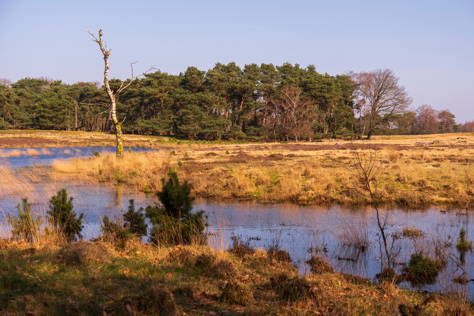
Strabrechtsche Heide (about 10–14 km / 6.2–8.7 mi)
This is the signature section: broad heathland with big skies, open sightlines, and a very different feel from the forest. Depending on the exact line of the loop, you may pass near: - Heath pools and wet hollows (important for amphibians and dragonflies in season) - Sandy ridges and open patches where wind can be a factor
Wildlife to watch for (quietly, from a distance): - Heathland birds (skylark-like song overhead in the right season) - Roe deer at forest-heath edges, especially early/late in the day - Reptiles such as lizards on sunny sandy margins (they’re quick—watch where you place hands if you stop on warm banks)
Heathland is also where navigation can feel deceptively simple—“just follow the open path”—but multiple desire lines can split and rejoin. In low visibility (fog, drizzle, or dusk), the openness can make it harder to judge which track is the main one. Use HiiKER to confirm you’re holding the correct bearing across the open stretches.
Practical planning: water, food, and facilities
For a 31 km (19.3 mi) easy-grade day, the limiting factor is usually fuel and hydration, not fitness on climbs.
- Water: Carry enough for several hours; open heath can be surprisingly drying in wind. Don’t rely on natural water

Surfaces
Asphalt
Unknown
Sand
Dirt
Gravel
Concrete
Unpaved
Wood
Comments and Reviews
User comments, reviews and discussions about the Lange Bleek, Landgoed De Pan and Strabrechtsche Heide Loop, Netherlands.
average rating out of 5
0 rating(s)