Download
3D Flyover
Add to list
More
11.6 km
~2 hrs 20 min
17 m
Loop
“Wander through tranquil fields, wildflower meadows, and historic bridges on this enchanting Dutch countryside loop.”
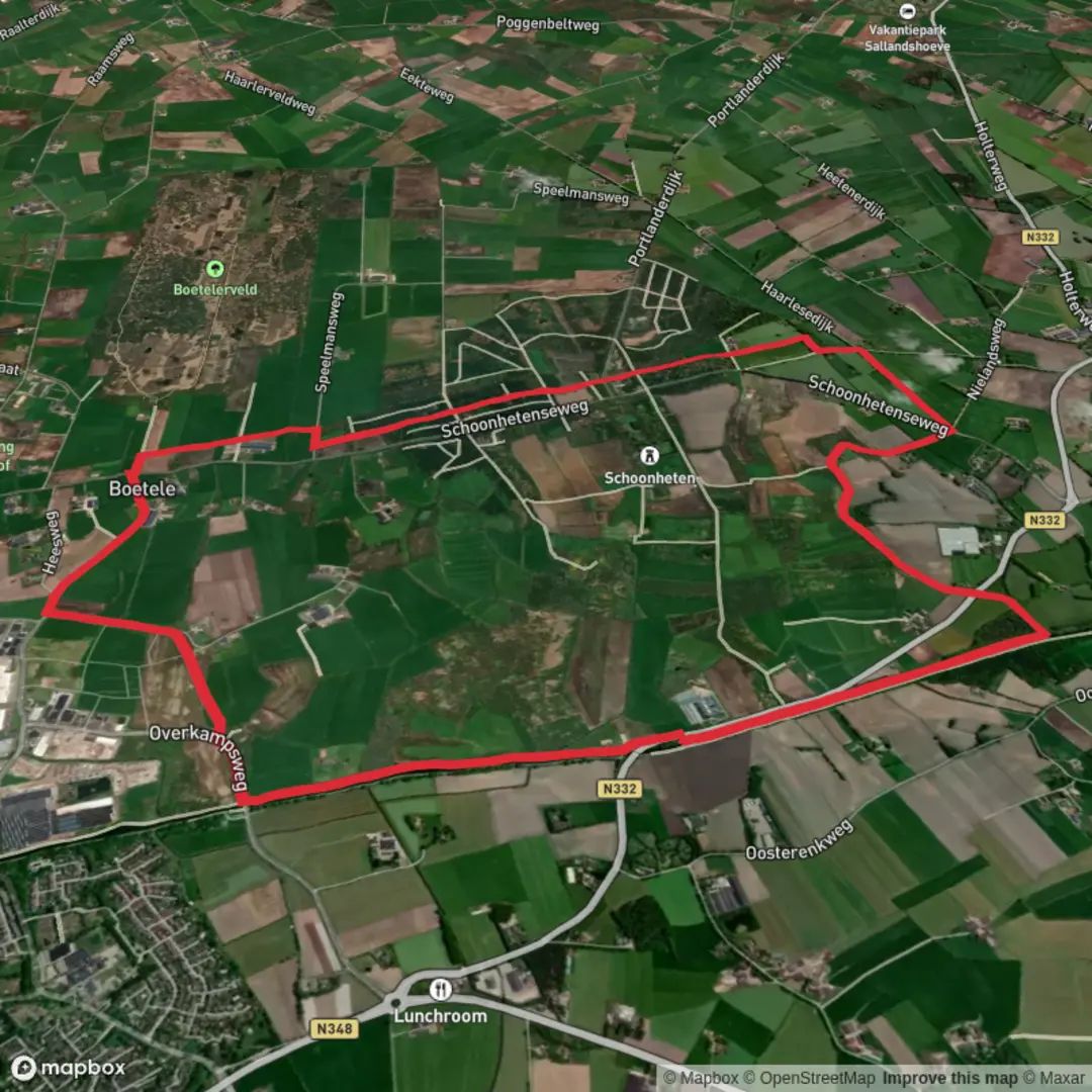
Embarking on the Ramelerbrug and Boetelerenk via Kreilemans Weg hike offers a delightful journey through the serene landscapes of the Netherlands. This approximately 12-kilometer (7.5-mile) loop trail is characterized by its flat terrain, making it accessible for hikers of all levels.
Getting to the Trailhead
The hike begins near the town of Raalte in the province of Overijssel. For those traveling by car, Raalte is conveniently accessible via the N35 highway, with ample parking available in the town center. If you're opting for public transport, Raalte railway station is well-connected by trains from major Dutch cities. From the station, local buses or a short taxi ride can take you to the starting point near Kreilemans Weg.
Trail Overview
Starting from Kreilemans Weg, the trail meanders through a picturesque mix of agricultural fields, dense woodlands, and open meadows. The well-maintained paths ensure a comfortable walking experience, with clear signage guiding you along the route.
Key Landmarks and Natural Features
Ramelerbrug: Approximately 3 kilometers (1.9 miles) into the hike, you'll encounter the Ramelerbrug, a charming bridge that spans a tranquil canal. This spot offers a perfect opportunity for a brief rest and to enjoy the surrounding water views.
Boetelerenk: Around the 8-kilometer (5-mile) mark, the trail leads you to Boetelerenk, an area known for its lush greenery and diverse flora. During spring and summer, the meadows here are adorned with vibrant wildflowers, attracting various butterfly species.
Flora and Fauna
The region boasts a rich biodiversity. As you traverse the woodlands, keep an eye out for native tree species such as oak, beech, and pine. Bird enthusiasts might spot species like the European robin, blackbird, and occasionally, the elusive kingfisher near water bodies. The open fields are often frequented by hares and, if you're lucky, you might even glimpse a roe deer in the early morning or late afternoon.
Historical Significance
The area surrounding Raalte has a deep-rooted history. The trail passes near old farmsteads that date back several centuries, reflecting the region's agricultural heritage. Additionally, remnants of ancient dikes and water management systems are evident, showcasing the Dutch's longstanding battle and harmony with water.
Navigation and Safety
While the trail is well-marked, it's advisable to use a reliable navigation tool to ensure you stay on course. HiiKER is an excellent app that provides detailed maps and real-time tracking for this route. Given the flat terrain, the hike is rated as easy, but it's always wise to wear comfortable walking shoes and carry sufficient water, especially during warmer months.
This hike offers a harmonious blend of natural beauty, wildlife observation, and a touch of history, making it a rewarding experience for all who embark on it.

Surfaces
Unknown
Sand
Ground
Concrete
Grass
Asphalt
Comments and Reviews
User comments, reviews and discussions about the Ramelerbrug and Boetelerenk via Kreilemans Weg, Netherlands.
average rating out of 5
0 rating(s)