Download
3D Flyover
Add to list
More
12.7 km
~2 hrs 32 min
0 m
Loop
“Big skies, timeless windmills, and tranquil fields paint a vivid portrait of classic Dutch countryside charm.”
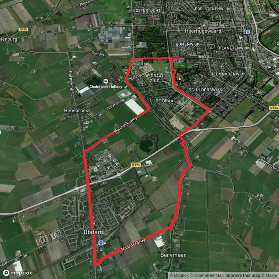
Starting from the outskirts of Heerhugowaard, a town easily accessible by train from Amsterdam (about 40 minutes), the Noord Hollandpad and Molendijks Weg loop offers a gentle 13 km (8 miles) journey through the heart of North Holland’s classic polder landscape. The trailhead is near the Heerhugowaard railway station, making it convenient for those arriving by public transport. For drivers, parking is available at the station or nearby shopping centers.
Navigating the Dutch Polder Landscape
This loop is almost entirely flat, with negligible elevation gain—perfect for those seeking a leisurely walk or a beginner-friendly hike. The route follows a combination of the Noord Hollandpad, a long-distance path traversing the province, and the Molendijks Weg, a scenic dike road. HiiKER is the recommended navigation tool for following the route, as it provides up-to-date trail maps and waypoints.
Landmarks and Points of Interest
Within the first 2 km (1.2 miles), the trail skirts the edge of Heerhugowaard’s residential neighborhoods before quickly opening up to wide, open fields. The polder landscape, reclaimed from the sea centuries ago, is defined by straight canals, windmills, and dikes. The Molendijk itself is a historic dike, built to protect the land from flooding and to manage water levels in the low-lying region.
At around 4 km (2.5 miles), you’ll pass close to the Broekhorn windmill, a classic Dutch windmill still in operation. This area is a great spot to pause and appreciate the engineering that has shaped the region’s history. The windmills here were vital for draining the land and making agriculture possible.
Nature and Wildlife
The route is lined with waterways, reed beds, and meadows, providing habitat for a variety of birds. In spring and summer, look for lapwings, godwits, and herons. The ditches and canals are home to frogs and, occasionally, otters. Wildflowers bloom along the dike in warmer months, attracting bees and butterflies.
Cultural and Historical Context
The Noord Hollandpad traces part of the ancient water management system that allowed the Dutch to reclaim and farm land below sea level. The Molendijks Weg itself is a testament to centuries of Dutch ingenuity in battling the sea. Small villages along the route, such as Broek op Langedijk, are known for their historic “vaart” (canal) systems, once used for transporting vegetables by boat.
Facilities and Logistics
There are several benches and picnic spots along the dike, especially near the windmill and at canal crossings. Cafés and shops can be found in Heerhugowaard and Broek op Langedijk, about halfway through the loop. Public toilets are available at the train station and in the town center.
The entire loop is well-marked, but using HiiKER will ensure you stay on track, especially at junctions where the Noord Hollandpad and Molendijks Weg intersect with local farm roads. The trail is suitable for all seasons, though waterproof footwear is recommended in wetter months due to occasional muddy patches near the canals.
This hike offers a quintessential Dutch experience: big skies, historic windmills, and the quiet beauty of the polder, all within easy reach of the city.

Surfaces
Asphalt
Unknown
Paved
Gravel
Comments and Reviews
User comments, reviews and discussions about the Noord Hollandpad and Molendijks Weg, Netherlands.
average rating out of 5
0 rating(s)