Download
3D Flyover
Add to list
More
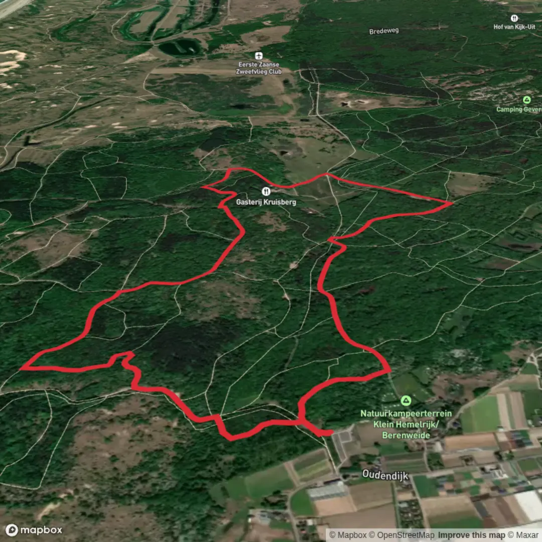
5.5 km
~1 hrs 6 min
7 m
Loop
“A calm, mostly level countryside loop where heritage whispers in hedgerows—watch for mud and wind.”
A gentle, mostly level loop of about 5 km (3.1 mi) with roughly 0 m (0 ft) of climbing, this walk is ideal for a low-effort outing where the focus is on scenery, local heritage, and relaxed pacing rather than physical challenge. Expect easy underfoot conditions overall, with the main variables being seasonal mud, farm/estate access, and wind exposure across open stretches.
Getting to the start (car + public transport)
Because the start point is only listed as “near” (no coordinates or town provided), the best way to pin down the nearest known address or landmark is to use the route’s start point in HiiKER (or share the longitude/latitude here and I’ll convert it to the closest recognizable place). In the meantime, here’s how to plan access once you’ve identified the start on HiiKER:
- By car: Navigate to the closest signed parking area shown near the trailhead on HiiKER. In this kind of lowland loop, parking is often at a village square, church, small recreation lot, or roadside pull-in near the first junction. Arrive early on weekends—spaces can be limited where lanes are narrow and parking is informal.
- By public transport: Use the nearest rail station or bus stop to the HiiKER start point, then plan a short walk-in (often 0.5–2.0 km / 0.3–1.2 mi). In rural areas, buses may be infrequent outside commuter hours, so check the last return service before you set off.
If you paste the lon/lat (or a HiiKER link), I can name the nearest street address or prominent landmark and tailor the transport directions precisely.
You’ll typically begin on a quiet lane or broad track, easing into the loop with minimal elevation change. With ~0 m (0 ft) of gain, any “ups and downs” will feel like subtle rises rather than true climbs—think gentle ramps, field-edge undulations, or small embankments. The first 1 km (0.6 mi) is usually about settling into the rhythm: look for waymarkers at junctions, and note any early gates or cattle grids that hint you’re crossing working land.
Underfoot, expect a mix of: - Firm gravel or compacted farm track (fast and easy) - Short grassy sections (can be slick when wet) - Occasional muddy patches in shaded hollows or along drainage lines, especially after rain
If the loop passes close to farms, you may encounter electric fencing, livestock, or temporary diversions. Keep an eye out for signage and give animals a wide berth.
Landmarks, landscape, and what to watch for
“Kruisberg” place-names commonly refer to a “cross hill” or a site historically associated with a wayside cross, chapel, or religious marker—often positioned at a junction, a boundary, or a slightly raised point in otherwise flat terrain. Even on a low-elevation route, a “berg” in local naming can indicate a modest rise or simply a historically notable spot rather than a true hill.
“Spaarpot” (“money box”/“piggy bank”) is the kind of name that often attaches to a local field name, small wood, old inn, or landmark with a story—sometimes tied to folklore, a former toll point, or a place where valuables were hidden during periods of unrest. If the loop passes a named farmstead, old boundary stone, or a small chapel, that’s often where these names come alive.
As you move through the middle of the loop (roughly km 1.5 to 3.5 / mi 0.9 to 2.2), the character tends to be defined by open fields, hedgerows, and small copses. This is where conditions can change quickly: - Wind exposure: Open farmland can feel much colder than the temperature suggests. - Soft ground: Tractor ruts can hold water; step on the raised edges rather than the deepest grooves. - Wayfinding at field corners: The “obvious” track sometimes isn’t the right one—confirm turns with HiiKER at each junction.
Wildlife is typically subtle but rewarding if you slow down: - Birdlife: Hedgerows and field margins often hold finches, thrushes, and corvids; wetter ditches can attract herons and waterfowl. - Small mammals: Rabbits and hares are common in open country; foxes are more likely at dawn/dusk. - Insects and wildflowers (seasonal): Spring and summer bring pollinators along verges; late summer can be rich in seed heads and butterflies where margins are left uncut.
If any part of the loop skirts woodland, watch for slippery leaf litter in autumn and rooty, uneven footing even on an “easy” trail.
Navigation and pacing
At 5 km (3.1 mi), most hikers will take 1–1.5 hours at a relaxed pace, longer if you’re stopping for photos or birdwatching. The main navigational challenges on short, flat loops are usually: - Multiple similar-looking junctions - Unmarked farm tracks - Temporary closures or reroutes
Keep HiiKER handy and check your position before and after each turn, especially where a track splits around a field or farm access road.
Practical prep for an easy, lowland loop
Even with minimal elevation gain, comfort and safety come down to surfaces and weather:

Surfaces
Unknown
Unpaved
Asphalt
Comments and Reviews
User comments, reviews and discussions about the Kruisberg and Spaarpot Loop, Netherlands.
average rating out of 5
0 rating(s)