
Download
3D Flyover
Add to list
More
28.1 km
~5 hrs 42 min
58 m
Point to Point
“A gentle, full-day ramble from Stepelo’s quiet lanes to Groenlo’s ramparts, with muddy surprises.”
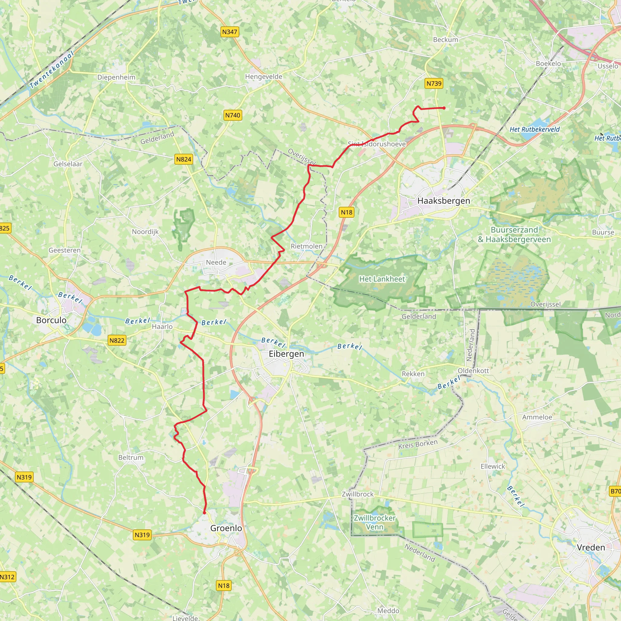
You’re looking at a long, low-relief walk through the eastern Netherlands, starting in the Stepelo area just north of Haaksbergen (Overijssel) and finishing in the fortified town of Groenlo (Gelderland, Achterhoek). At roughly 28 km (17.4 mi) with about 100 m (328 ft) of total ascent, it’s an Easy day in terms of climbing, but it’s still a full-distance outing—plan for time on mixed surfaces (pavement, farm tracks, woodland paths) and potentially muddy sections after rain.
Getting to the start (Stepelo, near Haaksbergen)
Best “known place” to aim for: Stepelo is a hamlet/area along the N739 (Haaksbergen–Beckum road), just north of Haaksbergen. (routeyou.com)
By public transport:
The most practical approach is to travel by train to Hengelo (NS station) and connect to regional buses toward Haaksbergen. Bus line information commonly lists stops in the Stepelo area such as “Stepelo, Beckummerweg” and “Stepelo, Deelweg.” (moovitapp.com)
Use HiiKER to pin the exact trailhead you want (for example, near one of those Stepelo stops) and to confirm the closest stop to your chosen start point.By car:
Drive to the Stepelo/Haaksbergen area and park considerately near public parking or wide verges by larger roads (avoid blocking farm access). Stepelo is directly associated with Haaksbergen and is easiest approached via the N739 corridor. (routeyou.com)
Getting back from Groenlo
Groenlo is served by regional buses from its Busstation (bus station). (drgl.nl)
If you’re returning to the rail network, you’ll typically bus onward to a nearby train station (often via larger towns in the region). Check connections day-of in HiiKER (for your route timing) and your local transit planner for schedules.
What the route feels like underfoot
Expect a classic Achterhoek/Twente borderland mix: quiet lanes, field edges, hedgerows, small woodlots, and drainage ditches/canals. With only ~100 m (328 ft) of gain spread across the day, the “ups and downs” are subtle—more like gentle rises over sandy soils and small embankments than any sustained climb.
Surface & footwear:
- In dry spells, trail runners or light hikers are fine.
- After rain, some farm tracks and woodland connectors can turn slick—bring footwear with decent tread and consider gaiters if it’s been wet.
Pacing:
For most hikers, 28 km (17.4 mi) is a 6–8+ hour day once you include pauses, navigation checks, and any time spent exploring Groenlo’s historic center.
Nature, landscapes, and wildlife to watch for
This region sits in a patchwork of agricultural land and managed woodland, which creates excellent edge habitat.
- Birdlife: You’ll often see (and hear) common farmland and woodland-edge species—keep an eye on fence lines, solitary trees, and wet ditches. Early morning and late afternoon are best for activity.
- Wet features: Even when the route looks “dry” on a map, the eastern Netherlands is laced with ditches, small streams, and ponds—these can attract amphibians and dragonflies in warmer months.
- Seasonal conditions:
- Spring: soft ground, active birds, fresh green hedgerows.
- Summer: long daylight, but exposed stretches can feel warm—carry more water than you think you’ll need.
- Autumn/W
- Spring: soft ground, active birds, fresh green hedgerows.
AI Planner
Days planned around your pace, with somewhere to stay each night.
Surfaces
Asphalt
Unknown
Grass
Unpaved
Concrete
Gravel
Wood
Comments and Reviews
User comments, reviews and discussions about the Stepelo to Groenlo via Austepad, Netherlands.
average rating out of 5
0 rating(s)


