Download
Preview
Add to list
More
27.8 km
~5 hrs 34 min
0 m
Point-to-Point
“Drift through hedgerowed fields and smuggler-laced border paths—flat, breezy, and quietly wild.”
This is a long, almost perfectly flat countryside circuit of about 28 km / 17.4 mi with roughly 0 m / 0 ft of climbing—ideal if you want steady, low-impact mileage on a mix of quiet lanes, farm tracks, and field-edge paths. You’ll be walking in the eastern Netherlands near the Achterhoek/Twente border area, where the landscape is shaped by small-scale farming, hedgerows, drainage ditches, and pockets of woodland—beautiful, but also exposed to wind and weather.
Getting to the start (Rietmolen area)
By car: Aim for the village of Rietmolen (postcode area 7165, Gelderland). A practical landmark to navigate to is St. Antoniuskerk (the church) in Rietmolen, which is the most obvious central reference point in the village. From there you can use HiiKER to line up the first leg onto Assinkweg and settle into the route.
By public transport: Rietmolen is small, so connections typically involve a train to a larger nearby town (commonly Neede or Haaksbergen depending on your approach) and then a regional bus onward. The most reliable way to match the day’s bus stops and walking access is to pin the start near Rietmolen village center (by the church) in HiiKER, then check the nearest bus stop it suggests for your exact start point.
What the walk feels like (surface, pacing, and exposure)
Expect easy navigation but frequent small turns: farm entrances, lane junctions, and path splits around fields. Underfoot is usually firm—paved cycle lanes, compacted farm tracks, and grassy margins—though after rain, field-edge sections can turn soft and the ditch-side verges get slick. Because the elevation is essentially flat, the main “difficulty” comes from distance, wind, and surface changes rather than hills.
Plan your pacing like a long day out: - 28 km / 17.4 mi is commonly 6–7.5 hours of walking time depending on breaks and ground conditions. - With little shade in open farmland, warm days can feel surprisingly draining—bring more water than you’d expect for a flat route.
Assinkweg: quiet lanes and the “coulisse” landscape
Early on, Assinkweg typically gives you that classic eastern-NL “coulisse” feel: a patchwork of fields separated by hedgerows, tree lines, and drainage ditches. You’ll pass scattered farmsteads and small woodlots; keep an eye out for: - Buzzards and kestrels hovering over fields - Hares and rabbits along field margins - In wetter stretches, frogs and plenty of insect life near ditches
What to look out for here is traffic behavior: even on quiet roads, you’ll encounter fast-moving local cars and cyclists. Walk single-file on narrow lanes and use HiiKER to anticipate bends where visibility is limited.
Kommiezenpad: border history, old routes, and boundary markers
The Kommiezenpad is named after the “commies”—border officials associated with controlling smuggling in this border region. (landschapoverijssel.routemaker.nl)
That history matters on the ground because the path often follows older lines of movement through the landscape—edges of estates, straighter connectors between hamlets, and routes that make sense for crossing a historically busy border area.
Along Kommiezenpad, you may encounter references to border stones (the route literature highlights specific numbered boundary stones in the area). (landschapoverijssel.routemaker.nl) Even if you don’t detour to each one, it’s worth slowing down when you see older markers or unusually straight boundary lines—this is one of the few “story-rich” sections of an otherwise nature-and-farmland day.
Practical notes for this section: - Some stretches can be narrow and grassy, with nettles/brambles in summer—long socks help. - After wet weather, expect mud at gates and pinch points where walkers funnel through.
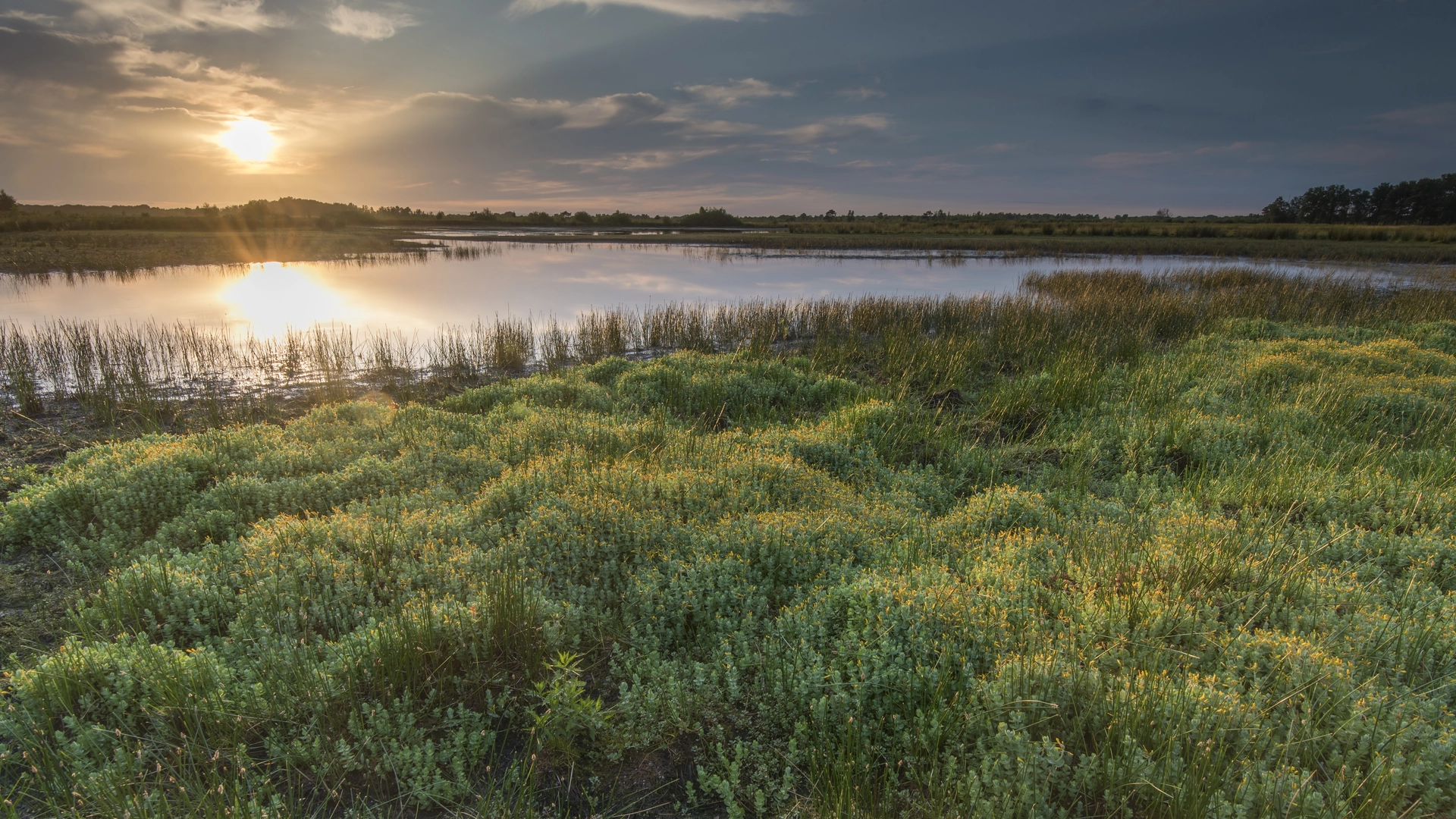
Werthepaatweg and the run toward Auskamplanden: open fields and wetland edges
As you transition onto Werthepaatweg, the route tends to feel more open—longer sightlines, more sky, and a stronger sense of the region’s flatness. Wind

Surfaces
Unknown
Asphalt
Ground
Dirt
Grass
Wood
Sand
Concrete
Gravel
Unpaved
Comments and Reviews
User comments, reviews and discussions about the Rietmolen to Auskamplanden via Assinkweg, Kommiezenpad and Werthepaatweg, Netherlands.
average rating out of 5
0 rating(s)