Download
3D Flyover
Add to list
More
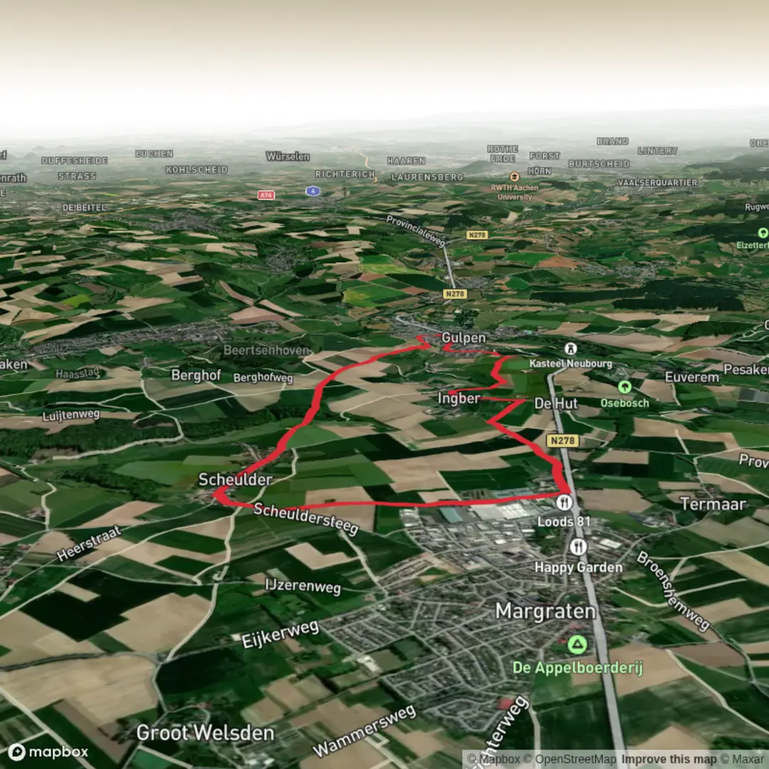
10.4 km
~2 hrs 13 min
81 m
Loop
“Stroll through blooming fields, historic villages, and tranquil woodlands, soaking up South Limburg’s enchanting charm.”
Starting from the charming village of Gulpen, this loop trail covers approximately 10 km (6.2 miles) with a gentle elevation gain of about 100 metres (328 feet), making it accessible for most walkers. The trailhead is conveniently located near the Gulpener Bierbrouwerij, a well-known local brewery, which also serves as a recognizable landmark for those arriving by car or public transport. Buses from Maastricht and Aachen stop at Gulpen’s central bus station, just a short walk from the starting point, and parking is available in the village center.
Route Overview and Navigation
The route winds through the rolling hills of South Limburg, passing through the picturesque villages of Wittem and Margraten before looping back to Gulpen. Navigation is straightforward, with well-marked paths and signposts at key junctions, but for added confidence and real-time tracking, HiiKER is recommended for up-to-date trail maps and waypoints.
Landmarks and Points of Interest
Shortly after leaving Gulpen, the trail ascends gently through patchwork fields and orchards, offering panoramic views of the Limburg countryside. At around 2 km (1.2 miles), you’ll reach Wittem, home to the historic Redemptorist Monastery and the striking Wittem Castle, both of which date back to the Middle Ages. The monastery is still active and welcomes visitors to its peaceful gardens.
Continuing towards Margraten, the landscape transitions into open meadows and small woodlands. At approximately 6 km (3.7 miles), the route passes near the Netherlands American Cemetery and Memorial, a significant World War II site where thousands of American soldiers are buried. The cemetery is open to visitors and provides a poignant reminder of the region’s wartime history.
Nature and Wildlife
The South Limburg region is renowned for its biodiversity. Expect to see a variety of wildflowers in spring and summer, as well as butterflies and songbirds along the hedgerows. The area’s mixed woodlands are home to roe deer and foxes, though these are more often heard than seen. The Gulp river valley, which the trail skirts at several points, supports kingfishers and herons.
Trail Conditions and Preparation
Paths are mostly compacted dirt and gravel, with some paved sections through villages. After rain, some stretches can become muddy, especially in shaded woodland areas. Sturdy walking shoes are recommended, but hiking boots are not essential unless conditions are particularly wet. There are several benches and picnic spots along the way, particularly near Wittem and Margraten, and cafes in each village offer opportunities for refreshments.
Getting There and Away
Gulpen is easily accessible by public transport, with regular bus services from Maastricht (about 30 minutes) and Aachen (about 40 minutes). For those driving, the Gulpener Bierbrouwerij and the central parking area in Gulpen provide convenient places to leave your car. The loop nature of the trail means you’ll finish back where you started, making onward travel simple.
For navigation and up-to-date trail information, HiiKER is the recommended tool to ensure you stay on track and make the most of your walk through this scenic and historically rich corner of the Netherlands.

Surfaces
Unknown
Asphalt
Gravel
Grass
Comments and Reviews
User comments, reviews and discussions about the Gulpen Wittem and Margraten Loop, Netherlands.
average rating out of 5
0 rating(s)