Download
3D Flyover
Add to list
More
17.4 km
~3 hrs 29 min
6 m
Loop
“Big skies, canal-side lanes, and a hushed woodland interlude make for an unhurried loop.”
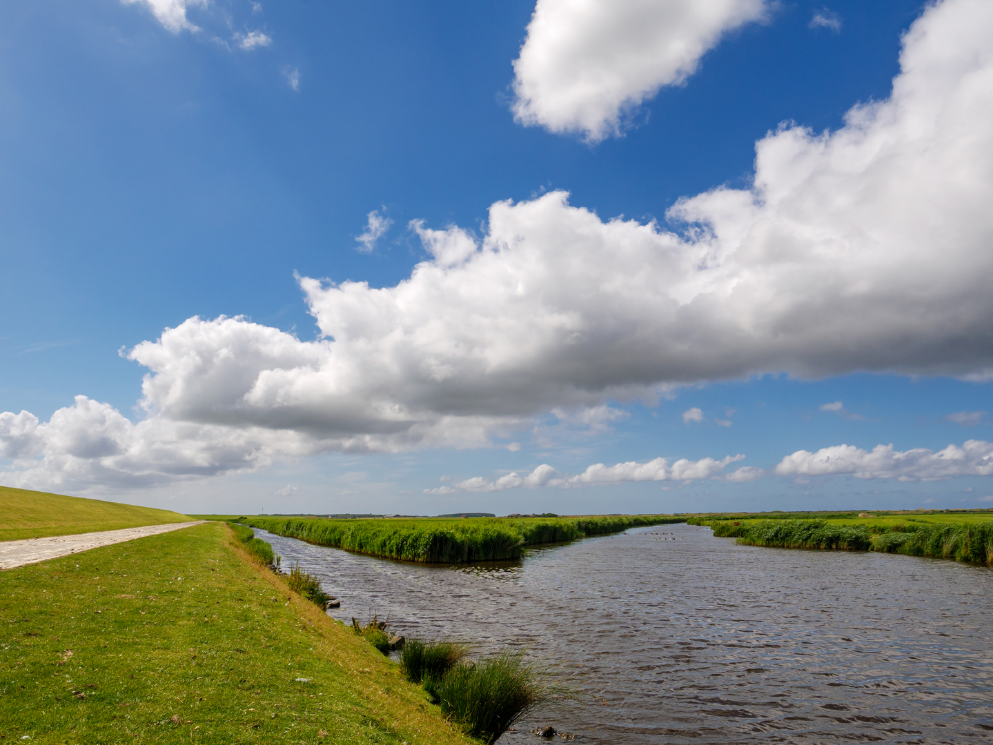
A flat, countryside-and-woodland circuit of about 17 km (10.6 mi) with essentially 0 m (0 ft) of climbing, this loop is ideal for a relaxed day out on firm paths, farm lanes, and easy woodland tracks. Expect big skies, open fields, drainage ditches and canals typical of the lowlands, then a quieter, shaded stretch through Sint Jan Sleutelbergbos before returning via the rural hamlets around Kaldenbroek.
Getting to the start (car + public transport)
Because the start point you provided is incomplete (“near …”), the most practical way to plan is to aim for the Kaldenbroek hamlet area near Venlo, Limburg (Netherlands) and choose a safe, legal pull-in or small parking area close to the first track on your HiiKER route. A common “anchor” landmark for navigation in this area is Kaldenbroek (near Venlo) and the borderland lanes leading toward Tegelen / Belfeld—use HiiKER to pinpoint the exact trailhead and then match it to the nearest signed road junction or parking bay.
- By car: Drive toward Kaldenbroek (Venlo area, Limburg) and park only where permitted (small rural lay-bys, signed trail parking, or village-edge parking). Rural roads can be narrow; avoid blocking farm gates and field access.
- By public transport: The nearest major rail/bus hub is typically Venlo. From there, local buses and/or a short taxi ride can get you close to the Kaldenbroek area. Plan the final approach as a short walk from the nearest stop to the HiiKER start point (bus stop locations vary by route and timetable).
If you share the route’s coordinates (or a HiiKER link), I can translate the start to the nearest known address or named landmark precisely.
What the terrain feels like
You’ll be on predominantly level ground—think compacted farm tracks, paved or semi-paved lanes, and woodland paths that are usually straightforward. After rain, the lowland soils can hold water: expect muddy patches, slick leaf litter in the woods, and occasional puddling along field edges and ditch lines. Footwear with decent tread is still worthwhile even on an “easy” profile.
The first third: open lowland lanes and field edges (0–6 km / 0–3.7 mi)
The opening kilometres typically move through agricultural countryside: long, straight lanes, hedgerows, and drainage channels. The walking is easy and rhythmic, but it’s also the most exposed section: - Wind exposure can be the biggest “difficulty” here—bring a light shell even on mild days. - Watch for farm traffic (tractors, delivery vans) on narrow lanes; step onto the verge early and visibly. - Along ditches and canals, keep an eye out for steep, undercut banks—they can crumble, especially after wet weather.
Wildlife is often subtle but rewarding: you may spot waterfowl along drainage lines, small songbirds in hedges, and (at dawn/dusk) hares moving between fields. In spring and early summer, field margins can be lively with insects—consider packing repellent if you’re sensitive.
Middle section: Sint Jan Sleutelbergbos—quiet woodland walking (6–12 km / 3.7–7.5 mi)
Once you enter Sint Jan Sleutelbergbos, the character changes quickly: more shade, softer ground, and a calmer soundscape. The paths are generally uncomplicated, but the woods can introduce a few planning points: - Trail junction density increases. Use HiiKER to confirm turns, especially where multiple forestry tracks run parallel. - Leaf litter and roots can be slick; take care on gentle bends and at small wooden bridges/boardwalk-like crossings if present. - In wetter periods, low spots can become boggy—you may need to skirt puddles along the edge of the track.
Nature highlights here tend to be close-range: woodland birds, fungi in autumn, and a more enclosed, “green tunnel” feel in late spring. If the route passes any small clearings, they’re good places for a short break—just be mindful of ticks in grassy edges (long socks and a quick post-hike check help).
Final third: returning through rural borderland scenery (12–17 km / 7.5–10.6 mi)
The loop typically eases back out of the trees into a mix of quiet lanes and field tracks. Fatigue is rarely from climbing—more from steady distance—so this is where foot comfort matters: - If you’re prone to hotspots, consider a brief stop around 12–14 km (7.5–8.7 mi) to adjust socks or tape. - Late in the day, low sun can reduce visibility on straight lanes; stay alert for cyclists and local traffic.
You’ll likely finish with the same broad lowland feel you started with—open horizons, water management features (ditches/canals), and the patchwork of farms and small wooded pockets that define this part of Limburg.
Landmarks, landscape character, and historical context
This region’s defining “landmark” is often the landscape itself: engineered lowlands shaped by centuries of farming and water control. The presence of drainage channels, straightened lanes, and managed woodland reflects long-term human use—fields laid out for productivity, woods managed for timber and habitat, and routes that often follow old property lines and practical connections between hamlets.
Given the proximity to Venlo and the Dutch–German border area, the wider region has a layered history of

Surfaces
Unknown
Unpaved
Asphalt
Gravel
Comments and Reviews
User comments, reviews and discussions about the Kaldenbroek and Sint Jan Sleutelbergbos Loop, Netherlands.
average rating out of 5
0 rating(s)