Download
3D Flyover
Add to list
More
18.2 km
~3 hrs 39 min
7 m
Loop
“Breezy Rhine floodplains: wide skies, grazing meadows, and muddy side-channels invite an unhurried loop.”
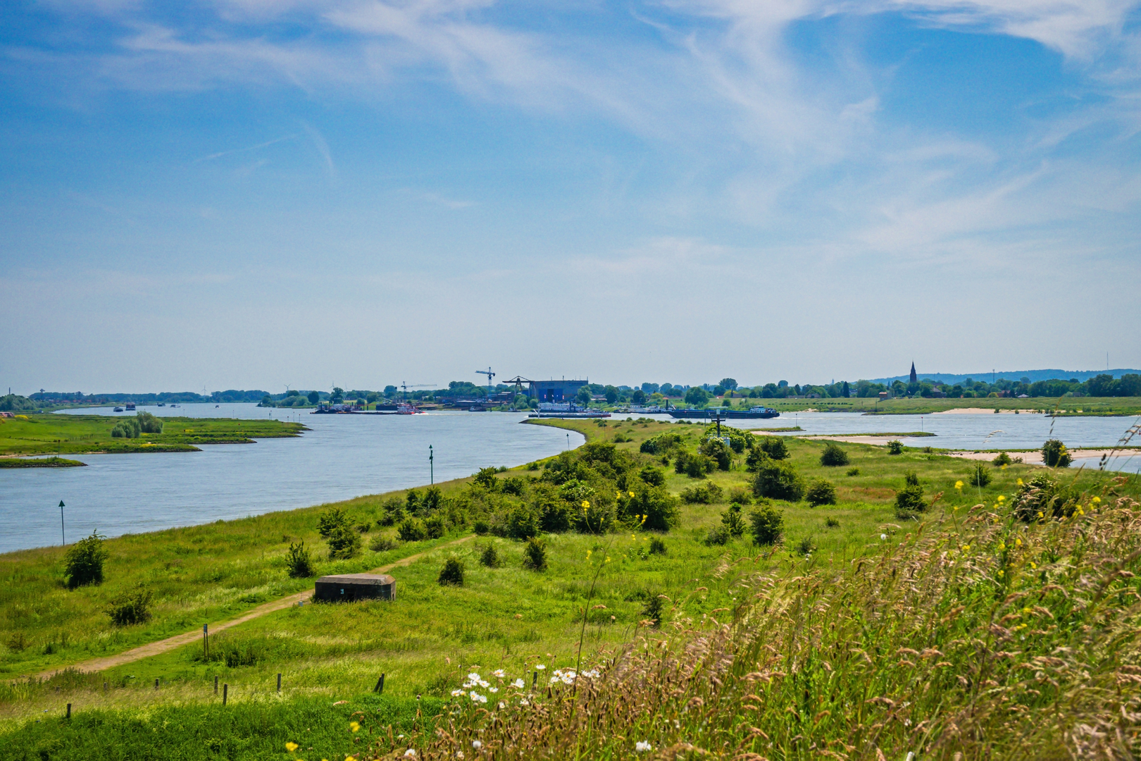
This is a flat, riverside loop through the Rhine floodplains just east of Arnhem/Nijmegen, where wide skies, grazing meadows, side channels, and dike-top paths make for an unhurried 18 km (about 11.2 mi) day. With essentially no climbing (around 0 m / 0 ft of gain), the main “effort” comes from distance, wind exposure on the dikes, and occasionally soft or muddy ground in the lower floodplain sections after rain or high water.
Getting to the start (car + public transport)
Because “near” isn’t fully specified, the most common and practical access for this loop is from the Huissen / Ressen edge of the floodplains—close to the Rhine dike between Arnhem and Nijmegen.
- By car: Aim for the Huissen side of the river landscape, using parking near the dike and floodplain access points. A reliable landmark to navigate to is Huissen (Lingewaard), Gelderland, then follow local signs toward the Rhine dike and uiterwaarden (floodplains). If you share a lon/lat for the exact trailhead, I can convert it to the nearest recognizable address/landmark and tighten this up.
- By public transport: The easiest approach is typically via Arnhem or Nijmegen (major rail hubs), then a regional bus toward Huissen. From Huissen, expect a short walk to the dike and floodplain entrances. Check the day-of schedule because rural bus frequencies can drop outside commuting hours.
What the route feels like underfoot
You’ll alternate between: - Dike-top paths (firm, open, often breezy; great visibility) - Floodplain tracks (can be grassy, uneven, and seasonally muddy) - Farm lanes / village edges (short connective stretches near Huissen/Ressen)
Plan on 4–5 hours of moving time for most hikers at an easy pace, plus stops for birdwatching and river views.
Landmarks, landscape, and the “waard” character
“Waarden” and “uiterwaarden” are the Netherlands’ working floodplains—land shaped by the Rhine’s seasonal rhythms and centuries of water management. Expect a big, horizontal landscape: dikes as the high line, and below them a patchwork of wet meadows, willow scrub, reedbeds, and side channels.
Over roughly the first 4–6 km (2.5–3.7 mi) you’ll likely settle into the pattern: dike walking with long views across the Rhine corridor, then dropping into the floodplain where the terrain feels more intimate—taller grasses, scattered shrubs, and occasional wet hollows. The middle of the loop is usually the most “wildlife-rich,” while the final third tends to feel more open again as you rejoin higher, firmer lines.
Nature and wildlife to look out for
These Rhine floodplains are prime habitat for: - Waterbirds: geese, ducks, swans, coots, and—depending on season—waders in shallow margins. - Raptors: kestrels and buzzards are common over open fields; you may also spot harriers quartering low. - Beavers and otter sign: in quieter side channels you might notice gnawed branches, slides, or tracks (sightings are luck-based). - Large grazers: many Dutch floodplain projects use cattle or horses for natural grazing. Give them space, pass calmly, and keep dogs under close control (or leashed where required).
Spring and early summer bring the most birdsong and wildflowers; late summer can mean taller vegetation and more insects; winter is excellent for big flocks and dramatic skies.
Historical significance: living with the Rhine
This region’s story is inseparable from the Rhine: dikes, polders, and floodplain engineering built to protect settlements while still giving the river room during high water. The villages around here—Huissen and the surrounding Lingewaard area—sit in a landscape that has been continuously shaped by trade routes, agriculture, and water control. Even when you’re simply walking a grassy track, you’re moving through a centuries-old system of river management and reclaimed land, where the “high ground” is often human-made.
Planning notes: weather, surfaces, and safety
- Wind exposure: With little shelter on the dikes, a mild forecast can feel colder. Bring a wind layer even on otherwise pleasant days.
- Mud and wet feet: After rain or when the Rhine is high, lower floodplain paths can be slick. Waterproof footwear or quick-drying trail shoes help; gaiters are useful in tall wet grass.
- High-water detours: Floodplains can be temporarily inaccessible. Before you go, check your route in HiiKER and be ready to stay on the dike if low paths are flooded.
- Sun and shade: Shade is limited. In warmer months, carry more water than you think you’ll need.
- Ticks: Tall grass and scrub can mean ticks in spring through autumn—long socks and a post-hike check are smart.
Distance breakdown (approximate)
- 0–6 km (0–3.7 mi): Easy dike and access tracks; big river views; very flat.
- 6–13 km (3.7–8.1 mi): The most “floodplain” feeling—side channels, wetter ground, best birdlife potential; watch for muddy patches.
- 13–18 km (8.1–11.2 mi): Gradual return toward village edges and firmer paths; wind can pick up again on exposed sections.
If you

Surfaces
Unknown
Asphalt
Ground
Grass
Comments and Reviews
User comments, reviews and discussions about the Roswaard and Huissensche Waarden Loop, Netherlands.
average rating out of 5
0 rating(s)