Download
3D Flyover
Add to list
More
18.2 km
~3 hrs 38 min
0 m
Loop
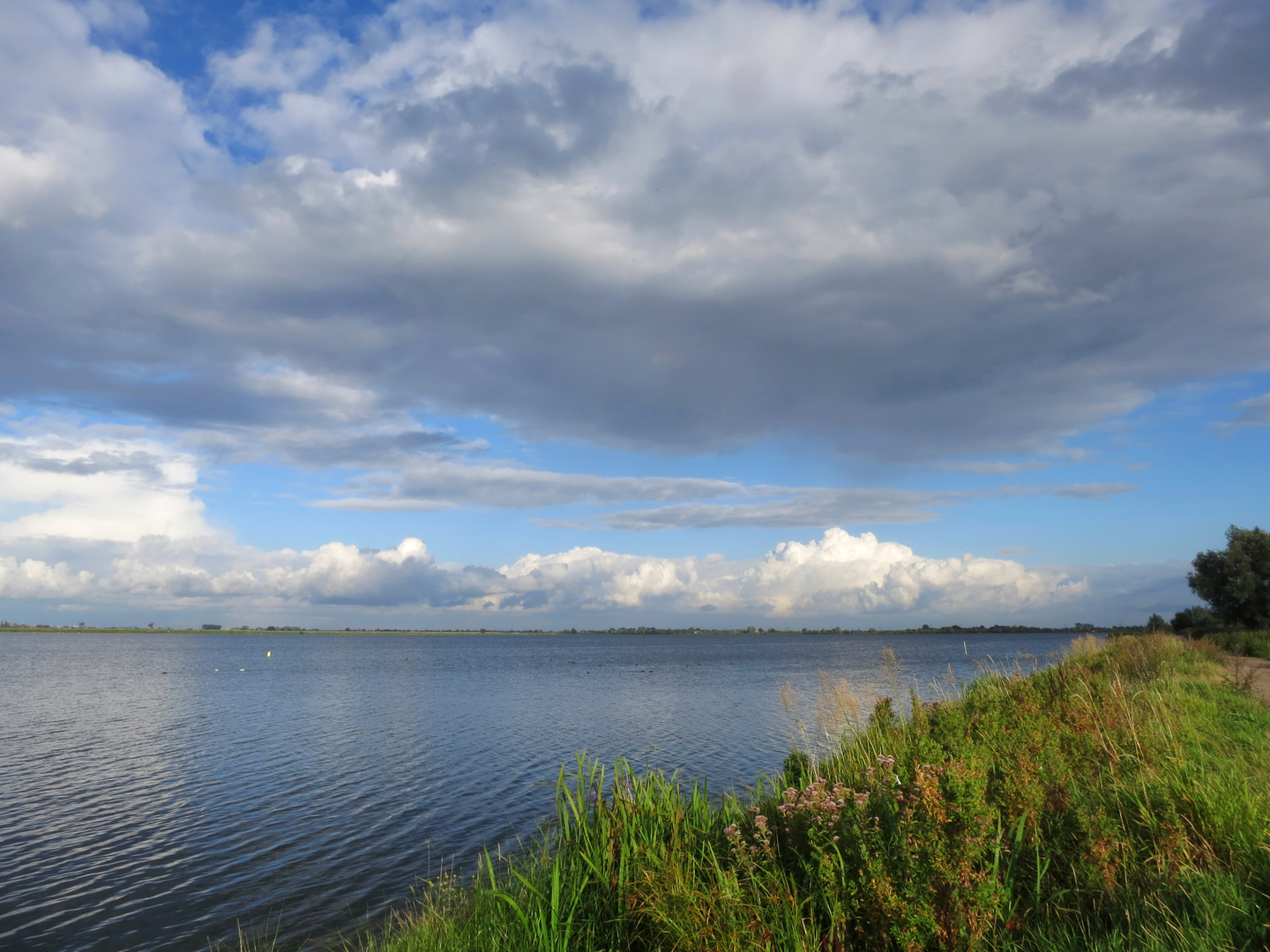
“A calm, sky-wide loop through Dutch plassen—reeds, wet meadows, and birdsong—best savoured steadily.”
An easy, mostly level loop of about 18 km (11.2 mi) with roughly 0 m (0 ft) of climbing, this walk strings together a classic Dutch “plassengebied” landscape: broad, open water, reedbeds, wet meadows, and long, straight paths on dikes and old peatland edges. Expect big skies, lots of birds, and a route that feels spacious and calm rather than dramatic—ideal for steady pacing and relaxed navigation.
Getting to the start (car + public transport)
Because the start point is only given as “near” (no coordinates provided), the most reliable way to pinpoint the exact trailhead is to open the route in HiiKER and use its start-point directions. That said, this loop name strongly suggests the Reeuwijkse Plassen area (South Holland, near Gouda), where Kalverbroek, Broekvelden, and Groot Vogelenzang are well-known polder/plassen sections.
- By car: Aim for the Reeuwijkse Plassen / Reeuwijk-Brug area, just east of Gouda. Common access points are near waterside parking areas and recreation entrances around the plassen. Once you have the exact start pin from HiiKER, you can navigate directly to the nearest parking lot.
- By public transport: The usual rail hub is Gouda (intercity connections). From Gouda, local buses typically run toward Reeuwijk-Brug / Reeuwijk-Dorp; from there it’s often a short walk to the dikes and waterside paths. Use HiiKER’s start location to choose the best bus stop for the day you go.
If you share the lon/lat (or a HiiKER link), I can convert it to the nearest known address or landmark precisely and tailor the transport directions to that exact start.
What the terrain is like and what to wear/pack
- Surface: Predominantly flat, with a mix of paved cycle paths, compacted gravel, and grassy or earthen dike-top tracks. After rain, some sections can be slick or soft at the edges—especially near reedbeds and drainage ditches.
- Footwear: Light hiking shoes are usually enough; choose something with decent grip if it’s been wet.
- Wind & exposure: With open water and polder fields, wind can be the biggest “difficulty.” Bring a windproof layer even on mild days.
- Water management: You’ll be walking alongside canals, ditches, and lakes for much of the loop—keep an eye on children and dogs near steep, grassy banks.
Route flow (approximate distances) You’ll typically move through three distinct landscape “chapters,” each with its own feel. Distances below are approximate for an 18 km (11.2 mi) loop.
1) Plassen edges and dike paths (0–6 km / 0–3.7 mi)
The opening kilometers usually follow straight, efficient paths along water margins and dikes. The views are wide and uncluttered: open lakes (“plassen”), reed fringes, and lines of willows or alder marking drainage channels. Because elevation gain is essentially 0 m, pacing is straightforward—your speed will be dictated more by wind and how often you stop to watch birds than by terrain.
Look out for: - Reedbeds and wet margins where you’ll often see waterfowl tucked out of the wind. - Narrow bridges and sluice structures (small water-control works) that hint at how engineered this landscape is.
2) Wet meadows, birdlife, and quiet backwaters (6–13 km / 3.7–8.1 mi)
This middle section is where the loop tends to feel most “nature-forward.” You’ll pass more sheltered stretches—backwaters, reed corridors, and meadow edges—where bird activity can be constant.
Nature and wildlife to expect
This is prime habitat for Dutch lowland wetland species. Depending on season, you may see: - Geese, ducks, coots, and swans on open water. - Herons and egrets hunting along ditch lines. - Marsh and reed specialists (often heard before seen) in denser vegetation. - In spring and early summer, meadow birds may be present in surrounding grasslands—stay on the path and keep noise low where signage requests it.
Bring binoculars if you have them; the flatness and open sightlines make wildlife viewing especially rewarding.
3) Return leg along open water and polder lines (13–18 km / 8.1–11.2 mi)
The final third often alternates between open, breezy water views and straighter polder connectors. This is where fatigue can sneak up—not from hills, but from steady walking and exposure. If the wind is in your face, it can feel like the route “takes longer” than the distance suggests.
Navigation and wayfinding
The area is crisscrossed with paths, dikes, and cycle routes that can look similar. Use HiiKER to:
- Confirm you’re taking the correct side of a canal or lake at junctions.
- Avoid accidentally following a parallel cycleway that diverges.
- Check for short detours if any path is temporarily closed for waterworks or maintenance.
Landmarks and regional history (what you’re walking through) This landscape is shaped by centuries of Dutch water management. The “plassen” in many parts of South Holland are closely tied to peat extraction and later water control—peat digging historically created low-lying pits that filled with water, and the

Surfaces
Unknown
Asphalt
Grass
Wood
Paved
Comments and Reviews
User comments, reviews and discussions about the Kalverbroek, Broekvelden and Groot Vogelenzang Loop, Netherlands.
average rating out of 5
0 rating(s)