Download
3D Flyover
Add to list
More
38.2 km
~2 days
0 m
Multi-Day
“A ruler-flat polder odyssey from Gouda’s edge to dike-country, where wind and miles test resolve.”
This is a long, ruler-flat lowland traverse through the Dutch “Groene Hart” and into the river-and-dike landscapes of the Lopikerwaard, linking urban edges, canal towpaths, and long straight polder roads. At ~38 km (23.6 mi) with roughly 0 m / 0 ft of climbing, the challenge is almost entirely about time-on-feet, wind exposure, and staying comfortable on hard surfaces rather than elevation.
Start and finish landmarks (nearest known places)
- Start (Gauda / Gouda area): The most practical “hike head” is Gouda Goverwelle railway station (in the Goverwelle neighborhood of Gouda). (en.wikipedia.org)
- Finish (Klaphek): “Het Klaphek” is a tiny hamlet in the rural south of IJsselstein (Utrecht), on/near the Lekdijk and close to where the Hollandse IJssel historically connected to the Lek. (routesinutrecht.nl)
Getting to the start (public transport and car)
By train (best option):
- Take Dutch rail to Gouda Goverwelle station, which sits on the Utrecht–Rotterdam corridor and is designed for easy access to the Goverwelle district. (en.wikipedia.org)
From the platforms, you can step straight into residential streets and green corridors that feed into the Goverwellepad/Jaagpad network.
By car: - Aim for parking near Gouda Goverwelle station (neighborhood streets and small lots are typical here). Start early to reduce parking friction and to give yourself daylight margin for a 38 km day.
What the route feels like underfoot
Expect a predominantly paved or hard-packed day: neighborhood paths, towpaths, dike-top lanes, and straight polder roads (Damweg-style farm roads). Even though the route is “easy” by elevation, it can be physically demanding because: - Hard surfaces can fatigue feet, knees, and hips over 23.6 miles. - The open polders and river dikes can be windy with little shelter. - Long straight segments can feel mentally longer than the map suggests.
Use HiiKER to keep an eye on junction density—towpaths and dike roads often have multiple parallel lines (road vs. cycleway vs. footpath) that look interchangeable until you’re on the wrong side of a canal.
Goverwellepad and the urban-to-polder transition (approx. 0–8 km / 0–5 mi)
Leaving the station area, you’ll quickly trade houses and local parks for the edge-of-city water management landscape that defines Gouda’s surroundings. This is classic peat-and-polder country: low fields, drainage ditches, and long sightlines.
You’ll notice how “flat” here isn’t natural flatness so much as engineered flatness—a landscape maintained by pumping, canals, and carefully controlled water levels. Gouda’s wider region is part of the Green Heart, where walking routes commonly thread between towns and wetland/polder features. (staatsbosbeheer.nl)
What to look for - Ditches, sluices, and pumping infrastructure: small but constant reminders that the land is managed. - Birdlife: in open pasture and wet margins, expect common Dutch polder species (waterfowl, gulls, corvids, and seasonal meadow birds). Bring binoculars if you like birding.
Watch-outs - Fast cyclists on shared paths—hold a predictable line. - Soft verges: the grass shoulder can be boggy even when the path is dry.
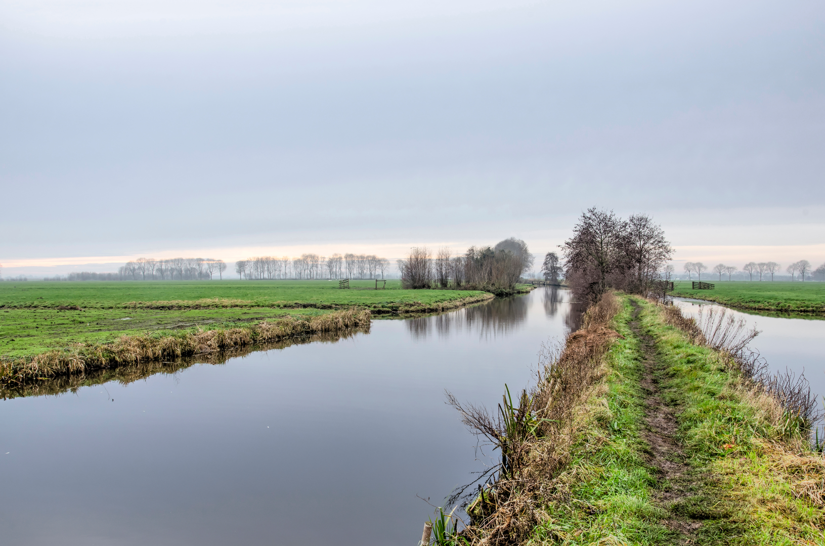
Jaagpad: towpath walking and waterway navigation (approx. 8–22 km / 5–13.7 mi)
“Jaagpad” literally refers to a towpath—historically used for hauling boats along canals and rivers. In practice, this section tends to be straightforward navigation: follow the water, stay on the correct bank, and keep an eye on bridges and crossings.
This is where the day can become deceptively demanding: the grade is still essentially zero, but the wind exposure and monotony of straight lines can add up. If the route runs near broader waterways, you may also feel cooler than expected due to evaporative chill.
Landmarks and landscape cues - Long, linear canals and riverside corridors that act like “handrails” for navigation. - Farmsteads on slightly

Surfaces
Grass
Unknown
Asphalt
Paved
Gravel
Unpaved
Cobblestone
Wood
Concrete
Comments and Reviews
User comments, reviews and discussions about the Gauda to Klaphek via Goverwellepad, Jaagpad and Damweg, Netherlands.
average rating out of 5
0 rating(s)