Download
Preview
Add to list
More
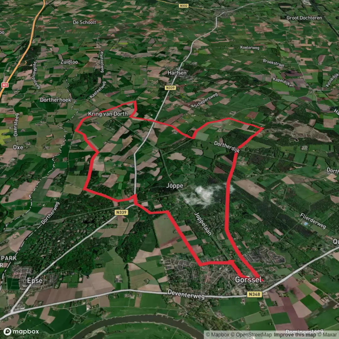
16.6 km
~3 hrs 20 min
20 m
Loop
“Wander the Drie Kieften Route for a vibrant tapestry of wildflowers, woodland whispers, and echoes of history.”
The Drie Kieften Route is a scenic and accessible trail approximately 17 kilometers (10.5 miles) in length, with minimal elevation gain, making it suitable for hikers of all skill levels. The trailhead is conveniently located near the village of Lettele in the province of Overijssel, Netherlands.
Getting There
For those traveling by car, Lettele is accessible via the N344 road, connecting Deventer and Holten. Parking is available near the village center, close to the trailhead. Public transportation options include taking a train to Deventer, followed by a local bus service to Lettele. It's advisable to check the latest schedules and routes to plan your journey accordingly.
Trail Overview
The Drie Kieften Route offers a diverse landscape, encompassing lush forests, open meadows, and serene waterways. The well-marked path ensures a straightforward hiking experience, with clear signage guiding you through the route.
Key Landmarks and Natural Features
Forested Sections: The trail meanders through dense woodlands, predominantly composed of oak and beech trees. These areas provide ample shade and are home to various bird species, making it a delightful spot for birdwatching enthusiasts.
Open Meadows: As you progress, the path opens up to expansive meadows dotted with wildflowers, especially vibrant during the spring and summer months. These sections offer panoramic views of the surrounding countryside.
Waterways: The route crosses several small streams and follows the banks of the Schipbeek canal for a portion. These water features not only enhance the scenic beauty but also attract a variety of wildlife, including herons and kingfishers.
Wildlife and Flora
The diverse habitats along the Drie Kieften Route support a rich array of wildlife. In addition to the aforementioned bird species, hikers might encounter roe deer grazing at the forest edges or spot hares darting across the meadows. The flora is equally varied, with seasonal blooms of bluebells in the woodlands and a mix of grasses and wildflowers in the open areas.
Historical Significance
The region around Lettele has a rich history, with evidence of human habitation dating back to prehistoric times. The trail passes near ancient burial mounds, known locally as "hunebedden," which are remnants of the Funnelbeaker culture from the Neolithic period. Additionally, the area played a role during World War II, with several resistance activities taking place in the nearby forests.
Trail Conditions and Recommendations
The Drie Kieften Route is predominantly flat, with well-maintained paths suitable for both hiking and cycling. However, certain sections can become muddy after heavy rainfall, so appropriate footwear is recommended. Facilities along the trail are limited, so carrying sufficient water and snacks is advisable. For navigation, consider using the HiiKER app to access detailed maps and trail information.
Safety and Etiquette
While the trail is generally safe, it's important to stay on marked paths to protect the local flora and fauna. Cyclists and hikers share portions of the route, so mutual respect and awareness are essential. Always inform someone of your hiking plans and expected return time, especially if venturing alone.
Embarking on the Drie Kieften Route offers a delightful blend of natural beauty, wildlife encounters, and historical insights, making it a rewarding experience for all who traverse its path.

Surfaces
Asphalt
Sand
Unknown
Concrete
Comments and Reviews
User comments, reviews and discussions about the Drie Kieften Route, Netherlands.
average rating out of 5
0 rating(s)