Download
3D Flyover
Add to list
More
15.7 km
~3 hrs 8 min
0 m
Loop
“Wander through tranquil wetlands, wildflower meadows, and historic borderlands where nature and history entwine.”
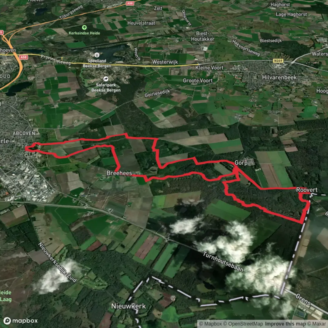
Starting from the outskirts of Goirle, a small town in the southern Netherlands, this 16 km (about 10 miles) loop hike along the Grenslandpad offers a gentle, flat journey through a landscape shaped by both nature and history. The trailhead is conveniently located near the recreational area of ‘t Zand, a well-known local landmark, making it easy to find whether arriving by car or public transport. From Tilburg Centraal Station, frequent buses run to Goirle, with stops near ‘t Zand, while drivers will find ample parking at the recreation area.
Trail Overview and Navigation
The route follows a section of the Grenslandpad, a long-distance path tracing the Dutch-Belgian border. With virtually no elevation gain—remaining at 0 metres (0 feet) throughout—the hike is accessible to walkers of all abilities. The terrain is a mix of sandy paths, woodland tracks, and open heath, with clear waymarking. For precise navigation and up-to-date trail conditions, HiiKER is the recommended tool, offering detailed maps and route information.
Natural Highlights and Wildlife
The loop passes through the Bankven and Koude Water nature reserves, both renowned for their tranquil wetlands and diverse habitats. Early in the hike, you’ll skirt the edges of Bankven, a serene pond surrounded by reeds and birch trees. This area is a haven for birdlife—look out for herons, grebes, and, in spring, the vibrant flash of kingfishers. The path then meanders through mixed woodland, where you might spot roe deer or hear the drumming of woodpeckers.
Midway, the trail enters the Koude Water reserve, a mosaic of marshes and heathland. The open stretches here are dotted with wildflowers in summer, attracting butterflies and dragonflies. Boardwalks cross wetter sections, keeping feet dry and offering close-up views of the unique flora, including sundews and orchids.
Cultural and Historical Significance
This region has long marked the boundary between the Netherlands and Belgium, and the Grenslandpad itself follows the historic border. Along the way, you’ll encounter old boundary posts—reminders of the shifting frontiers and smuggling routes that once defined local life. The nearby village of Goirle has roots dating back to the Middle Ages, and the landscape still bears traces of ancient peat extraction and farming.
Facilities and Practicalities
Rest areas and picnic spots are scattered along the route, particularly near Bankven and at the halfway point by Koude Water. There are no significant climbs, making the hike suitable for families and those seeking a relaxed day out. The sandy soils can become muddy after rain, so waterproof footwear is advisable. Toilets and refreshments are available at ‘t Zand, both at the start and end of the loop.
For those planning their journey, HiiKER provides downloadable maps and GPX files, ensuring you stay on track and can explore the area’s highlights with confidence.

Surfaces
Dirt
Unknown
Sand
Ground
Asphalt
Gravel
Cobblestone
Concrete
Paved
Comments and Reviews
User comments, reviews and discussions about the Bankven and Koude Water via Grenslandpad, Netherlands.
average rating out of 5
0 rating(s)