Download
3D Flyover
Add to list
More
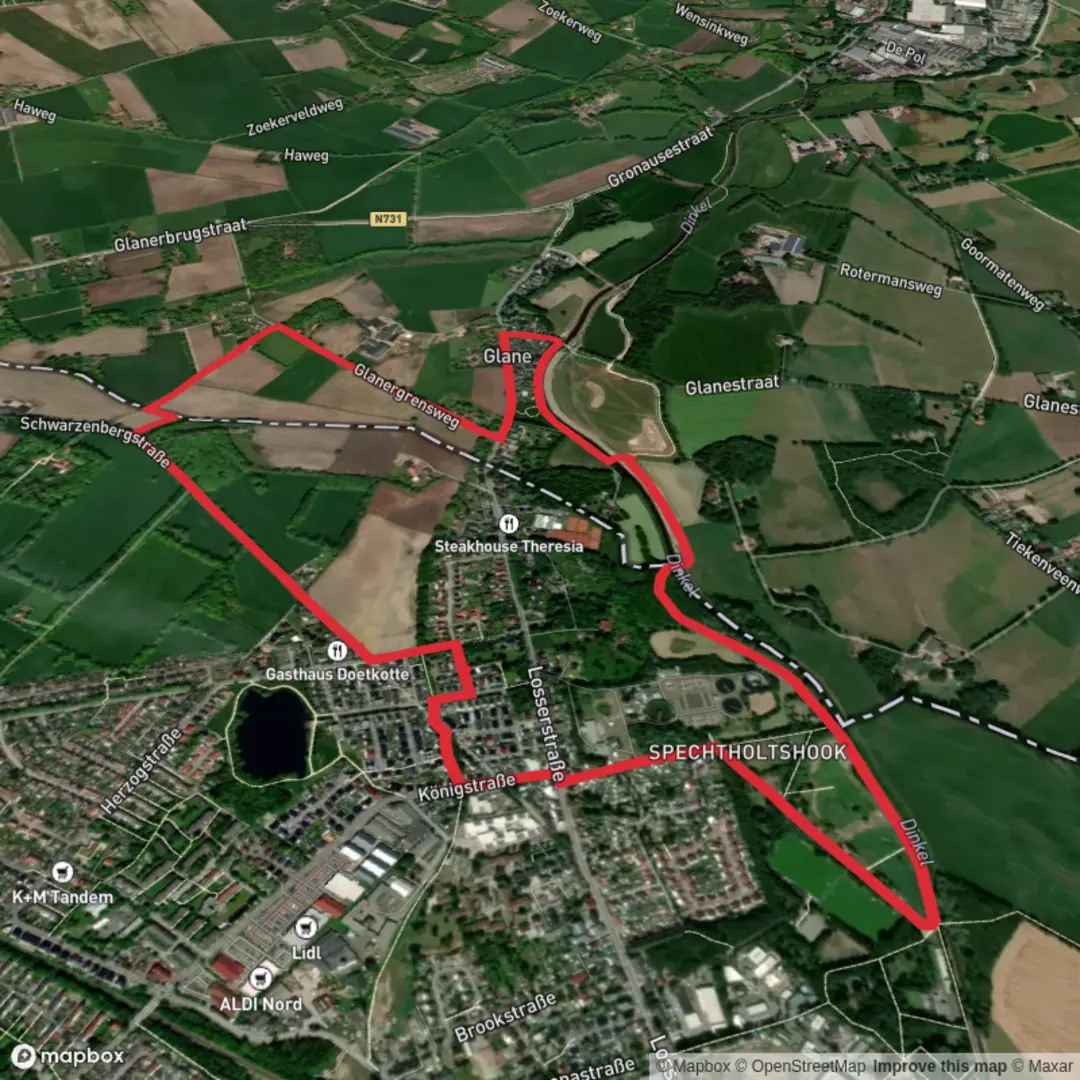
5.9 km
~1 hrs 11 min
9 m
Loop
“Wander through blooming meadows and storied landmarks, where history and nature paint the Twente borderland.”
Embarking on the Glanergrens Weg and Dinkelpad via Dinkel offers a serene 6-kilometer (approximately 3.7 miles) journey through the picturesque landscapes of the Twente region, straddling the Dutch-German border. With minimal elevation gain, this easy trail is ideal for hikers of all levels, providing a rich tapestry of natural beauty, historical landmarks, and cultural insights.
Trailhead and Access
The hike commences near the village of Glane in the Netherlands. For those traveling by car, parking is available in Glane, with the trailhead accessible from the village center. Public transport users can reach Glane via bus services from nearby cities such as Enschede. From the bus stop, it's a short walk to the starting point.
Trail Overview
Starting in Glane, the path meanders through a diverse landscape of woodlands, meadows, and along the banks of the Dinkel River. The Dinkel, a 93-kilometer (approximately 58-mile) river, originates in Germany and flows into the Netherlands near Glane, offering hikers a unique cross-border experience. The trail is well-marked with yellow arrows, ensuring easy navigation.
Natural Highlights
As you traverse the trail, you'll encounter the serene beauty of the Dinkel River, known for its meandering course and natural floodplains. The surrounding woodlands are home to a variety of bird species, making it a delightful route for birdwatchers. In spring and summer, the meadows bloom with wildflowers, adding vibrant colors to the landscape.
Historical Significance
One of the notable landmarks along the route is the Mauritsbrug (Maurits Bridge). This bridge marks the spot where, during the Eighty Years' War in 1597, Prince Maurits of Nassau crossed the Dinkel with his army. An information board near the bridge provides historical context, and a nearby cannon serves as a reminder of the area's strategic importance during that period.
Points of Interest
Landweer Riekeman: This historical earthwork, dating back to the 14th to 16th centuries, was part of the Beuninger Landweer, a defensive structure designed to protect the region from invaders and to control livestock movements. The remnants of the earthen walls and ditches are visible along the trail, offering a glimpse into medieval defensive strategies.
Saksische Boerderijen (Saxon Farms): The trail passes by traditional Saxon farmhouses, characterized by their timber-framed structures and thatched roofs. These farms reflect the architectural heritage of the Twente region and provide insight into the rural life of past centuries.
Trail Conditions and Recommendations
The path consists of both paved and unpaved sections, with some areas featuring sandy trails, especially near the riverbanks. Sturdy walking shoes are recommended to navigate these varying terrains comfortably. While the trail is accessible year-round, spring and autumn offer particularly pleasant weather and scenic beauty.
Navigation and Safety
The route is well-signposted with yellow arrows, but carrying a detailed map or using a navigation app like HiiKER can enhance your hiking experience. Always check local weather conditions before setting out, and be mindful of the natural environment by staying on marked paths and respecting local wildlife.
This hike offers a harmonious blend of natural splendor and historical intrigue, making it a rewarding experience for those seeking to explore the rich heritage and landscapes of the Twente region.

Surfaces
Unknown
Asphalt
Concrete
Paved
Wood
Comments and Reviews
User comments, reviews and discussions about the Glanergrens Weg and Dinkelpad via Dinkel, Netherlands.
average rating out of 5
0 rating(s)