Download
3D Flyover
Add to list
More
4.9 km
~58 min
0 m
Loop
“A gentle loop through Gasterse Duinen—heather, pale sands, whispering pines, and a dolmen’s quiet history.”
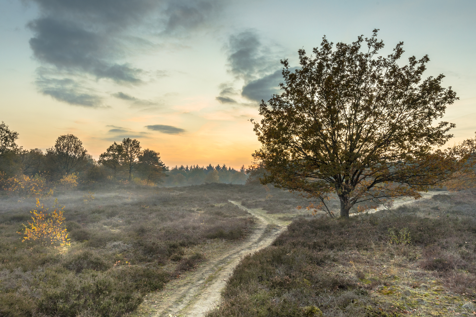
The walk is a compact, mostly level loop of about 5 km (3.1 miles) with roughly 0 m (0 ft) of elevation gain, set in the rolling heath-and-sand landscape of the Gasterse Duinen on the edge of the Drentsche Aa stream-valley region in Drenthe. Even though the route is short and rated easy, it feels varied: open heather fields, pale sand “dune” ridges, pockets of pine and oak woodland, and wide views that change quickly with wind and light.
Getting to the start (car + public transport)
Best start landmark / nearest known address: the most common trailhead is the parking area by the prehistoric dolmen Hunebed D10 in the Gasterse Duinen. A widely used navigation point is “Parkeerplaats Gasterse Duinen” on/near Oudemolenseweg, 9466 PB Gasteren (Netherlands), close to the road between Gasteren and Oude Molen. From the parking area you enter the reserve via a cattle grid (wildrooster) and pick up the signed walking paths. (shirshendusengupta.com)
By car: drive to Gasteren (Drenthe) and follow signs toward Gasteren–Oude Molen / Oudemolenseweg; the dolmen parking area is set up specifically for visitors and is the simplest place to leave a car. (drenthe.nl)
By public transport: a practical option is to travel to Assen or Groningen and take bus 51 (weekday service) to Gasteren, then walk about 1 km (0.6 mi) to the dolmen parking/trailhead. (If bus times don’t line up, local demand transport such as a regional taxi is sometimes suggested for this area.) (wandelmagazine.nu)
What the loop is like underfoot (and how to navigate it)
Expect a mix of: - Firm sandy tracks and narrower footpaths across heath - Short stretches that can be wet or puddled in rainy periods, especially in the northern part of the area—waterproof footwear can be the difference between “easy stroll” and “soggy socks.” (wandelmagazine.nu)
Navigation is straightforward because this loop is commonly waymarked (often described as a purple-marked route). If you want a digital backup, load the route in HiiKER and keep an eye on your position where multiple sandy paths braid together across the open heath.
Kilometer-by-kilometer expectations (approximate)
0.0–1.0 km (0.0–0.6 mi): heath, sand, and the cattle grid entrance
From the parking area, you’ll step over/through the cattle grid into open country. The first section quickly introduces the character of the Gasterse Duinen: heather, scattered trees, and pale sand underfoot. This is also where you’ll notice fencing—parts of the reserve are managed with grazing animals to keep the heath open. (drenthe.nl)
~0.2–0.5 km (0.1–0.3 mi) detour/feature: Hunebed D10
Very early on, you can visit Hunebed D10, a small, partially incomplete prehistoric stone tomb. It’s close enough to the start that it works as either a quick first stop or a final stop on the way back. (themodernantiquarian.com)
1.0–3.5 km (0.6–2.2 mi): “dunes,” open heath, and big-sky walking
This middle portion is the heart of the loop: broad, open heathland with low rises of wind-shaped sand (the “duinen”). In late summer, the heather can be especially striking, and the openness makes this section feel bigger than its distance. (themodernantiquarian.com)
3.5–5.0 km (2.2–3.1 mi): woodland edges and return toward the dolmen parking
The final stretch typically threads back via slightly more sheltered paths—woodland margins and scrub—before rejoining the approach tracks near the

Surfaces
Unknown
Unpaved
Ground
Gravel
Comments and Reviews
User comments, reviews and discussions about the Gasterse Duinen and De Burgvallen Loop, Netherlands.
average rating out of 5
0 rating(s)