Download
3D Flyover
Add to list
More
12.7 km
~2 hrs 32 min
0 m
Loop
“Wander sunlit heath, ancient burial mounds, and whispering woods where Drenthe’s wild beauty unfolds gently.”
Begin your journey in the heart of Drenthe, near the village of Gasteren, where the trailhead is easily accessible by car with parking available at the Gasterse Duinen parking lot on Gasterenweg. For those arriving by public transport, take a train to Assen and connect via local bus to Gasteren; from there, it’s a short walk to the start.
Through the Gasterse Duinen Heathlands
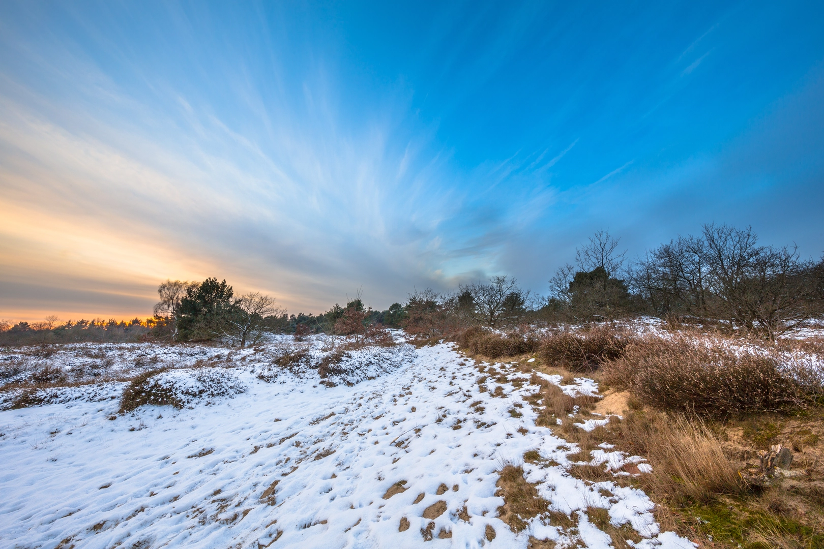
The first stretch leads you into the Gasterse Duinen, a striking expanse of heathland and drifting sand, unique to this part of the Netherlands. The terrain is flat, with virtually no elevation gain—expect a gentle walk throughout the 13 km (about 8 miles) loop. The sandy paths wind through purple heather in late summer, dotted with juniper bushes and scattered pine trees. Keep an eye out for grazing sheep, which help maintain the open landscape, and listen for the calls of skylarks and curlews overhead.
Achter t Veen: Wetlands and Peat History
After about 4 km (2.5 miles), the route transitions into Achter t Veen, an area shaped by centuries of peat extraction. Here, the landscape shifts to wetter ground, with boardwalks guiding you over marshy sections. The peat bogs are a haven for dragonflies and rare butterflies, and you may spot roe deer at the forest edge. This region’s history is deeply tied to the peat industry, which fueled local economies from the Middle Ages through the 19th century. Interpretive signs along the way provide insight into how the land was drained and harvested.
Ubbinksbos and the Grafheuvels (Burial Mounds)
At around the 8 km (5 mile) mark, you’ll enter the Ubbinksbos, a tranquil pine and oak woodland. The highlight here is the series of ancient burial mounds, or grafheuvels, dating back to the Bronze Age (roughly 3,000–800 BCE). These low, grass-covered mounds are protected archaeological sites, offering a glimpse into the region’s prehistoric past. Pause to appreciate the quiet atmosphere and the sense of history beneath your feet.
Navigation and Trail Conditions
The entire loop is well-marked, but for added confidence, use HiiKER for up-to-date navigation and trail information. The paths are mostly sandy or forested, with occasional muddy patches after rain, so waterproof footwear is recommended. There are no significant climbs, making this route suitable for families and those seeking a relaxed day out.
Wildlife and Seasonal Highlights
Throughout the year, the area is alive with wildlife. In spring, look for blooming wildflowers and nesting birds; in autumn, the forests glow with golden leaves and mushrooms. The heathlands are especially beautiful in August when the heather is in full bloom.
Getting There and Facilities
Gasteren is the nearest village, with basic amenities and a few local cafés. The trailhead at Gasterse Duinen is signposted from the village center. Public transport users can plan their journey via NS trains to Assen and then take Qbuzz bus 58 to Gasteren. Toilets and picnic areas are available at the parking lot, but there are no facilities along the trail itself, so bring water and snacks.
This loop offers a peaceful exploration of Drenthe’s natural and cultural heritage, with easy walking and plenty to discover along the way.

Surfaces
Unknown
Ground
Unpaved
Sand
Asphalt
Concrete
Paved
Dirt
Gravel
Wood
Comments and Reviews
User comments, reviews and discussions about the Gasterse Duinen, Achter t Veen and Ubbinksbos Grafheuvels Loop, Netherlands.
average rating out of 5
0 rating(s)