Download
3D Flyover
Add to list
More
31.3 km
~6 hrs 28 min
125 m
Multi-Day
“A long, gentle borderland ramble through heather seas and whispering pines—rewarding for well-prepared walkers.”
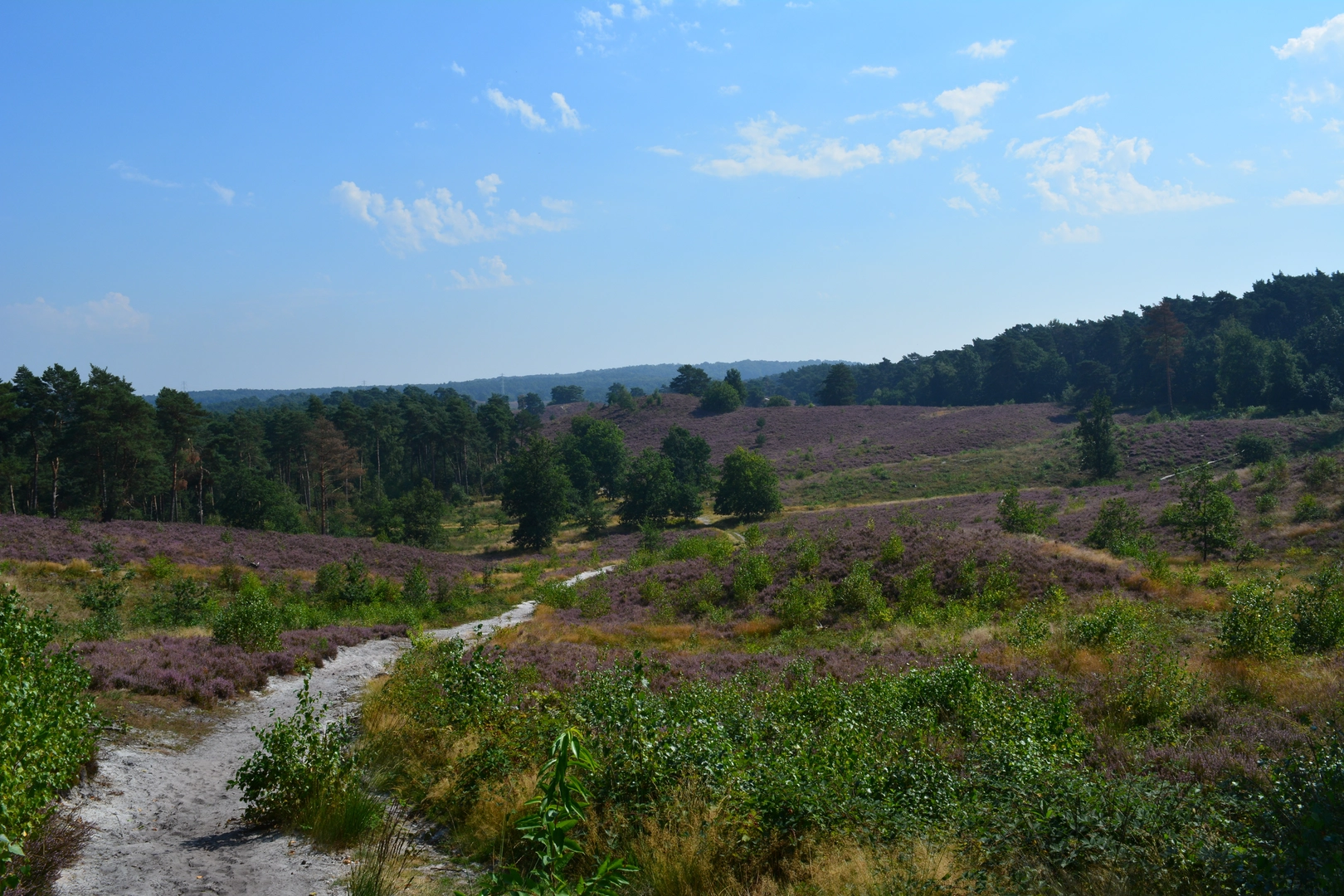
This is a long, low-relief heathland circuit of roughly 31 km (19.3 mi) with about 100 m (330 ft) of total ascent—more “all-day stroll” than “climb,” but the distance makes it a serious outing. Expect wide sandy tracks, pine-and-birch woodland, open heather fields, and a handful of border-area waypoints where you can easily drift onto the wrong path if you’re not checking your position regularly in HiiKER.
The loop sits in the Brunssummerheide (near Brunssum, Limburg, Netherlands) and crosses into/skirts the Teverener Heide (near Teveren/Geilenkirchen, North Rhine–Westphalia, Germany). A practical “nearest known landmark” for the start area is around the main access points by Brunssum—commonly approached via the Brunssummerheide visitor access near Brunssum town (look for signed nature reserve entrances and parking areas on the edge of the heath). If you share the exact lon/lat for your intended trailhead, I can pin it to the nearest street address or named entrance/parking area.
Getting to the start (car + public transport)
By car:
Brunssum is straightforward to reach from the A76/N281 corridor. Most hikers use one of the signed reserve car parks on the Brunssum side (typically free or low-cost, but rules can change). Arrive early on weekends—this is a popular local nature area and parking fills quickly on fair-weather days.
By public transport:
Aim for Brunssum by regional bus connections from nearby rail hubs such as Heerlen. From Brunssum town, it’s usually a short walk to the reserve edge depending on which entrance you choose. Plan your return timing: a 31 km (19.3 mi) day plus winter daylight can make “last bus” a real constraint.
What the route feels like underfoot
Most of the loop is on well-made forest roads, sandy tracks, and compacted paths. After rain, sandy sections can turn soft and energy-sapping; after dry spells, the sand can be loose and dusty. The elevation gain is modest (~100 m / 330 ft total), but you’ll notice gentle rollers where the path rises onto slightly higher heath ridges and drops back into woodland.
Because the terrain is subtle, the main challenge is staying on the intended line at frequent junctions—especially where multiple parallel tracks run through pine plantations and along the heath margins. Keep HiiKER handy and confirm at every major fork.
Landmarks, landscapes, and the best nature sections
You’ll move through a classic mosaic of European lowland heath and managed woodland:
- Open heathland (heather + grasses): The signature scenery. In late summer, heather can color the landscape; outside that window, the heath still feels expansive and airy compared to the surrounding forest blocks.
- Pine and mixed woodland: Provides shelter from wind and sun. These sections can feel repetitive, but they’re useful for steady pacing and shade.
- Borderland character: As you approach the Teverener Heide side, you’ll notice subtle changes in signage and trail furniture. It’s easy to wander across the border without realizing it—great for the “two countries in a day” feel, but it also means you should carry ID and be mindful of local rules.
Wildlife is often more “heard than seen,” but you have good odds of spotting:
- Roe deer at woodland edges (most likely early/late in the day)
- Heathland birds and woodland songbirds
- Insects in warm months (bring repellent in summer; ticks can be present in grassy/heathy margins)
Dogs are commonly walked here; if you’re dog-free, just expect occasional off-leash encounters depending on the specific zone and local regulations.
Navigation and timing (how to plan the day)
A reasonable planning pace for mixed easy terrain is 4–5 km/h (2.5–3.1 mph) moving speed. For 31 km (19.3 mi):
- Moving time: ~6–8 hours
- With breaks, photos, and navigation checks: ~7–9+ hours
Key navigation moments to anticipate:
- Heath/forest transitions: multiple track options appear where the open heath narrows into trees.
- Long straight forestry roads: easy to zone out and miss a turn.
- Border-area junction density: signage can be plentiful but not always consistent with your intended loop—verify with HiiKER rather than following the most-trodden line.
Historical significance and “why this landscape looks like this”
Heathlands like Brunssummerheide and Teverener Heide are not just “wild moor”—they’re strongly shaped by centuries of land use (grazing, cutting, and later forestry). The patchwork of open heath and planted woodland reflects changing management priorities over time: conserving heath habitat in some areas while maintaining timber/production forests in others. The broader region also carries a distinct borderland history—today it’s a seamless day hike across an internal EU border, but historically these boundaries mattered for administration, land rights, and local identity.
What to watch out for (practical hazards)
- Distance creep: Easy terrain can trick you into under-fueling. Treat this like an endurance day.
- Sandy fatigue: Soft sand can slow you down and stress calves/Achilles—consider supportive footwear and pace conservatively early.
- **Weather exposure on

Surfaces
Unknown
Asphalt
Gravel
Unpaved
Sand
Ground
Dirt
Paved
Wood
Concrete
Comments and Reviews
User comments, reviews and discussions about the Brunssummerheide and Teverener Heide Loop, Netherlands.
average rating out of 5
0 rating(s)