Download
3D Flyover
Add to list
More
80.9 km
~3 days
0 m
Multi-Day
“A long, sandy forest-and-heath loop where subtle dune ripples reward steady pacing and mindful feet.”
This is a long, low-relief loop of roughly 81 km (50 mi) with ~0 m (0 ft) of total climbing—best thought of as an all-day endurance walk or a relaxed 2-day hike. The terrain is predominantly flat sandy forest track, heathland paths, and dune-like sand ridges where the “ups and downs” are subtle underfoot rather than true elevation gain. Even with an “Easy” technical rating, the distance makes pacing, foot care, and resupply planning the main challenges.
Getting to the start (car + public transport)
Because the start is listed only as “near,” the most practical approach is to begin from a well-known access point that sits naturally between the named areas (Park Hemelrijk / Sint Anthonisbos / Overloonsche Duinen / Het Hurkske). A common, easy-to-navigate meeting point for this landscape is around Overloon, near the Overloon War Museum (Oorlogsmuseum Overloon) and the village facilities (parking, cafés, bus connections). If you’re using HiiKER, pick the trailhead/parking node closest to Oorlogsmuseum Overloon, Museumpark 1, 5825 AM Overloon, Netherlands as your anchor landmark.
- By car: Overloon is straightforward to reach via regional roads connecting to the A73 corridor (Venlo–Nijmegen direction). You’ll find large, obvious parking near the museum and village edges; arrive early if you’re hiking on a weekend or holiday.
- By public transport: The area is typically reached by train to Boxmeer or Venray, then bus/taxi onward to Overloon. Buses in rural Brabant/Limburg can be infrequent—plan around fixed departure times and have a fallback (taxi) if you’re starting early.
What the route feels like underfoot
Expect a steady rotation of: - Pine and mixed woodland on compacted forest roads (fast walking, easy navigation). - Sandy singletrack through dune-like sections (slower, more energy cost, more foot friction). - Heath and open clearings where wind exposure is higher and shade is limited. - Occasional cycle paths and quiet lanes linking forest blocks—useful for quick progress but pay attention at crossings.
Even with minimal elevation, the sand is the route’s “hidden difficulty.” It can turn an otherwise easy day into a calf-and-ankle workout, especially if it’s dry and churned.
Landmarks, landscapes, and the character of each area
Park Hemelrijk (Hemelrijk area) This portion tends to feel more “managed” and accessible, with wider paths and clearer wayfinding. You’ll likely pass recreational edges (parking areas, picnic spots, occasional signage). It’s a good place to do a final gear check early on: adjust pack fit, confirm water capacity, and make sure your socks/shoes are dialed before the sandier stretches.
Sint Anthonisbos A classic Dutch forest block: long, straight forestry lines mixed with softer meandering trails. The walking is efficient here, and it’s where many hikers accidentally go too fast early. Keep your pace conservative—on an 81 km (50 mi) day, the first 15–25 km (9–16 mi) should feel almost “too easy.”
Wildlife is often most active at the quieter edges: you may spot roe deer, hares, and a wide range of woodland birds. In warmer months, ticks can be present in grassy margins—long socks and periodic checks help.
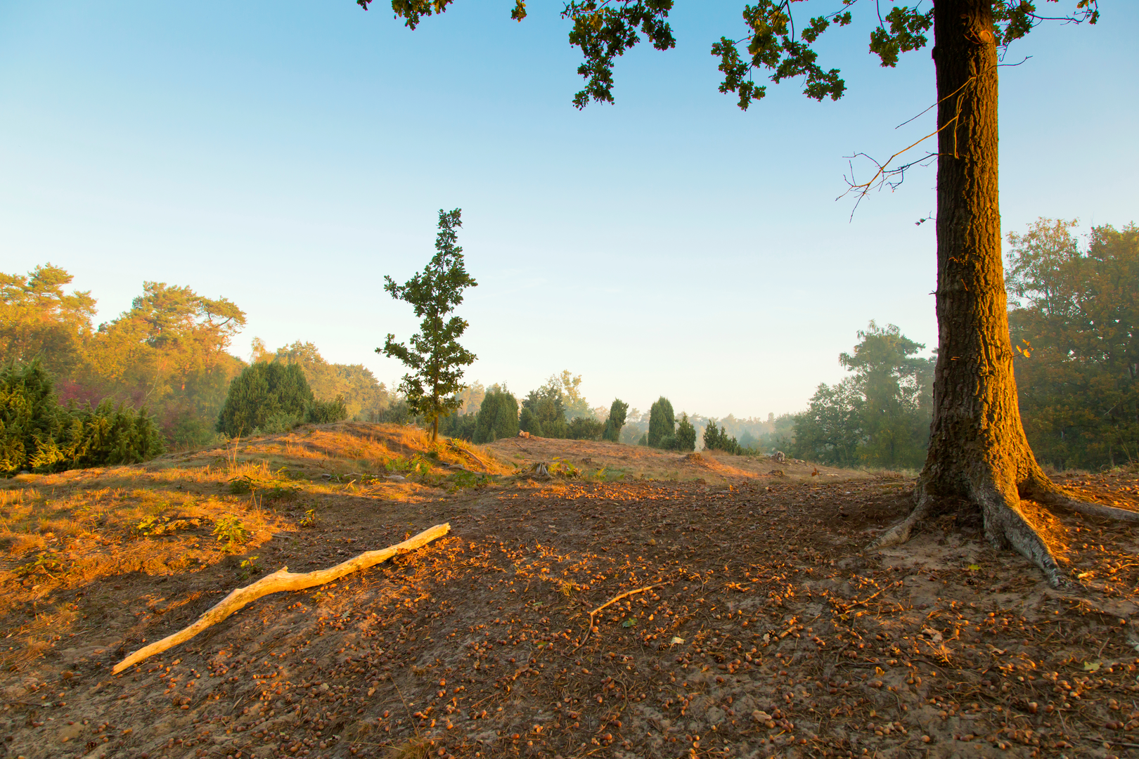
Overloonsche Duinen This is where the route’s texture changes. “Duinen” here doesn’t mean coastal dunes, but you can still expect undulating sand ridges, open sandy patches, and heath. Footing becomes less predictable: some sections are firm and fast, others are loose and energy-sapping.
Plan for your average speed to drop here. If you normally walk 5 km/h on firm track, you might see 3.5–4.5 km/h in deeper sand depending on conditions and fatigue.
Het Hurkske Often quieter and more intimate-feeling, with a mix of woodland and open patches. This is a good mental reset late in the hike: the scenery changes just enough to break up the monotony of long forest corridors. If you’re splitting the hike into two days, the broader region around here (or near village edges you pass) is where you’ll most likely find practical overnight options—always check local rules, as wild camping is generally restricted.
Navigation (use HiiKER as your primary tool)
This landscape can be deceptively confusing because many forest tracks look identical and intersections can be frequent. Use HiiKER to: - Keep a close eye on junction density (especially in Sint Anthonisbos). - Confirm you’re on the correct line when multiple parallel tracks run the same direction. - Identify bailout points: villages, bus stops, and road crossings every 10–20 km (6–12 mi) can be your safety valves if time, weather, or feet become an issue.
A practical strategy is to break the 81 km (50 mi) into mental “legs” of ~10–15 km (6–9 mi) and treat each as a checkpoint: water, food, feet, navigation check.
Distance planning: realistic splits and timing
If doing it in one push: - 81 km (50 mi) typically takes 14–18 hours of total elapsed time for most hikers once breaks, sand, and nightfall are included. - Start at first light and assume you may finish

Surfaces
Asphalt
Unknown
Concrete
Gravel
Cobblestone
Wood
Comments and Reviews
User comments, reviews and discussions about the Park Hemelrijk, Sint Anthonisbos, Overloonsche Duinen and Het Hurkske Loop, Netherlands.
average rating out of 5
0 rating(s)