Download
3D Flyover
Add to list
More
16.1 km
~3 hrs 17 min
35 m
Loop
“Wander the Veluwe’s “dancing” beeches and mossy lanes—an unhurried woodland loop for calm days.”
A gentle, mostly level woodland ramble through two of the Netherlands’ most atmospheric forests, where the main “challenge” is simply choosing which mossy lane or beech-lined track to linger on. At ~16 km (about 10 miles) with roughly ~0 m / ~0 ft of climbing, this is ideal for a relaxed day out, a winter walk when higher ground is unpleasant, or a low-stress navigation practice on a dense network of sandy forest roads.
Getting to the start (car + public transport)
Because the start point is listed only as “near” (no coordinates provided), the most practical way to plan is to anchor the hike at a well-known access point on the edge of Speulderbosch/Sprielderbosch. Common, easy-to-find starting landmarks for this loop area include:
- Drie (near Ermelo) — a small hamlet with multiple forest entrances and parking pull-ins along the Speulderbosweg / Drieërweg area.
- Boshuis Drie / nearby forest car parks — popular trail access in the same vicinity.
- Garderen (south side access) — another straightforward gateway to Speulderbosch.
If you share the lon/lat (or a map pin), I can convert it to the nearest recognizable address/landmark and tailor the directions precisely.
By car: Aim for a signed forest parking area near Drie (Ermelo) or the Speulderbos access roads. Arrive earlier on weekends—this is a beloved walking area and parking fills quickly on fair-weather days.
By public transport: The Veluwe is doable by transit, but you’ll usually combine train + bus + a short approach walk. Typical patterns are: - Train to Ermelo or Putten, then a bus toward Garderen/Drie (routes vary by season/day), finishing with a walk into the forest. Use HiiKER to confirm the exact trailhead you choose and to measure the approach distance from the nearest stop.
What the route feels like underfoot
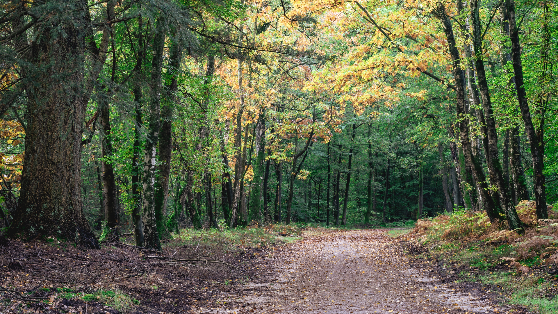
Expect a web of wide forestry tracks, sandy lanes, and occasional narrower footpaths threading between dense stands of beech, oak, and conifers. The “~0 m gain” profile matches the Veluwe’s generally rolling-but-subtle terrain here: you may notice gentle rises and dips, but nothing sustained. After rain, some sections can be soft and churned (especially where bikes and horses share the track), while in dry spells the sand can feel a bit draggy—still easy, just slower.
Plan on 3.5–5 hours of walking time for most hikers at an easy pace, plus stops.
Forest character: Sprielderbosch vs Speulderbosch
These neighboring woods have distinct personalities:
- Speulderbosch is famous for its gnarled, twisting beech trees—often called a “dancing” forest because trunks and branches contort in dramatic shapes. The effect is strongest on older beech avenues and in sections where the canopy closes overhead, creating a dim, green-lit corridor.
- Sprielderbosch tends to feel more open and spacious in places, with long straight tracks, mixed woodland blocks, and occasional clearings that hint at the area’s managed forestry history.
You’ll likely pass: - Beech avenues and old lanes that feel almost park-like. - Heath-edge clearings (depending on the exact loop line), where the forest briefly loosens and you get brighter, breezier walking. - Sandy crossroads with multiple signposts—great for route choice, but also where people most often take a wrong turn.
Navigation and wayfinding (keep it easy)
This is not technically difficult terrain, but it’s easy to drift onto the “wrong” parallel track because many lanes look identical. The simplest strategy: - Keep your route loaded in HiiKER and check it at every major junction. - Watch for track names/signposts and confirm direction before committing—especially where a wide lane splits into two equally inviting sandy roads. - If you’re hiking in fog or at dusk, the forest can feel disorienting; stick to the planned line and avoid improvising shortcuts.
Nature and wildlife to look out for
The Veluwe is one of the Netherlands’ best-known wildlife regions. In these forests, the most realistic sightings (or signs) include:
- Roe deer: often at forest edges and clearings, especially early/late.
- Wild boar: more often detected by rooted-up ground than seen; give them space if encountered.
- Red deer: possible in the wider Veluwe landscape; sightings depend on season and quietness.
- Woodpeckers and songbirds: listen for drumming and sharp calls in mature stands.
- Fungi and mosses: in damp months, the forest floor can be richly textured—great for slow, observant walking.
Ticks can be present in woodland and edge habitats in warmer months. Long socks/trousers and a post-hike check are sensible.
Landmarks and points of interest
Even on a “flat” loop, there are memorable features that help structure the day:
- The “dancing” beeches: the signature visual highlight—take time to wander slowly through the most contorted stands.
- Historic forest lanes: many straight tracks reflect centuries of woodland management and estate forestry. The Veluwe has long been shaped by a mix of resource use (timber, grazing) and later conservation/recreation.
- Quiet clearings and sandy stretches: these often mark transitions between woodland blocks and can be good snack stops

Surfaces
Unknown
Sand
Ground
Gravel
Comments and Reviews
User comments, reviews and discussions about the Sprielderbosch and Speulderbosch Loop, Netherlands.
average rating out of 5
0 rating(s)