Download
3D Flyover
Add to list
More
27.0 km
~5 hrs 33 min
92 m
Loop
“A big-sky heath and pine loop of sandy tracks—steady, wind-kissed, and quietly time-demanding.”
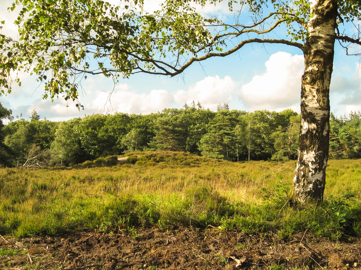
A mostly flat, big-sky loop through heathland, pine and mixed woodland, and quiet rural edges, with long stretches of sandy track and wide paths that make the distance feel steady rather than strenuous. At ~27 km (about 16.8 miles) with roughly 100 m (about 330 ft) of total ascent, the challenge here is more about time on feet, wind exposure across open heide, and keeping your pace consistent than it is about climbing.
Getting to the start (car + public transport)
Because the start point is only listed as “near” (no coordinates or town provided), the most reliable way to plan arrival is to anchor your start at a named access point close to the heide/forest edge—typically a signed trailhead/parking area (often a P car park) near the De Hooge Heide nature area. If you share the start lon/lat (or a HiiKER link), I can convert it to the nearest recognizable address/landmark and tailor the directions precisely.
- By car: Plan to park at a designated nature-area car park near De Hooge Heide (common around Dutch heide reserves). Arrive early on weekends—these lots can fill quickly on fair-weather days. Bring a backup parking option within 1–3 km (0.6–1.9 miles) in case the closest lot is full.
- By public transport: The usual pattern for this kind of loop is train to the nearest regional station, then bus toward the nearest village/hamlet on the heide’s edge, finishing with a short walk (1–4 km / 0.6–2.5 miles) to the trailhead. If you provide the nearest town name (or coordinates), I’ll map the most practical station/bus stop pairing.
What the route feels like underfoot
Expect a mix of: - Wide sandy tracks and compacted forest roads (fast, forgiving, but can be soft in dry spells) - Heathland paths that may be narrower and more exposed to wind - Occasional paved connectors near farms or small roads (useful for keeping momentum, but less shade)
With only ~100 m (330 ft) of gain spread across the day, any “ups” are likely gentle rises, low dunes, or subtle undulations rather than true hills. The loop format makes logistics simple—no shuttle needed—so your main planning variable is time: most hikers will take 5.5–7.5 hours moving time for 27 km (16.8 miles), plus breaks.
Landmarks and character: Render Klippen, Eperholt, De Hooge Heide
The names suggest a route linking distinct landscape pockets: - De Hooge Heide: classic lowland heath—open, airy, and seasonally dramatic. Late summer/early autumn often brings the heather’s strongest color, while spring can be bright with fresh greens and bird activity. - Eperholt: typically indicates a wooded area (holt often tied to woodland). Expect more shelter here—good for a break if the heide is windy. - Render Klippen: “klippen” can hint at small ridges, banks, or slightly higher ground—don’t expect cliffs, but do expect subtle viewpoint moments where the terrain lifts just enough to open the horizon.
You’ll likely pass forest compartments (straight tracks, managed woodland blocks) alternating with open heath. That contrast is the signature of many Dutch nature reserves: long sightlines, then sudden quiet shade.
Nature and wildlife to look out for
Heath and woodland edges are wildlife magnets—scan transitions where open heide meets scrub or pine.
- Birdlife: Heathland often supports ground-nesting and open-country species; woodland edges bring songbirds and raptors. Early morning tends to be most active.
- Mammals: Deer are common in many heath/forest mosaics; you may also see signs of fox or hare. Keep an eye on sandy sections for tracks.
- Insects: In warm months, expect plenty of pollinators on flowering heather and gorse-like shrubs; bring sun protection and consider insect repellent if still air and damp pockets coincide.
Stay on established paths in open heide—these habitats can be sensitive, and some areas may have seasonal restrictions to protect nesting wildlife.
Navigation and wayfinding (HiiKER)
This is the kind of landscape where paths can look deceptively similar—multiple sandy tracks, forestry junctions, and long straightaways that make it easy to drift onto the “right-looking” road.
- Download the route in HiiKER for offline use before you arrive.
- At major junctions, confirm direction of travel rather than just the next turn—forestry grids can mirror each other.
- If you lose the line, backtrack to the last confirmed point; shortcuts across heide can damage vegetation and often lead into dead-end scrub.
Pacing, water, and break strategy
With an Easy elevation profile but a long distance, plan like a “steady endurance walk”: - Pace: Aim for 4–5 km/h (2.5–3.1 mph) on the flats if you want a comfortable day with breaks. - Water: Carry enough for a full-day outing; open heath can feel hotter and drier than expected because of sun and wind. If there are villages or cafés on the perimeter, treat them as bonuses rather than guarantees unless you’ve confirmed opening hours. - Food: Bring lunch plus snacks you can eat while walking—this route rewards consistency.
Conditions and hazards to plan for
- Wind exposure: Open heide can be breezy even when nearby towns feel calm. A light

Surfaces
Unknown
Sand
Concrete
Asphalt
Comments and Reviews
User comments, reviews and discussions about the Render Klippen, Eperholt and De Hooge Heide Loop, Netherlands.
average rating out of 5
0 rating(s)