Download
3D Flyover
Add to list
More
21.3 km
~4 hrs 19 min
41 m
Loop
“Drift through Veluwe pines and heath in a steady, meditative loop—sand, mud, and look‑alike junctions keep you honest.”
A flat, low-effort 21 km (13.0 mi) loop like this is ideal for a long, steady day on wide forest tracks, sandy paths, and quiet lanes—more about rhythm, scenery, and small landmarks than climbing. With roughly 0 m (0 ft) of elevation gain, the main challenges tend to be underfoot conditions (sand, mud after rain), occasional bike traffic on shared paths, and staying oriented where multiple forestry tracks intersect.
Getting to the start (and where “near” likely means)
You didn’t include a specific start point, but “Gortelsche Berg” and “Tongerense” strongly point to the Veluwe area in Gelderland, Netherlands—between the villages of Gortel and Tongeren, near the larger reference points of Epe and Vaassen. A common, practical place to begin a loop in this area is near Gortel / Gortelseweg on the edge of the Veluwe forests, often close to small parking pull-offs and trail access points used by walkers and cyclists.
If you share the route’s coordinates (or a GPX), I can convert the exact lon/lat to the nearest recognizable landmark/address (for example, a specific car park, trailhead, or road junction) and tailor the directions precisely.
By car - Aim for the Gortel area (near Epe/Vaassen) and look for signed forest access points (often marked for walking/cycling routes). Parking is typically informal (small lots or roadside bays) rather than a single big trailhead. - Arrive early on weekends—this part of the Veluwe can be popular with walkers and cyclists.
By public transport - The nearest larger public-transport hubs are typically Apeldoorn or ’t Harde (depending on your approach), then a bus toward Epe/Vaassen, followed by a short taxi ride or a longer walk to the forest edge near Gortel. - Because rural bus frequencies can be limited, plan your return timing before you set off.
What the route feels like underfoot
Expect a mix of: - Packed forest roads (easy cruising, good for keeping pace) - Sandy stretches (slower, more tiring than the elevation suggests—sand can add “hidden effort” over 21 km / 13 mi) - Heath and open patches where the wind can feel sharper and the sun more direct - Short paved connectors near farms/hamlets on the edges of the forest
Even with minimal elevation change, the loop can feel long if you hit extended sand. If it has rained recently, low spots can hold water and become slick or churned up.
Navigation and wayfinding (keep it simple, avoid wrong turns)
This landscape often has many near-identical forestry junctions. The route is usually straightforward when you’re on the main track, but it’s easy to drift onto a parallel path and only notice 1–2 km later.
- Use HiiKER to keep an eye on junction density and confirm you’re taking the correct branch at multi-track intersections.
- Watch for numbered node signs (common in Dutch walking/cycling networks) and small wooden trail markers; they can be frequent but not always consistent across land managers.
- If you’re following a loop, confirm your direction at the start—clockwise vs counterclockwise can change which junctions feel “obvious.”
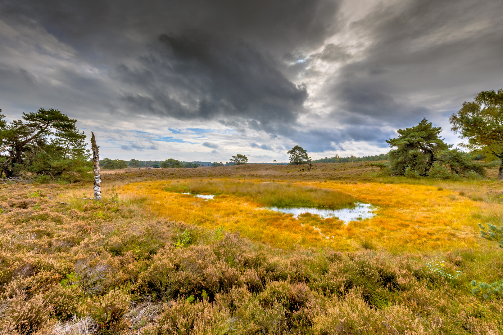
Landmarks, landscape, and the “Veluwe character”
This part of the Veluwe is known for broad, managed woodland interspersed with open areas. Over a 21 km (13 mi) loop, you’ll typically move through: - Pine and mixed woodland: tall straight trunks, open understory in places, and a soft forest-floor feel. - Heathland pockets: depending on the exact line of the loop, you may pass open heath where late summer can bring purple heather and more expansive views. - Forest edges near farmland: you may skirt fields and hedgerows near Tongeren, where the feel shifts from deep forest to rural lanes.
“Gortelsche Berg” is a name that can be misleading if you’re expecting a climb—here it’s more a local high spot or ridge-like area in an otherwise gently rolling landscape, not a mountain. The interest is in subtle terrain changes: slightly higher, drier ground with different vegetation and longer sightlines through the trees.
Wildlife and what to look out for
The Veluwe is one of the Netherlands’ best-known wildlife regions. On a quiet day you may spot: - Roe deer at forest edges, especially early/late - Wild boar signs (rooted ground, churned soil). Actual sightings are less common, but they do happen. - Birdlife: woodpeckers, jays, and raptors over open patches
Practical cautions: - Ticks can be present in woodland/heath edges in warmer months—long socks and a post-hike check help. - Shared-use paths: cyclists can move quickly and quietly on wide tracks; keep right and be predictable at bends and junctions. - Dog rules may vary by section (leash requirements are common in wildlife-sensitive areas).
Pacing, timing, and effort for an “easy” 21 km
Even with ~0 m (0 ft) gain, distance is the main factor. - Typical walking time: 4.5–6 hours depending on sand, stops, and navigation. - If you’re new to longer flat hikes, the last 5 km (3 mi) can feel more demanding than expected—flat doesn’t always mean effortless.
Gear and conditions to

Surfaces
Unknown
Asphalt
Concrete
Sand
Gravel
Unpaved
Comments and Reviews
User comments, reviews and discussions about the Gortelsche Berg and Tongerense Loop, Netherlands.
average rating out of 5
0 rating(s)