Download
3D Flyover
Add to list
More
12.8 km
~2 hrs 36 min
27 m
Loop
“Journey through whispering pines, wide-open heath, and echoes of ancient history just beyond Steenwijk.”
Starting from the outskirts of Steenwijk, the trailhead for this 13 km (about 8 miles) loop is easily accessible by both car and public transport. If arriving by train, disembark at Steenwijk Station, which is well-connected to major Dutch cities. From the station, it’s a short walk or a quick local bus ride to the trailhead near the intersection of Kamperweg and Zuidweg, close to the edge of the Woldberg forest area. For those driving, parking is available near the Woldbergheide recreational area, just north of Steenwijk.
Woodland Paths and Heathland Views
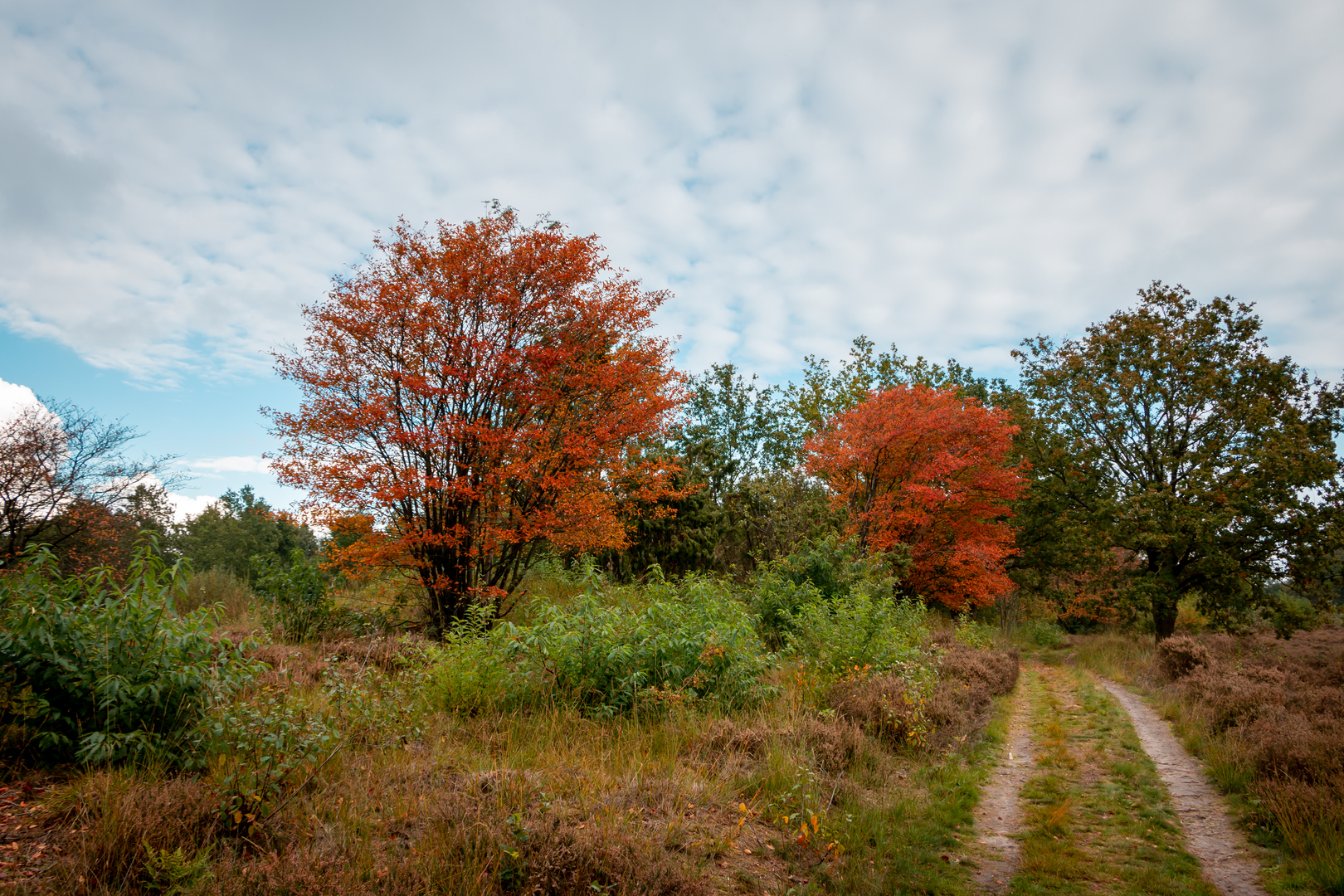
The route begins by weaving through the Bervoetsbos, a tranquil woodland known for its tall pines and dense undergrowth. Early in the hike, you’ll notice the flatness of the terrain—there’s virtually no elevation gain, making this route ideal for beginners or those seeking a relaxed walk. The forest floor is often carpeted with moss and ferns, and in spring, wildflowers add bursts of color. Keep an eye out for roe deer and a variety of woodland birds, especially in the quieter morning hours.
After about 3 km (1.9 miles), the path transitions onto the open expanse of Woldbergheide. This heathland is a highlight of the hike, with wide views across purple heather in late summer and scattered juniper bushes year-round. The sandy soil and open sky create a stark contrast to the shaded woods. This section is particularly popular with birdwatchers—look for skylarks and the occasional kestrel hovering overhead.
Historical and Natural Highlights
At roughly the halfway point, near the Holleberg, you’ll encounter gentle undulations in the landscape—remnants of ancient glacial activity. The Holleberg itself is a low, rounded hill, barely perceptible but historically significant as a marker in the region’s prehistoric landscape. Archaeological finds in the area suggest that these hills were once used as burial mounds by early inhabitants.
Continuing along Kamper Weg and Zuid Weg, the trail skirts the edge of agricultural fields and small patches of wetland. These areas are rich in biodiversity, with frogs, dragonflies, and, in the right season, a chorus of songbirds. The route is well-marked, but for added confidence, use HiiKER for real-time navigation and trail updates.
Practical Considerations
The entire loop is on well-maintained paths, suitable for walking year-round. There are no significant climbs, and the total elevation gain is negligible—less than 10 metres (about 33 feet) over the entire route. Benches and picnic spots are scattered throughout, especially near the forest edges and heathland. Facilities are limited, so bring water and snacks. The nearest cafes and restrooms are back in Steenwijk.
This hike offers a gentle immersion into the varied landscapes of Overijssel, blending woodland, heath, and subtle traces of ancient history, all within easy reach of public transport and local amenities.

Surfaces
Unknown
Concrete
Sand
Comments and Reviews
User comments, reviews and discussions about the Bervoetsbos, Woldbergheide and holleberg via Kamper Weg and Zuid Weg, Netherlands.
average rating out of 5
0 rating(s)