Download
3D Flyover
Add to list
More
28.5 km
~6 hrs
185 m
Loop
“A classic Twente big loop: moraine woods to tranquil estate waters, with gentle rises testing pacing.”
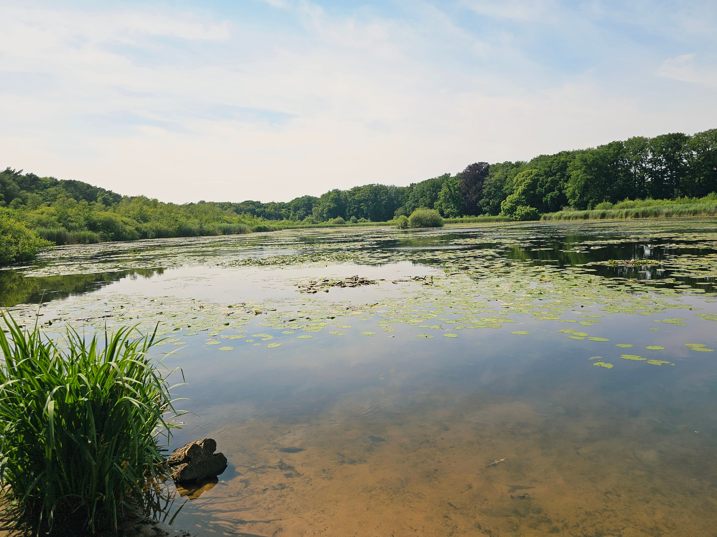
You’re looking at a classic Twente “big loop” that stitches together low, rolling moraine woodland on the Lonnekerberg with the watery, estate-landscape calm of Landgoed Lonnekermeer. At ~28 km (17.4 mi) with ~200 m (656 ft) of total ascent, it’s physically easy for most hikers, but it’s long enough that feet, pacing, and navigation matter more than steepness.
Nearest clear start landmark (for planning): the most practical, well-known start/parking point for the Lonnekermeer area is the small parking area at the intersection of Leutinkveldweg and Lonnekermeerweg, 7522 PW Enschede (Lonneker-West). (landschapoverijssel.nl)
From there, the loop naturally reaches the lanes you mentioned (Sniedersveldweg / Witbreuksweg) as it swings between the estate, the Lonnekerberg ridge, and the Enschede–Hengelo edge.
Getting to the start (car + public transport)
- By car: Navigate to the Leutinkveldweg × Lonnekermeerweg parking area (postcode 7522 PW Enschede). It’s a simple roadside lot used for the Lonnekermeer walking routes. (landschapoverijssel.nl)
- By public transport: The closest major rail hubs are Enschede and Hengelo stations; from either, you’ll typically finish with a bus + short walk or a taxi to the Lonneker-West / Lonnekermeerweg side. For turn-by-turn, use HiiKER and set the start to “Leutinkveldweg / Lonnekermeerweg, Enschede” so you can see the best transit-linked approach for the day you go.
What the terrain feels like over 28 km (17.4 mi)
Expect a mix of: - Firm estate tracks and woodland paths (easy walking, good in most seasons) - Sandy stretches on higher, drier ground around the Lonnekerberg - Occasional softer, damp edges near the lakes/low spots—after rain, some sections can be muddy or slick under leaf litter
Because the region is gently undulating, the ~200 m (656 ft) of gain comes in many small rises rather than one big climb. You’ll notice it most as a steady “up-and-down” rhythm over the day rather than any single strenuous hill.
Key sections and what to watch for
0–6 km (0–3.7 mi): Estate approach and first water views
Starting near the Leutinkveldweg/Lonnekermeerweg junction, you’ll quickly settle into quiet estate walking. The Lonnekermeer area is a protected nature/estate landscape and is known for its lakes and waterfowl presence—expect to hear and see birds especially in the calmer morning hours. (visittwente.nl)
Look out for:
- Narrower path pinch-points near water where passing cyclists can surprise you (keep right on shared tracks)
- Wet boards/roots in shaded sections
6–14 km (3.7–8.7 mi): Lonnekerberg woodland and moraine ridgeline
As you arc toward the Lonnekerberg, the character shifts to slightly higher ground. The Lonnekerberg is a modest hill (roughly ~60 m / ~200 ft high), but it stands out locally because it’s part of the moraine landscape around Enschede/Oldenzaal. (geocaching.com)
This is where you’ll typically pick up the most “continuous” ascent of the day—still easy, but more noticeable than the lakeside flats.
Footing and navigation: - Sandy, pine-needle-covered stretches can hide roots; ankles are more at risk here than knees. - In the more uniform forest, junctions can look similar—keep HiiKER handy so you don’t drift onto parallel tracks.
14–20 km (8.7–12.4 mi): Sniedersveldweg / Witbreuksweg lanes and open edges
This middle portion often feels more “in-between”: a blend of quiet lanes, field edges, and transitions between nature parcels. These straighter connectors are where people tend to speed up—great for making time, but it’s also where blisters show up if your socks/shoes aren’t dialed.
**What to watch

Surfaces
Unknown
Asphalt
Unpaved
Sand
Dirt
Ground
Paved
Cobblestone
Comments and Reviews
User comments, reviews and discussions about the Lonnekerberg and Lonnekermeer via Sniedersveldweg and Witbreuksweg, Netherlands.
average rating out of 5
0 rating(s)