Download
Preview
Add to list
More
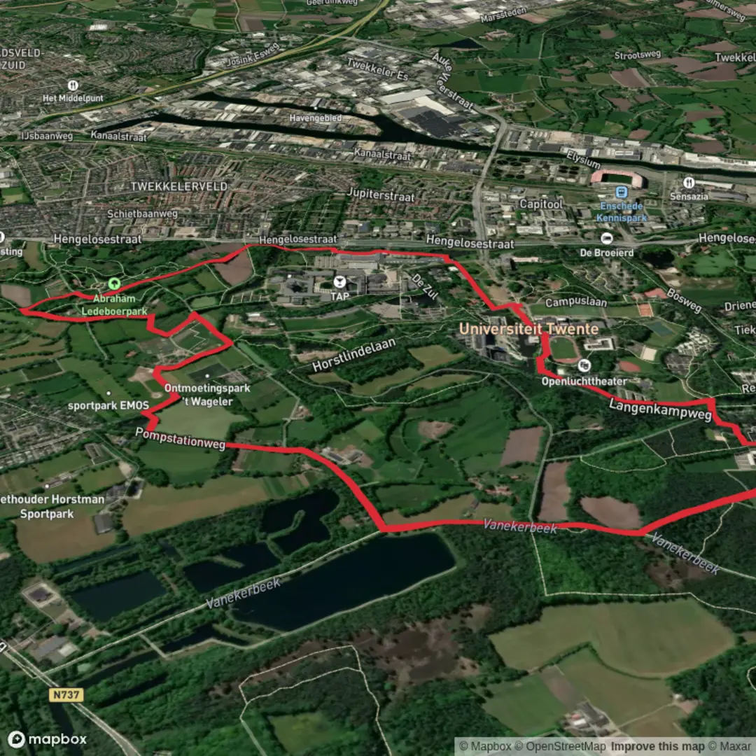
7.4 km
~1 hrs 30 min
21 m
Loop
“Wander through meadows and woodlands, where wildflowers bloom and history lingers beneath open skies.”
Starting from the outskirts of Enschede, near the University of Twente, this 7 km (about 4.3 miles) loop offers a gentle, flat walk with virtually no elevation gain, making it accessible for all fitness levels. The trailhead is easily reached by public transport: take a train to Enschede Kennispark station, then walk about 10 minutes north to the university campus, where the route begins. For those arriving by car, parking is available at the university’s main car parks.
Landscape and Terrain
The path meanders through the Drienerveld, a patchwork of open meadows, small woodlands, and hedgerows typical of the Twente region. Expect wide, grassy fields interspersed with stands of birch and oak, and occasional glimpses of grazing sheep or cattle. The terrain is almost entirely flat, with well-maintained dirt and gravel paths suitable for walking shoes or trainers. After rain, some sections may be muddy, so waterproof footwear is recommended in wet weather.
Nature and Wildlife
Birdwatchers will enjoy spotting species such as the Eurasian jay, woodpecker, and common buzzard. In spring and summer, wildflowers line the trail, attracting butterflies and bees. The area is also home to rabbits and, if you’re lucky, you might spot a roe deer darting through the undergrowth. The Drienerveld is managed for biodiversity, so expect a mix of open and wooded habitats supporting a variety of flora and fauna.
Historical and Cultural Highlights
The route passes close to Witbreuksweg, an old country road with roots dating back to medieval times, once serving as a key link between local farms and the city of Enschede. The University of Twente itself, established in the 1960s, is a landmark of modern Dutch educational architecture, and its campus blends seamlessly with the surrounding landscape. Along the way, you may notice remnants of traditional Twente hedgerows, which historically marked property boundaries and provided shelter for livestock.
Navigation and Facilities
Navigation is straightforward, with clear signage at major junctions. For detailed route guidance and offline maps, use HiiKER, which provides up-to-date trail information and waypoints. There are benches at intervals for rest, and the university campus offers cafés and restrooms, especially near the start and end of the hike. Drinking water is available at the campus, but it’s wise to carry your own bottle for the walk.
Getting There and Practical Tips
Public transport is reliable, with frequent trains and buses to Enschede Kennispark. Cyclists can also reach the trailhead easily, as the area is well-served by bike paths. If driving, set your navigation to the University of Twente’s main entrance on Drienerlolaan, Enschede. The trail is suitable year-round, though spring and early autumn are particularly beautiful for wildflowers and changing foliage. Dogs are welcome but should be kept on a leash, especially near livestock.

Surfaces
Unknown
Asphalt
Ground
Dirt
Sand
Grass
Paved
Cobblestone
Comments and Reviews
User comments, reviews and discussions about the Drienerveld and Witbreuks Weg, Netherlands.
average rating out of 5
0 rating(s)