Download
3D Flyover
Add to list
More
21.1 km
~4 hrs 15 min
26 m
Point-to-Point
“An easy-going, mostly flat wander from village lanes to wild inland dunes, ending by quiet waterways.”
This is a mostly flat, easy-going 21 km (13.0 mi) point-to-point walk linking small settlements, waterways, and one of the most distinctive sandy landscapes in the northern Netherlands: the Aekingerzand (also known as the Kale Duinen). With essentially no meaningful climbing (about 0 m / 0 ft of elevation gain), the effort here comes from distance, wind exposure on open sand, and the occasional softer footing.
Getting to the start (Zuivelfabriek) and planning the finish (Damsluis)
By car - Aim for parking near the former dairy/factory area (“Zuivelfabriek”) in/near Appelscha (a well-known gateway village to Drents-Friese Wold National Park). In practice, you’ll want to park at a signed public lot close to the village edge and walk a few minutes to the start point. - Because this is a point-to-point route, it’s easiest with two cars (one left near the finish by the Damsluis—a small sluice structure on local waterways), or by arranging a pickup.
By public transport - The most common approach is to travel by train to a larger hub (often Assen, Heerenveen, or Steenwijk, depending on where you’re coming from) and continue by regional bus toward Appelscha. From the bus stop in/near the village center, it’s typically a short walk to the start area. - For the finish, plan your onward travel from the nearest village/town to the Damsluis area (often a rural stop or a short taxi/bike link). If you’re relying on buses, check the day’s timetable carefully—service can be limited in rural areas, especially evenings and Sundays.
If you share the route’s lon/lat points (start, finish, and any key waypoints), I can translate each to the nearest known address or named landmark precisely.
What the route feels like underfoot
Expect a mix of: - Village lanes and farm tracks leaving the Zuivelfabriek area - Forest paths through managed woodland - Sandy, open dune walking across Aekingerzand/Kale Duinen (the most “wild” feeling section) - Canal/ditch-side paths and dike-like tracks approaching the Damsluis
Because the elevation is negligible, the route is friendly for steady pacing. The main variables are wind (especially on the dunes), sun exposure on open sand, and seasonal wetness on low-lying paths near drainage channels.
Key sections and landmarks (with approximate distances)
0–4 km (0–2.5 mi): Leaving the Zuivelfabriek area You’ll start on easy surfaces—pavement or compacted paths—threading out of the built-up edge into greener corridors. This early stretch is ideal for settling into a rhythm and checking gear. Look for: - Small bridges and drainage ditches typical of reclaimed and managed lowland landscapes - Hedgerows and field margins that can be lively with songbirds in spring and early summer
4–11 km (2.5–6.8 mi): Forest transition into Drents-Friese Wold The route becomes more natural underfoot, often on firm forest tracks. This region is shaped by centuries of land use—woodland management, heath restoration, and sand control efforts. You’ll likely pass: - Pine and mixed woodland blocks with occasional clearings - Edges of heathland where the ground can be springy and slightly uneven
Wildlife you might notice (often more by sign than sight): - Roe deer (most active at dawn/dusk) - Fox tracks on sandy sections - Woodpeckers and other forest birds; listen for drumming in quieter stands
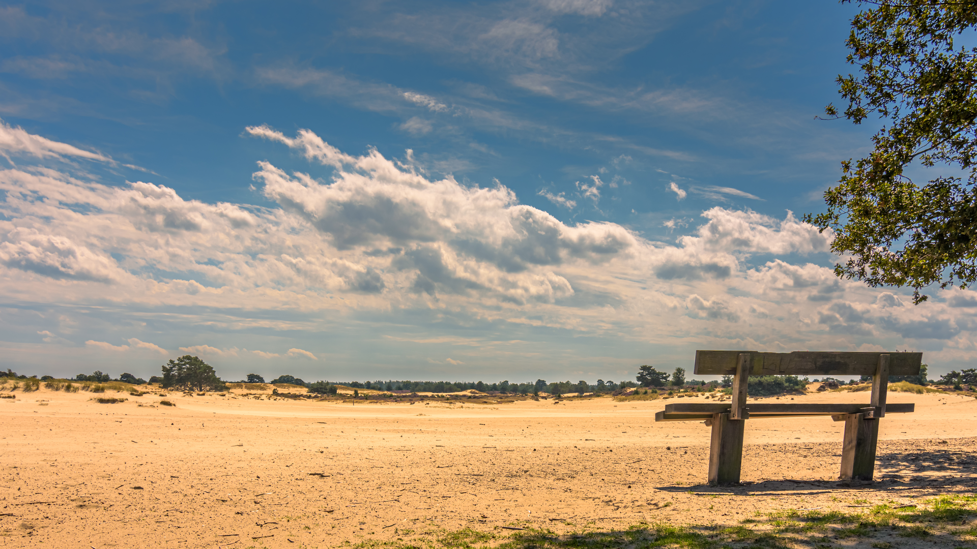
11–15 km (6.8–9.3 mi): Aekingerzand / Kale Duinen (open sand) This is the signature landscape: a broad, pale sand area that feels almost coastal despite being inland. The walking changes here: - Footing can turn soft and energy-sapping in patches - Wind can be stronger and more constant, and it’s easy to feel cooler than expected even on mild days
What to look out for: - Blown sand and shifting micro-dunes—paths can be faint or braided - Heath and pioneer vegetation (grasses, mosses, hardy shrubs) stabilizing the sand in places - In warm months, insects can be active; in late summer, nearby heath may show purple blooms
Navigation note: this is the section where it’s most useful to have your route loaded in HiiKER, because landmarks are subtle and the “best line” across the sand can vary with conditions and trail wear.
15–21 km (9.3–13.0 mi): Veldhuizen and waterways toward the Damsluis Leaving the dunes, the route typically returns to firmer tracks and more structured landscapes—fields, tree lines, and water management features. Approaching the Damsluis, expect: - Straight, efficient canal-side or drainage-channel paths - Occasional gates or farm access points—be ready to yield to local traffic (bikes, farm vehicles) - A clear sense of the Netherlands’ long relationship with water control: ditches, embankments, and sluice infrastructure guiding water levels for agriculture and settlement
The Damsluis itself is a small but meaningful landmark—part of the broader system of **polders

Surfaces
Unknown
Asphalt
Grass
Gravel
Unpaved
Sand
Ground
Dirt
Concrete
Cobblestone
Comments and Reviews
User comments, reviews and discussions about the Zuivelfabriek to Damsluis via Aekingerzand of Kale Duinen and Veldhuizen, Netherlands.
average rating out of 5
0 rating(s)