Download
3D Flyover
Add to list
More
38.0 km
~2 days
0 m
Multi-Day
“A long, flat wander through border heaths and pinewoods—wind, sand, and wayfinding test your resolve.”
This is a long, low-relief day out across the heathlands and pinewoods of the Dutch–Belgian border region, where the walking is mostly flat, fast, and forgiving underfoot—ideal for steady pacing over a big distance. At around 38 km (23.6 mi) with roughly 0 m (0 ft) of climbing, the challenge is less about hills and more about time on feet, wind exposure across open heide, and staying oriented through a web of sandy tracks and forest lanes.
Getting to the start (car + public transport)
Because the start is listed only as “near,” the most practical way to plan is to anchor your start at a well-known access point on the Groote Heide. Common, easy-to-navigate trailheads for this loop are around Valkenswaard (North Brabant, Netherlands)—often near the main heath access and parking areas by the edge of town.
- By car: Aim for Valkenswaard, then follow local signs for Groote Heide / Leenderheide parking areas on the south side of town. These are typically large, established lots used by walkers and cyclists and put you directly onto the heath/forest track network.
- By public transport: The nearest major hub is Eindhoven. From Eindhoven, regional buses run toward Valkenswaard; from there you can walk from town edges to the heath access points. When you build your route in HiiKER, set the start at a prominent Groote Heide access point near Valkenswaard so your directions and timing line up with the actual trailhead you choose.
If you share the lon/lat for your intended start, I can convert it to the nearest recognizable address or landmark and tailor the approach directions precisely.
What the terrain is like (and why it feels “easy” but long)
Expect a mix of: - Heathland paths: firm sandy singletrack and wider sandy lanes; can be soft in dry spells. - Forest roads: straight, fast, and sometimes monotonous—great for making time. - Borderland track networks: lots of intersections where it’s easy to drift onto the wrong parallel path.
Even with minimal elevation change, the loop can feel harder if: - Wind is up across open heide (it can be surprisingly draining over hours). - Sand is loose (adds effort, especially late in the day). - Wet patches linger in low areas (after rain, some heath edges and forest hollows can hold water).
Route flow and approximate distance markers
Because this is a loop, you can walk it either direction; many hikers prefer starting with open heath while legs are fresh, then using forest sections later for efficient cruising.
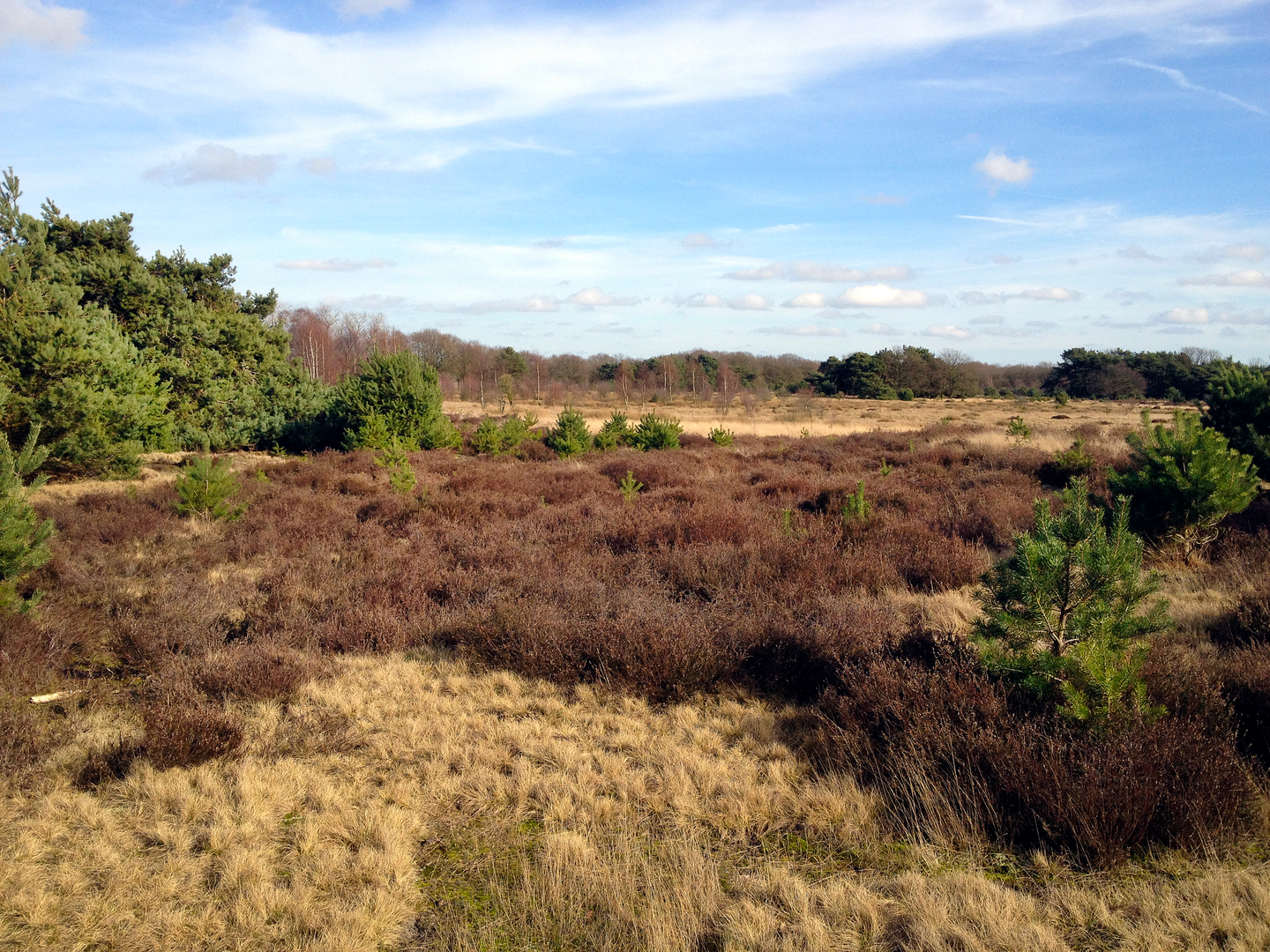
0–8 km (0–5 mi): Heath edge and open heide You’ll likely begin on broad access tracks that quickly open onto classic heathland—low shrubs, heather, and scattered pines/birch. In late summer, heather can color the landscape; in other seasons it’s more muted but still expansive. This is where you’ll feel wind most and where navigation can be trickiest because multiple sandy lines run in parallel.
8–18 km (5–11.2 mi): Forest corridors and long straightaways The route typically transitions into managed pinewoods and mixed forest blocks. Underfoot becomes more consistent—packed sand and forest road. This is a good section to settle into a sustainable pace and keep an eye on hydration and calories early, because the flatness can trick people into under-fueling.
18–28 km (11.2–17.4 mi): Spinsterberg area and heath–forest mosaic “Spinsterberg” suggests a local high point or sandy rise rather than a true climb; in this region, “berg” often means a modest dune-like bump or ridge. Even if the total gain is near zero, you may notice gentle undulations and slightly drier, sandier ground. This middle portion is often the most scenic blend: heath openings, forest edges, and occasional viewpoints across the open landscape.
28–38 km (17.4–23.6 mi): Return leg on faster tracks The final third commonly uses more direct forest lanes and perimeter tracks. This is where foot comfort matters most—flat, repetitive surfaces can create hot spots. If you’re managing time, these straighter sections are where you can maintain a steady cadence without technical interruptions.
Landmarks, nature, and wildlife to look for
This border heathland landscape is shaped by a long history of common grazing, turf cutting, and later forestry, which is why you see open heide interspersed with planted pine blocks. Heathlands are ecologically important and often actively managed to prevent them from turning into closed forest.
Likely wildlife and signs: - Roe deer: often seen at forest edges early/late in the day. - Foxes and small mustelids: usually shy; you’ll more often see tracks. - Heathland birds: listen for calls in open areas; ground-nesting species make staying on paths especially important in breeding season. - Reptiles (in warm months): sunny sandy edges can host lizards; watch where you step when stopping off-trail. - Insects: in summer, expect mosquitoes near wetter pockets and ticks in rough vegetation—long socks and checks help.
Seasonal notes: - Late summer/early autumn: heather can be at its best; also peak insect activity on warm, still days. - Winter: paths can be firm but damp; short daylight makes timing important for a 38 km day.
Navigation and on-tr

Surfaces
Asphalt
Unknown
Dirt
Sand
Comments and Reviews
User comments, reviews and discussions about the Groote Heide and Spinsterberg Loop, Netherlands.
average rating out of 5
0 rating(s)