Download
3D Flyover
Add to list
More
37.2 km
~2 days
130 m
Multi-Day
“Wander Drenthe’s hushed forests and heather fringes in a long, flat loop that rewards patient legs.”
A long, low-elevation loop through Drenthe’s quiet forest-and-heath mosaic, this route links three classic landscapes—Hunzebos, Westerbos, and the Exloo area—on mostly flat, forgiving terrain. Expect a full-day outing: ~37 km / 23.0 mi with only ~100 m / 330 ft of total ascent, so the challenge is distance and time-on-feet rather than steep climbing.
Where you’ll start (and what’s nearby)
The start is best thought of as near Exloo (Drenthe), close to the Hunzebos/Westerbos forest edge—a practical “anchor” for planning is Exloo village center (around the area of Hoofdstraat, Exloo) and the nearby forest access points used for local walking routes. If you share the exact lon/lat for the trailhead, I can pin it to the nearest specific address/parking area or a named landmark (e.g., a particular car park, bus stop, or visitor point).
Getting to the start (car + public transport)
By car - Aim for Exloo, Drenthe and use village-edge parking near forest access points (common options are public parking areas near trail entrances and recreation facilities on the outskirts). Arrive early—this is a long loop, and daylight matters more than elevation.
By public transport
- The most straightforward approach is typically train to Emmen (the nearest larger rail hub), then bus toward Exloo. From the bus stop in/near the village, you’ll usually have a short walk to reach the forest edge and pick up the loop.
- Before you go, check the day’s bus frequency (it can thin out outside peak commuting hours), and plan a “latest return” option so you’re not forced to rush the final kilometers.
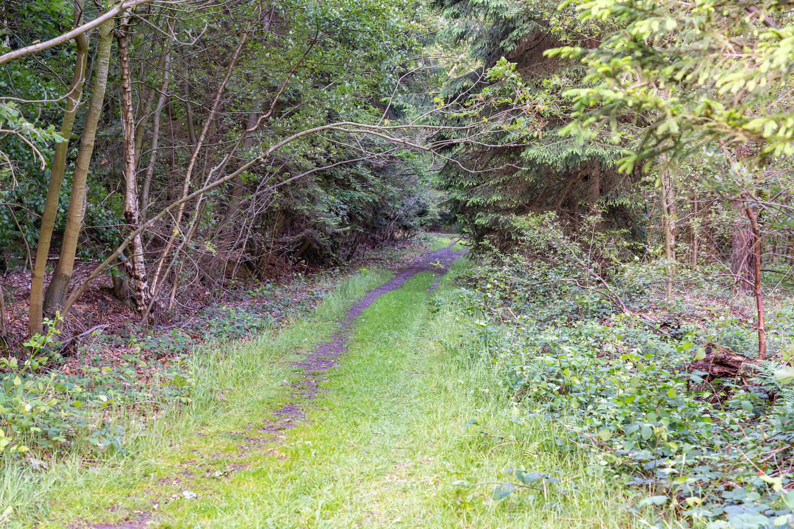
What the terrain is like
- Surface: A mix of compact forest paths, sandy tracks, and occasional paved connectors between woodland blocks and open areas. After rain, some sections can be soft or muddy; in dry spells, sandy stretches can feel slower underfoot.
- Gradient: Nearly flat throughout. The ~100 m / 330 ft of gain is mostly gentle undulation—small rises over sandy ridges and subtle forest-edge rolls rather than any sustained climb.
- Effort profile: Easy technically, but endurance-focused. Many hikers will take 7–10+ hours depending on pace and breaks.
Navigation and wayfinding (use HiiKER)
This landscape has lots of intersecting forestry tracks that can look similar, especially where straight sandy lanes meet at right angles. Load the route in HiiKER and: - Keep an eye on track junction density in the forest blocks (it’s easy to drift onto a parallel path). - Use distance-to-next-turn checks in HiiKER in long straight sections—small deviations can go unnoticed for a while. - In open heath or field-edge segments, wind and visibility changes can make landmarks feel farther away than expected; HiiKER helps confirm you’re holding the correct line.
The hike, section by section
0–10 km (0–6.2 mi): Settling into Hunzebos woodland
The opening kilometers typically feel sheltered and quiet, with tall conifers and mixed woodland creating a steady rhythm on wide tracks. You’ll likely pass: - Forestry lanes with long sightlines (great for steady pacing). - Small clearings and edges where birch and scrub appear—these transition zones often have more bird activity than the deeper plantation stands.
What to look for - Roe deer are common in Drenthe’s wooded edges, especially early and late in the day. - Woodpeckers and other forest birds are often heard before they’re seen. - In damp pockets, you may find mossy ground and seasonal puddling—watch footing if you’re trying to maintain a brisk pace.
10–22 km (6.2–13.7 mi): Westerbos and the forest–heath transitions
As you move toward Westerbos, the character often alternates between denser stands and more open, brighter corridors. This is where the route can feel most “maze-like” because multiple forestry tracks run in parallel.
Pacing and planning - This is a good place to schedule a short food/water break: you’re far enough in to benefit from it, and you still have a long back half. - If the route uses any short paved links between forest blocks, treat them as a chance to reset your navigation in HiiKER before re-entering the trees.
Nature notes - Where the forest opens into heath or sandy clearings, you may see heather (seasonal color peaks late summer) and gorse in places. - Open areas can be breezier and cooler than expected, even on mild days—carry a light layer.
22–37 km (13.7–23.0 mi): Exloo surroundings and the long, flat finish
The final third often strings together forest edges, quieter lanes, and open stretches that feel deceptively easy—until cumulative fatigue sets in. Because the elevation gain is minimal, it’s common to underestimate how much the last 8–10 km (5–6 mi) can drag.
Key things to watch - Foot care: Flat, repetitive terrain can cause hot spots. Consider socks you trust and carry blister care. - Energy management: Plan a “final-third” snack window; many hikers bonk here because the terrain doesn’t force obvious rest stops. - Low-light risk: In winter or shoulder seasons, a

Surfaces
Ground
Unknown
Sand
Concrete
Cobblestone
Asphalt
Unpaved
Comments and Reviews
User comments, reviews and discussions about the Hunzebos, Westerbos and Exloosche Loop, Netherlands.
average rating out of 5
0 rating(s)