Download
3D Flyover
Add to list
More
68.7 km
~3 days
0 m
Multi-Day
“A long, flat Kempen wander through heather skies and whispering pines—best for steady endurance.”
This is a long, low‑relief circuit of roughly 69 km (43 mi) with essentially 0 m (0 ft) of climbing, stitched together from several local loops across the Kempen/De Kempen landscape—wide heathlands, pine and mixed woodland, sandy tracks, and quiet rural edges. Expect an “easy” profile in terms of elevation, but a full-day (or two-day) endurance walk because of the distance and the amount of time spent on unpaved surfaces.
For a practical start point, a common, easy-to-find access hub for the Cartierheide area is P+R / parking near the Cartierheide nature area by Eersel (North Brabant, NL)—often approached via the Eersel–Hapert side of the Kempen. If you share the route’s coordinates (or a map), I can pin this to the nearest exact address or landmark and describe the first kilometers turn-by-turn using HiiKER.
Getting to the start (car + public transport)
- By car: Aim for a signed Cartierheide parking area (typically marked as a nature parking lot / “P” for the heath). Arrive early on weekends—these Kempen heathlands are popular with walkers and cyclists, and parking fills quickly on fair-weather days.
- By public transport: The Kempen region is well served by buses connecting villages like Eersel, Hapert, Bladel, Reusel and nearby larger rail hubs (often via Eindhoven as the main regional rail node). A typical approach is:
1) Train to a major station (commonly Eindhoven Centraal),
2) Bus onward toward Eersel/Hapert/Bladel,
3) Short walk from the village edge to the heath access points.
Check the last return bus times before committing to the full 69 km (43 mi), especially on Sundays/holidays when service can thin out.
What the day feels like: long, steady, and quiet—more about rhythm and terrain than hills. Underfoot you’ll rotate through firm gravel, forest duff, sandy doubletrack, and occasional paved connectors between nature blocks and villages.
Terrain, surfaces, and pacing
- Surface mix: Predominantly unpaved. After dry spells, sandy sections can feel energy-sapping; after rain, some forest tracks can hold water and become soft.
- Navigation: The landscape can look deceptively similar—straight pine corridors, repeating junctions, and multiple parallel tracks. Load the route in HiiKER and keep an eye on junction density; it’s easy to drift onto a near-identical track that runs the same direction.
- Time planning: Even with minimal elevation, 69 km (43 mi) is a serious distance. Plan for frequent short stops rather than long breaks to keep legs from stiffening on flat terrain.
Nature and landmarks you’ll notice
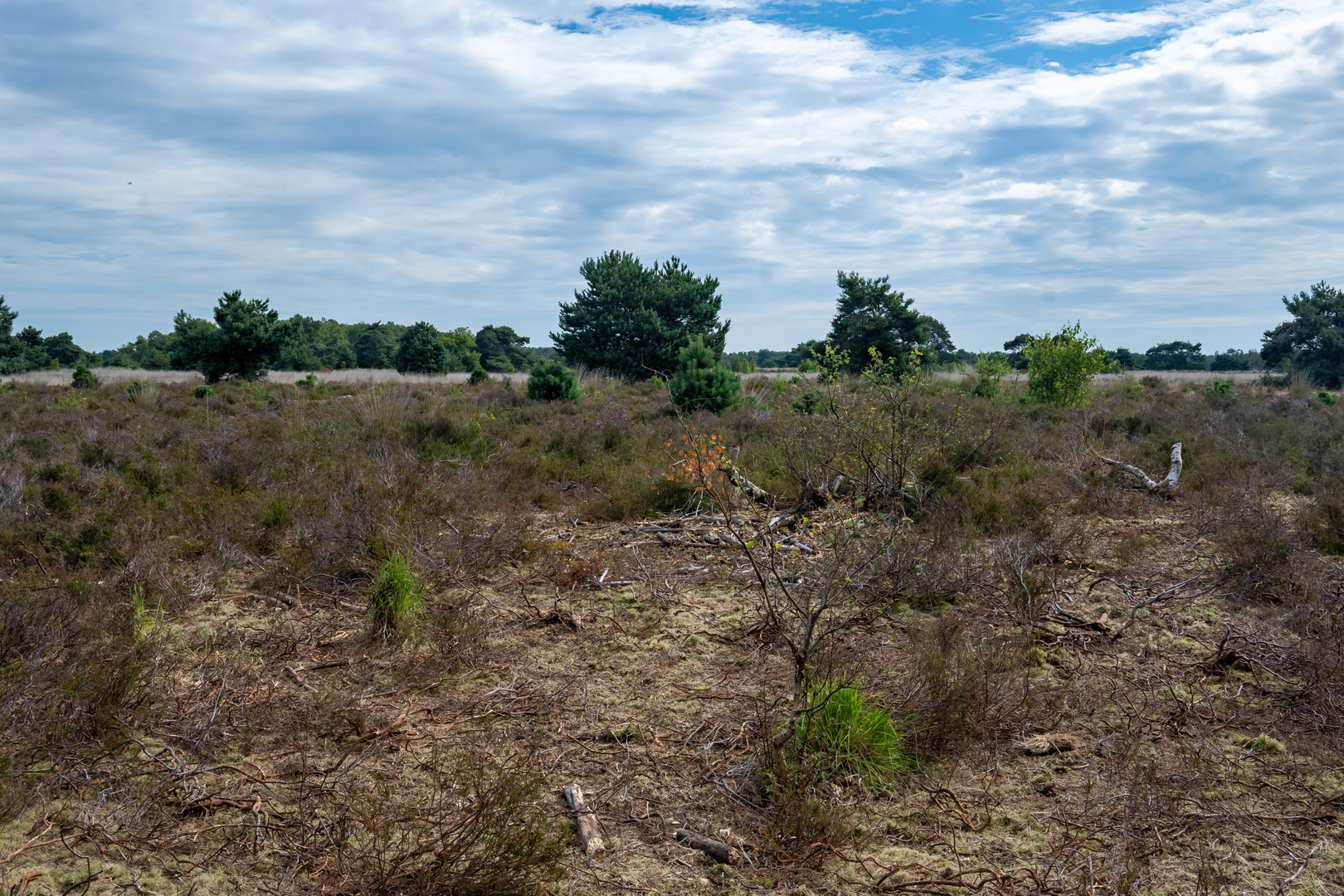
The Kempen is known for its heath-and-forest mosaic, shaped by centuries of land use: grazing, sod cutting, and later large-scale pine planting for timber and soil stabilization. That history is visible in the abrupt transitions between: - Open heath (heide): Low shrubs (heather) and grasses, with wide skies and long sightlines. In late summer, heather can color the landscape; outside bloom season it’s still striking for its openness. - Pine plantations and mixed woodland: Straight, evenly spaced stands alternate with more natural mixed patches. These forests provide wind shelter but can be monotonous—another reason to rely on HiiKER at busy junctions. - Sandy tracks and drift-sand character: Some Kempen areas retain a “sandy” feel—light soils, sparse groundcover in places, and tracks that can be powdery when dry.
Wildlife is typically subtle rather than dramatic, but you can reasonably expect: - Roe deer at woodland edges (most likely early/late in the day), - Foxes and small mustelids (rarely seen, more often noticed by tracks), - Heathland birds and woodland songbirds; raptors may circle over open heath on calm days, - In wetter pockets, amphibians and dragonflies in season.
Ticks can be present in heath/edge habitat—long socks and periodic checks are sensible.
Services, water, and resupply strategy
Because this route links multiple named loops, you’ll likely pass near villages more than once, but don’t assume constant services. - Water: Carry enough to bridge long nature stretches. In cool weather, many hikers manage with 2–3 L; in warm weather, plan more and identify refill points in villages. - Food: For 69 km (43 mi), bring a mix of quick calories and real food. If your route skirts village centers, bakeries and small supermarkets can be ideal resupply—just verify opening hours. - Toilets: Most reliable in village centers or at larger recreation hubs; in nature areas, facilities can be sparse.
Hazards and what to look out for
- Sandy fatigue: The “easy” rating can be misleading—soft sand increases effort. If you feel your pace collapsing, shorten stride and keep cadence steady.
- Cyclists: Many Kempen tracks are shared-use. Listen for bikes on fast gravel lanes and keep right at blind bends.
- Weather exposure: Heath is open and can be windy; forests can feel calm but also darker and cooler. In summer, sun exposure on heath can be significant—hat and sunscreen matter even on “flat”

Surfaces
Unknown
Asphalt
Concrete
Paved
Grass
Dirt
Cobblestone
Unpaved
Sand
Comments and Reviews
User comments, reviews and discussions about the Cartierheide, De Kempem, De groote Cirkel, Beleven and De Uitwijk Loop, Netherlands.
average rating out of 5
0 rating(s)