Download
3D Flyover
Add to list
More
10.0 km
~1 hrs 59 min
0 m
Loop
“Wander through blooming heather, ancient dunes, and sweeping vistas on this enchanting Bakkeveen adventure.”
Trail Overview
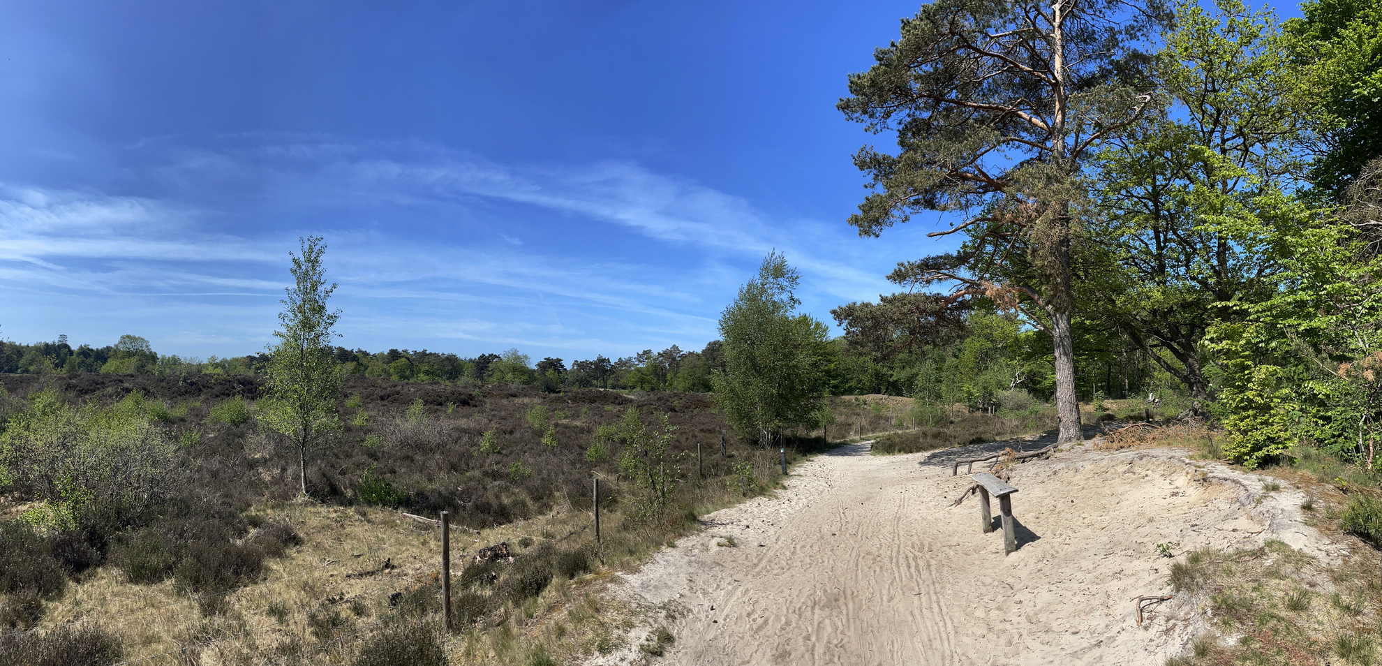
The Bakkeveense Duinen and Uitzichttoren Loop is a scenic circular hike of approximately 10 kilometers (6.2 miles) with minimal elevation gain, making it accessible for hikers of all levels. The trail meanders through the diverse landscapes of the Bakkeveense Duinen, encompassing forests, heathlands, sand drifts, and historical landmarks.
Getting There
The trailhead is located near the village of Bakkeveen in Friesland, Netherlands.
By Car: From major cities like Groningen or Leeuwarden, drive towards Bakkeveen. Parking is available at the Tourist Transfer Point (Toeristisch Overstap Punt or 'TOP') in Bakkeveen, situated at Mjûmster Wei, 9243 KG, Bakkeveen.
By Public Transport: Take a train to Drachten or Groningen, then transfer to a bus heading towards Bakkeveen. The nearest bus stop is in the village center, a short walk from the trailhead.
Trail Highlights
Bakkeveense Duinen: This nature reserve spans over 200 hectares and features a mix of sand dunes, forests, and heathlands. The area is renowned for its natural beauty and is part of the larger It Mandefjild reserve, designated as a Natura 2000 site due to its ecological significance. (friesland.nl)
Uitzichttoren Bakkeveen: Approximately 2 kilometers (1.2 miles) into the hike, you'll encounter the Uitzichttoren (Observation Tower). Standing at 23 meters (75 feet) tall, this tower offers panoramic views of the surrounding landscapes, including the expansive heathlands and distant villages. It's an excellent spot for photography and a brief rest. (friesland.nl)
Natural Features
Heathlands and Sand Drifts: The trail traverses vast heath fields, particularly around the Mandeveld area, where heather blooms in late summer, painting the landscape in shades of purple. Sand drifts are remnants of ancient glacial activity, providing a unique terrain to explore.
Pingoruïnes: Around the 5-kilometer (3.1-mile) mark, you'll pass by the Harmsdobbe and Poepedobbe, two pingoruïnes. These are circular depressions formed during the last Ice Age when ice lenses beneath the ground melted, causing the overlying earth to collapse and create small lakes. Historically, these ponds were used for agricultural purposes, such as washing sheep. (friesland.nl)
Wildlife
Birdwatching: The Bakkeveense Duinen is a haven for bird enthusiasts. Species such as the Common Raven, Common Crossbill, Firecrest, and Common Redstart are frequently spotted. In spring, the area becomes particularly vibrant with the presence of various woodpecker species. (birdingplaces.eu)
Grazing Animals: Herds of sheep and Exmoor ponies are often seen grazing in the heathlands, contributing to the maintenance of the landscape and providing hikers with delightful encounters.
Historical Significance
Landweer: Around the 7-kilometer (4.3-mile) point, the trail passes by the Landweer, a late medieval defensive earthwork marking the historical boundary between Friesland and Drenthe. Constructed to deter invading forces, it stands as a testament to the region's strategic importance in the past. (friesland.nl)
Allardsoog: Near the 8-kilometer (5-mile) mark, you'll reach Allardsoog, a hamlet located at the tripoint of Friesland, Groningen, and Drenthe provinces. This area features an ancient hollow road, once a significant medieval route connecting the provinces. Additionally, several Neolithic burial mounds are present, indicating human activity dating back thousands of years. (friesland.nl)
Trail Navigation
The route is well-marked with green posts, guiding hikers through the diverse terrains. For detailed maps and real-time navigation, consider using HiiKER, which provides comprehensive trail information and offline maps.
Amenities
Rest Areas: Benches are strategically placed along the trail, offering spots to rest and enjoy the scenery.
Cafés and Restaurants: At the trail's end in Bakkeveen, several eateries provide opportunities to relax and refuel.

Surfaces
Unknown
Dirt
Sand
Asphalt
Paved
Comments and Reviews
User comments, reviews and discussions about the Bakkeveense Duinen and Uitzichttoren Loop, Netherlands.
average rating out of 5
0 rating(s)