Download
3D Flyover
Add to list
More
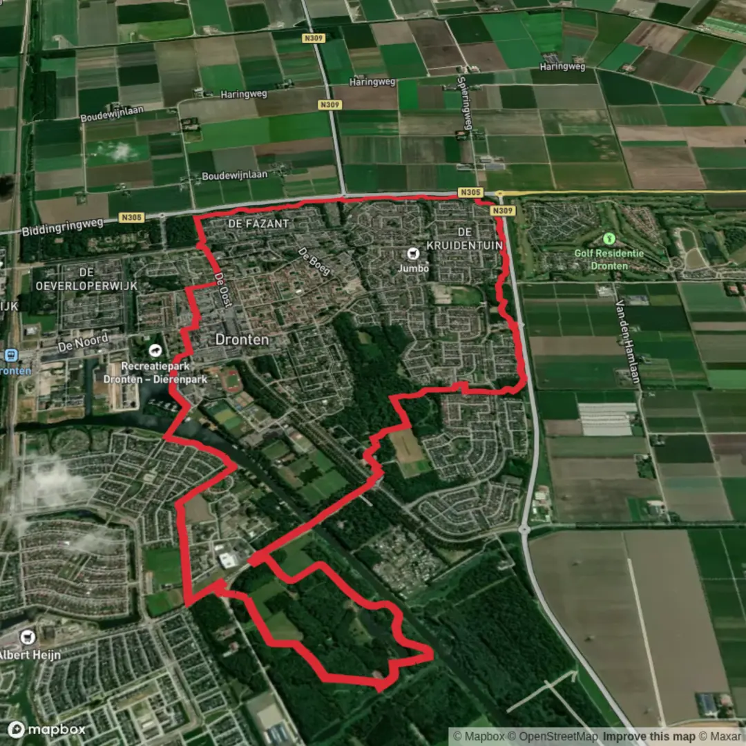
12.3 km
~2 hrs 27 min
0 m
Loop
“Wander through shimmering lakesides, blossoming woodlands, and sweeping polders where land meets sky.”
Starting from the marina area near Dronten, this 12 km (about 7.5 miles) loop offers a flat, easy-going walk with virtually no elevation gain, making it accessible for hikers of all abilities. The trailhead is conveniently located near Jachthaven De Klink, a well-known marina on the shores of the Drontermeer, which serves as a recognizable landmark for those arriving by car or public transport. Dronten itself is easily reached by train from major Dutch cities, and local buses connect the station to the marina area.
Getting Oriented and Navigation
The route is well-marked and follows a combination of paved and unpaved paths, weaving through open polder landscapes, wooded areas, and along the water’s edge. For precise navigation and up-to-date trail conditions, HiiKER is the recommended tool, offering detailed maps and waypoint information.
Highlights Along the Route
Jachthaven De Klink and Drontermeer Shoreline
The loop begins by skirting the marina, where you’ll see a lively scene of boats and waterfowl. The Drontermeer, a narrow lake separating the polder from the old mainland, is a haven for birdwatchers—look for grebes, herons, and swans gliding across the water. The open views across the lake are especially striking in the early morning or late afternoon.
Van Veldhuizenbos Woodland
After leaving the shoreline, the path enters Van Veldhuizenbos, a young woodland planted as part of Flevoland’s ambitious land reclamation projects. This forest is a patchwork of birch, oak, and willow, with wide, straight paths typical of planned Dutch woodlands. In spring and summer, the undergrowth is alive with wildflowers and butterflies, while autumn brings a colorful display of foliage.
Polder Landscapes and Agricultural Heritage
Much of the route traverses the reclaimed land of Eastern Flevoland, an area with a unique history. Once part of the Zuiderzee, this region was drained and converted to farmland in the mid-20th century, making it one of the Netherlands’ youngest landscapes. The flat, open fields are dotted with modern wind turbines and traditional Dutch farmhouses, offering a glimpse into the country’s ongoing relationship with water management and agriculture.
Wildlife and Nature
The combination of water, woodland, and open fields supports a variety of wildlife. Besides waterfowl, you may spot hares darting across the fields and, in quieter moments, roe deer at the forest’s edge. The area is also known for its rich insect life, including dragonflies and damselflies near the water.
Facilities and Practical Tips
There are several benches and picnic spots along the route, particularly near the marina and within Van Veldhuizenbos. The marina area offers parking, restrooms, and a café, making it a convenient place to start and finish your walk. The entire loop is flat, with a total elevation gain of less than 5 metres (16 feet), and is suitable for families, cyclists, and those with limited mobility.
Public transport users can reach Dronten by train, then take a local bus or taxi to Jachthaven De Klink. For drivers, ample parking is available at the marina. The trail is accessible year-round, though waterproof footwear is recommended in wetter months due to occasional muddy patches in the woodland sections.

Surfaces
Unknown
Gravel
Asphalt
Concrete
Paved
Comments and Reviews
User comments, reviews and discussions about the Jachthaven and Van Veldhuizenbos Loop, Netherlands.
average rating out of 5
0 rating(s)