Download
3D Flyover
Add to list
More
5.7 km
~1 hrs 10 min
23 m
Loop
“Wander sandy forest lanes from Doornse Gat to Ruiterberg’s quiet estate, with gentle dips.”
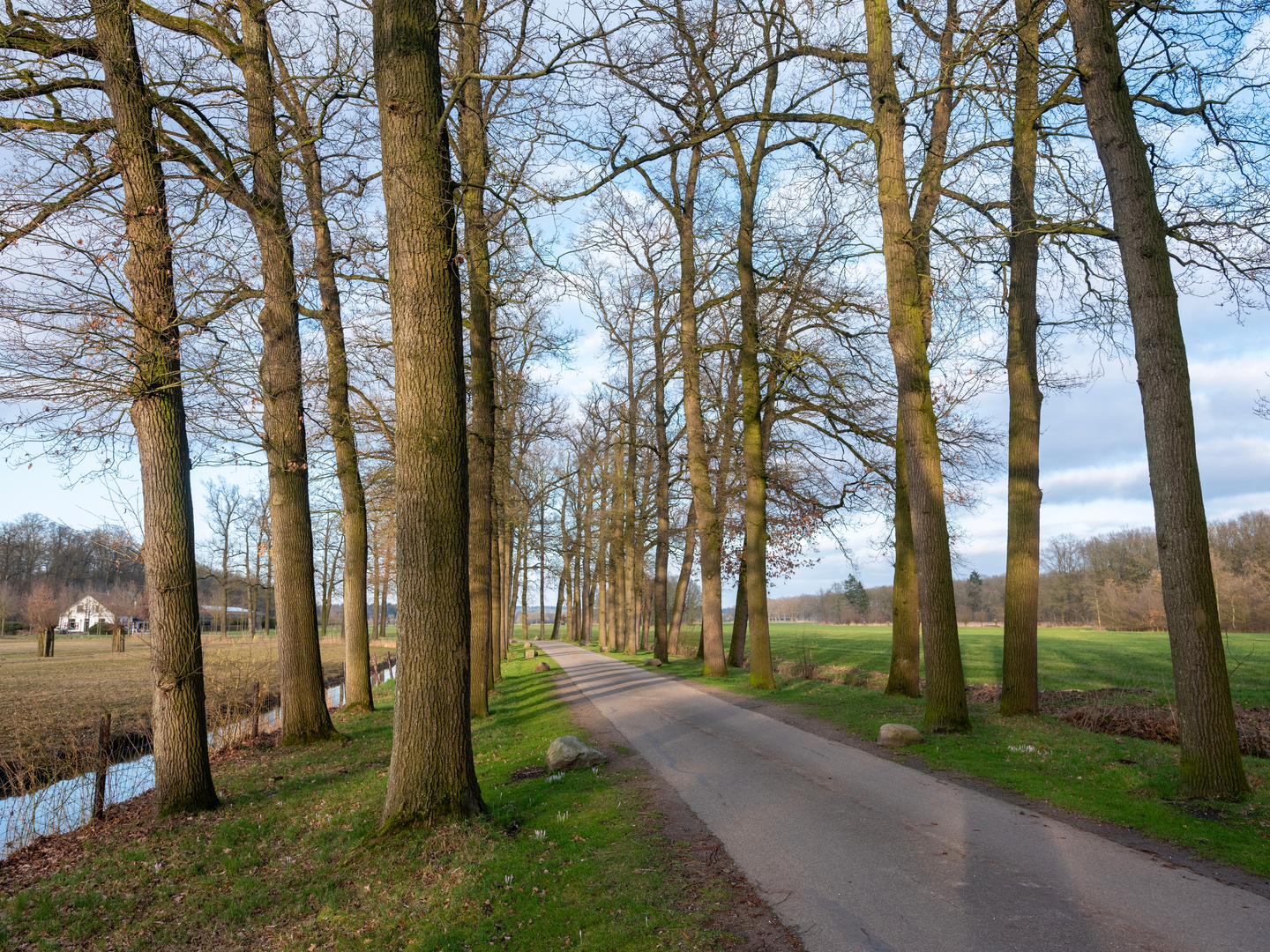
This easy loop sits in the Kaapse Bossen on the Utrechtse Heuvelrug, starting from the well-known recreation area Het Doornse Gat near Doorn (Utrecht, Netherlands). Expect a mostly forested walk with wide sandy lanes and smaller woodland paths, passing a historic estate landscape around Landgoed Ruiterberg. Although the overall feel is “flat-to-gently-rolling,” the area is a glacial ridge, so you may notice short, mild rises and dips even if the net elevation gain is close to 0 m (0 ft).
Distance & effort
- ~6 km (3.7 mi) loop
- ~0 m (0 ft) elevation gain overall (allow for a few small undulations typical of the Heuvelrug)
- Estimated time: 1.5–2 hours at a relaxed pace, longer if you linger at the estate features or the play area
Where the hike starts (nearest landmark / address)
- The most practical start point is Parking Het Doornse Gat, on/along Leersumsestraatweg, Doorn (recreation area “Doornse Gat”). (np-utrechtseheuvelrug.nl)
- Nearby significant landmark on the loop: Landgoed Ruiterberg, commonly referenced with the address Maarsbergseweg 6, 3941 MJ Doorn. (skbl.nl)
Getting to the start (car + public transport)
By car - Navigate to “Parkeerplaats Het Doornse Gat” (Leersumsestraatweg, Doorn). It’s a dedicated recreation-area car park and a common trailhead for marked routes in the Kaapse Bossen. (np-utrechtseheuvelrug.nl)
By public transport
- The National Park information for this entrance notes bus access via bus lines 50 and 81, getting off at halte “Sonora”, then walking to the Doornse Gat entrance area. (np-utrechtseheuvelrug.nl)
(Use HiiKER to confirm the exact walking line from the stop to the trailhead and to choose the correct side of the road to begin.)
You’ll begin at the Doornse Gat recreation area—historically a former sand excavation that’s now been repurposed for day recreation. (alltrails.com) Early on, you’ll likely notice a “bowl” or depression-like landscape; it’s a distinctive feature here and helps explain why this spot feels more open and lively than the surrounding forest.
From the recreation area, the loop typically transitions quickly into the Kaapse Bossen: straight forest lanes alternating with more winding tracks. Underfoot is often a mix of compacted sand, forest soil, and occasional firmer sections near the busier entrance. After rain, the lower parts near the depression can hold damp patches, while the higher sandy lanes tend to drain faster.
As you move deeper into the woods, the atmosphere becomes quieter and more estate-like: long sightlines through planted woodland blocks, then a shift toward the designed landscape around Ruiterberg. The “landgoed” character is noticeable—paths feel intentionally placed, and you’ll pass features associated with the historic outside-place (buitenplaats) setting.
Landgoed Ruiterberg: landmarks and historical context
Ruiterberg is notable as the last buitenplaats established in Doorn (laid out in 1916), with the house construction beginning shortly after. (skbl.nl) The estate’s story is closely tied to early-20th-century prosperity and the tradition of building country houses on the wooded ridge.
During World War II, the estate’s house was destroyed, and later the landgoed came into the care of Natuurmonumenten (1956)—a key reason the surrounding grounds remain accessible for walking today. (skbl.nl) As you pass the estate area, you may notice that access is generally focused on paths and garden/park edges rather than right up to the house—parts of the immediate house setting are typically not open. (skbl.nl)
Nature, wildlife, and what to look out for
This is classic Utrechtse Heuvelrug woodland: mixed forest structure, with a good chance of seeing signs of wildlife even on a short loop. In and around Ruiterberg, hikers commonly report wildlife such as roe deer (reeën) and badgers (dassen), along with smaller mammals like rabbits and hares; raptors such as buzzards and hawks are also noted in the area. (happy-hikes.nl)
Practical “look out for” notes: - Shared-use paths: The Kaapse Bossen area can be busy, especially

Surfaces
Unknown
Unpaved
Asphalt
Dirt
Sand
Comments and Reviews
User comments, reviews and discussions about the Doornse Gat and Landgoed Ruiterberg Loop, Netherlands.
average rating out of 5
0 rating(s)