Download
3D Flyover
Add to list
More
10.6 km
~2 hrs 7 min
7 m
Loop
“Wander sun-dappled dunes, sweeping beaches, and wildflower paths where Zeeland’s landscapes and history entwine.”
Hooge Hil, Breezand, Lage Duintjes and Dukndistel Loop
Embarking on the Hooge Hil, Breezand, Lage Duintjes, and Dukndistel Loop offers a delightful 11-kilometer (approximately 6.8 miles) journey through the diverse landscapes of Zeeland, Netherlands. With virtually no elevation gain, this easy trail is suitable for hikers of all levels.
Trailhead and Access
The loop begins near Domburg, a charming coastal town renowned for its beaches and artistic heritage. To reach Domburg by car, take the A58 motorway towards Middelburg, then follow the N57 and N287 to Domburg. For those using public transport, trains run to Middelburg station, from where bus services connect to Domburg.
Hooge Hil
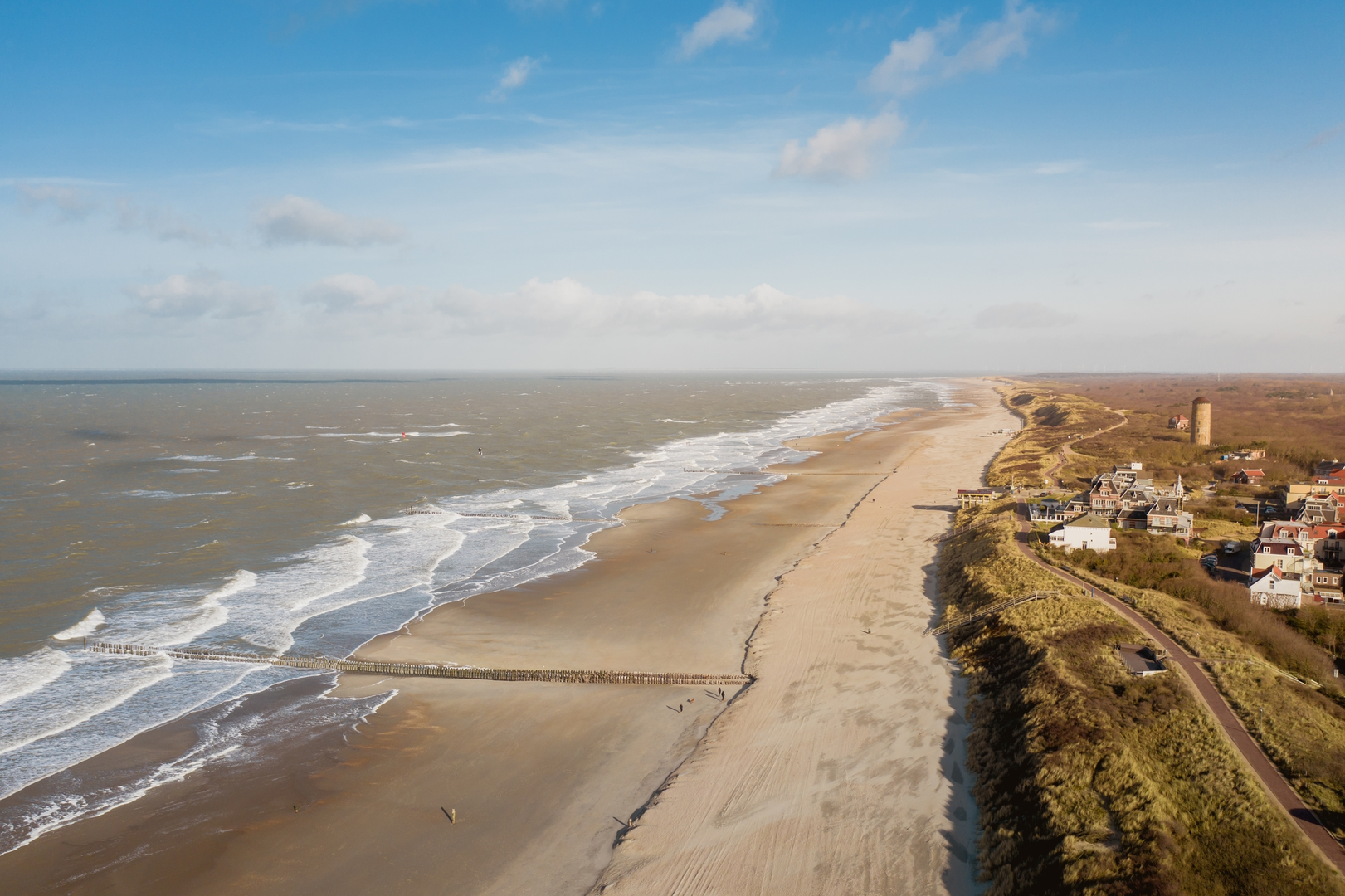
Starting at Hooge Hil, the highest dune in Domburg, hikers are greeted with panoramic views of the village, expansive beaches, and the North Sea. This vantage point, favored by 19th-century artists for its unique light, provides an excellent opportunity for photography and appreciation of the coastal landscape. (domburg.com)
Breezand
Proceeding towards Breezand, the trail meanders through serene dune landscapes and coastal vegetation. Breezand is part of the larger Breezanddijk area, known for its natural beauty and as a habitat for various bird species. Birdwatchers may spot species such as the Eurasian oystercatcher and common tern along this stretch.
Lage Duintjes
The path then leads to Lage Duintjes, characterized by lower dunes and diverse flora. This area showcases the dynamic nature of coastal ecosystems, with shifting sands and resilient plant life. The relatively flat terrain here makes for a leisurely walk, allowing hikers to immerse themselves in the tranquil surroundings.
Dukndistel
Continuing to Dukndistel, the trail passes through areas rich in dune vegetation, including sea buckthorn and marram grass. The name "Dukndistel" refers to the dune thistle, indicative of the plant species prevalent in this region. This segment of the hike offers insights into the unique adaptations of flora to the coastal environment.
Historical Significance
The region around Domburg has a rich history, with evidence of human settlement dating back to Roman times. The dunes have served as both natural protection and a source of inspiration for artists, particularly during the 19th century when the Domburg School of painters captured the area's distinctive light and landscapes.
Navigation and Preparation
For detailed maps and navigation assistance, hikers can utilize the HiiKER app, which provides comprehensive trail information and offline maps. Given the coastal nature of the trail, it's advisable to check weather conditions before setting out, as winds can be strong, and weather can change rapidly. Wearing layers and bringing windproof clothing will enhance comfort during the hike.
This loop offers a harmonious blend of natural beauty, wildlife observation, and historical context, making it a rewarding experience for those exploring the Zeeland coast.

Surfaces
Unknown
Asphalt
Ground
Sand
Gravel
Concrete
Wood
Dirt
Comments and Reviews
User comments, reviews and discussions about the Hooge Hil, Breezand, Lage Duintjes and Dukndistel Loop, Netherlands.
average rating out of 5
0 rating(s)