Download
3D Flyover
Add to list
More
16.2 km
~3 hrs 16 min
20 m
Loop
“Wander through storybook meadows, woodlands, and historic estates, where nature and Dutch heritage entwine.”
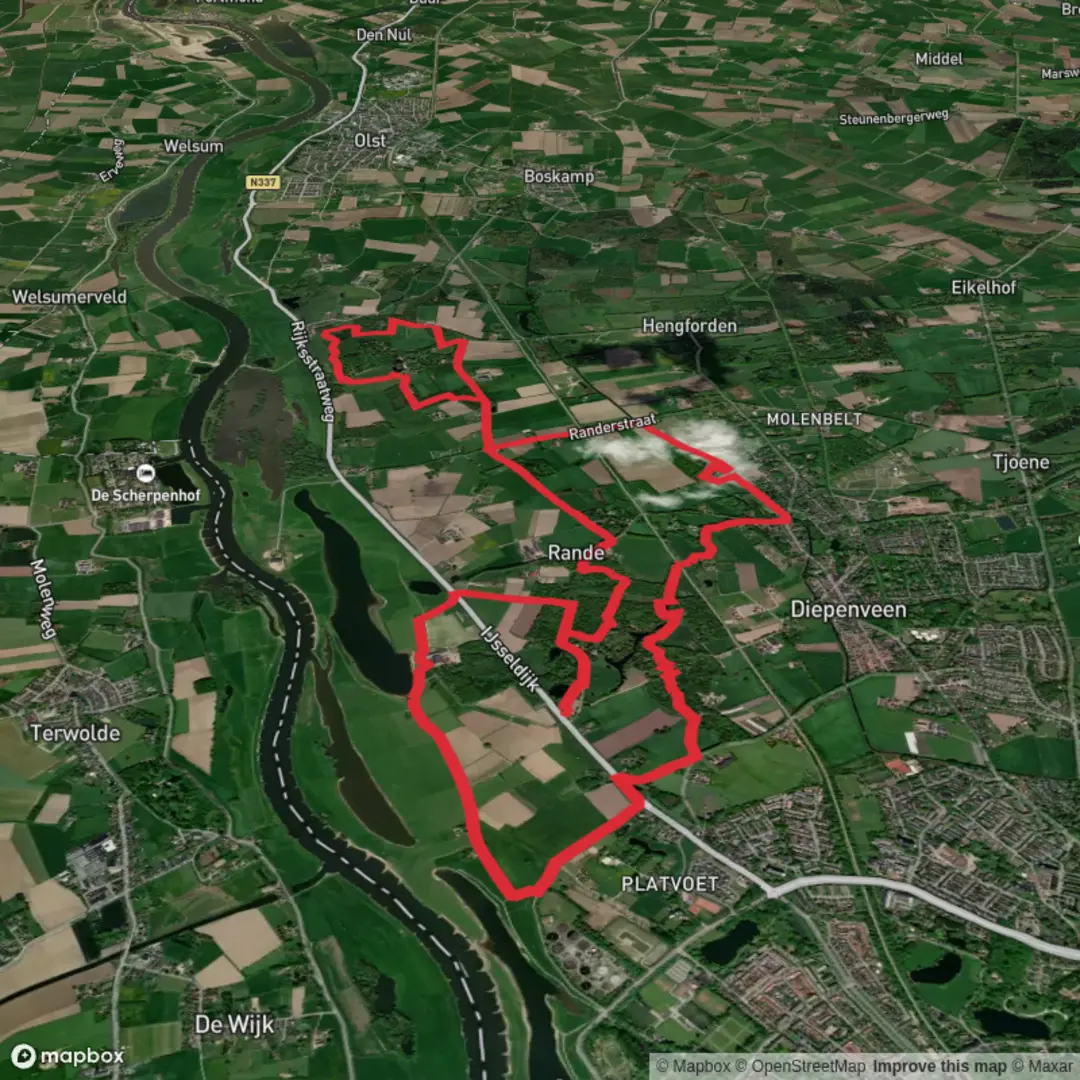
Starting near the charming village of Diepenveen, Netherlands, this 16 km (about 10 miles) loop trail offers a gentle, flat walk with virtually no elevation gain, making it accessible for most hikers. The trailhead is conveniently located near the historic estate of De Haere, which is easily reached by local bus from Deventer’s main train station or by car, with parking available at the estate’s entrance.
Getting There
From Deventer, take a local bus towards Diepenveen and alight at the stop closest to Kasteel De Haere. If driving, set your navigation to Kasteel De Haere, Olsterweg 5, 7431 PA Diepenveen. The estate’s car park is a popular starting point for walkers.
Trail Overview and Navigation
The loop meanders through a quintessential Dutch landscape of meadows, woodlands, and waterways. The route is well-marked, but for added confidence and real-time navigation, use HiiKER to follow the trail and check your progress.
Highlights Along the Route
De Haere Estate (Start/Finish, 0 km/0 miles)
Begin at the stately De Haere estate, a moated manor house dating back to the 14th century. The grounds are open to the public and feature landscaped gardens, a historic watchtower, and remnants of WWII-era bunkers, offering a glimpse into the region’s layered history.
Roobrug and the IJssel Floodplains (Approx. 4 km/2.5 miles)
The trail leads north towards Roobrug, a small bridge crossing a scenic canal. Here, the landscape opens up to the IJssel river’s floodplains, where you may spot grazing cattle, wild geese, and herons. The area is known for its rich biodiversity, especially in spring and autumn when migratory birds pass through.
Nieuw Doorn Weerth Woods (Approx. 8 km/5 miles)
Entering the Nieuw Doorn Weerth woodland, the path winds through mixed forest with oak, beech, and pine. Listen for woodpeckers and keep an eye out for roe deer, which are sometimes seen darting between the trees. The forest floor is carpeted with wildflowers in late spring.
Historic Dikes and Canals (Approx. 12 km/7.5 miles)
The route follows ancient dikes and man-made canals, a testament to centuries of Dutch water management. Interpretive signs along the way explain how these structures protected the land from flooding and enabled agriculture to flourish.
Practical Information
The entire loop is flat, with a total elevation gain of less than 5 metres (16 feet), making it suitable for families and casual walkers. Surfaces are a mix of gravel paths, grassy tracks, and quiet country lanes. Waterproof footwear is recommended in wetter months, as some sections can be muddy.
There are several benches and picnic spots along the route, particularly near the De Haere estate and at scenic viewpoints by the IJssel. Public toilets are available at the estate and in Diepenveen village.
Wildlife and Nature
Expect to see a variety of waterfowl, songbirds, and possibly hares or foxes in the open fields. The floodplains are especially lively with bird activity, and the woodlands provide a peaceful, shaded stretch in the middle of the hike.
Historical Significance
The region around Diepenveen has a long history of land reclamation and water management, visible in the dikes and canals that crisscross the landscape. De Haere estate itself played a role in local defense during WWII, with bunkers and a watchtower still standing as reminders.
For navigation and route planning, HiiKER provides detailed maps and trail information to ensure a smooth and enjoyable walk through this picturesque corner of Overijssel.

Surfaces
Unknown
Asphalt
Concrete
Dirt
Sand
Ground
Gravel
Wood
Comments and Reviews
User comments, reviews and discussions about the De Haere, Roobrug and Nieuw Doorn Weerth Loop, Netherlands.
average rating out of 5
0 rating(s)