Download
3D Flyover
Add to list
More
22.8 km
~4 hrs 36 min
22 m
Point-to-Point
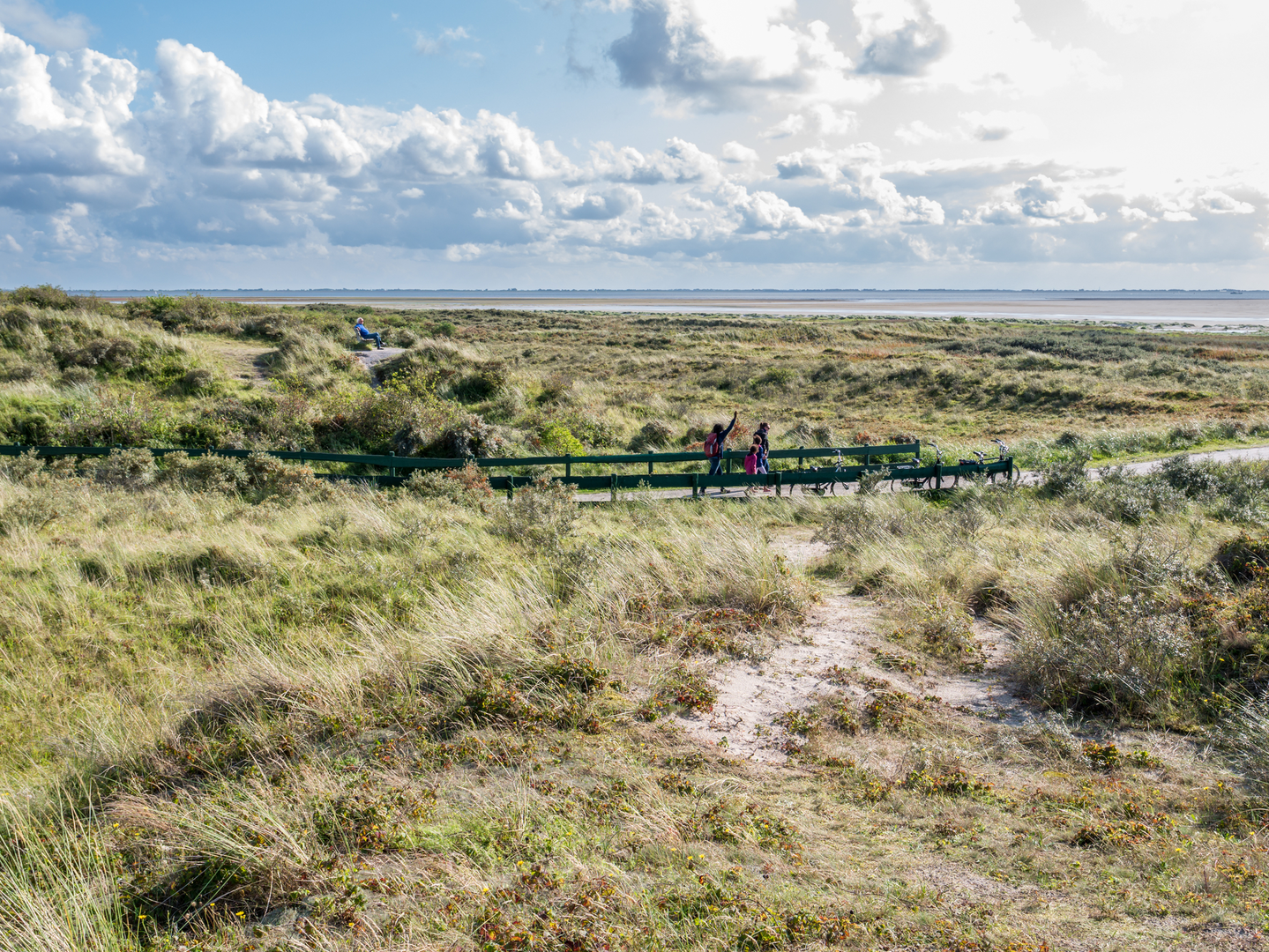
“Wander through windswept dunes, salt marshes, and centuries-old stories on this inviting island loop.”
Starting from the vicinity of Schiermonnikoog village, this gentle 3 km (about 1.9 miles) loop offers a flat, easy-going walk with virtually no elevation gain, making it accessible for all ages and fitness levels. The trailhead is conveniently located near the main entrance to Schiermonnikoog National Park, just a short walk or cycle from the ferry terminal and the village center. Public buses and bicycle rentals are available at the ferry landing, providing seamless access for those arriving without a car.
Getting Oriented and Navigation
The route is well-marked, but carrying a digital map on HiiKER is recommended for real-time navigation and to explore nearby points of interest. The loop follows sandy and grassy paths typical of the island, with clear signage at key junctions.
Natural Highlights and Wildlife
Schiermonnikoog is renowned for its diverse landscapes, and this loop showcases the best of its coastal and dune environments. Early in the walk, you’ll pass through open dune grasslands, where skylarks and meadow pipits are often seen flitting above the swaying grasses. The area is a haven for birdwatchers, especially during spring and autumn migrations when thousands of waders and waterfowl stop over in the wetlands.
At roughly the halfway point, the trail skirts the edge of the Ockesnol, a low-lying salt marsh. This habitat is rich in plant life, including sea lavender and glasswort, and is frequented by grazing Konik horses and Highland cattle, which help maintain the open landscape. Keep an eye out for spoonbills and avocets feeding in the shallow pools.
Cultural and Historical Context
Schiermonnikoog’s name means “Island of the Grey Monks,” a nod to the Cistercian monks who once owned the island in the Middle Ages. The Richel Weg, part of your loop, is named after a sandbank off the island’s coast, historically significant for its shifting shape and role in local navigation. The island itself has a storied past, having served as a strategic outpost during World War II and as a refuge for shipwreck survivors over the centuries.
Trail Conditions and Practical Tips
The loop is almost entirely flat, with an elevation gain of less than 1 metre (3 feet), and the paths are generally firm underfoot, though sections can be sandy or muddy after rain. Sturdy walking shoes are recommended, especially if you plan to explore side trails or venture onto the salt marsh. There are benches and picnic spots along the way, and the route is suitable for families and those with limited mobility.
Restrooms and refreshments are available in Schiermonnikoog village, just a few minutes from the trailhead. Dogs are welcome but must be kept on a leash to protect wildlife and grazing animals.
For those seeking a short, scenic, and educational walk through one of the Netherlands’ most unique island landscapes, this loop offers a perfect introduction to Schiermonnikoog’s natural and cultural heritage.

Surfaces
Sand
Unknown
Grass
Asphalt
Unpaved
Ground
Comments and Reviews
User comments, reviews and discussions about the Ockesnol and Richel Weg Loop, Netherlands.
average rating out of 5
0 rating(s)