Download
3D Flyover
Add to list
More
22.6 km
~4 hrs 31 min
0 m
Loop
“A long, wind-kissed Frisian loop of canals, pasture, and wâlden pockets, with comfort key.”
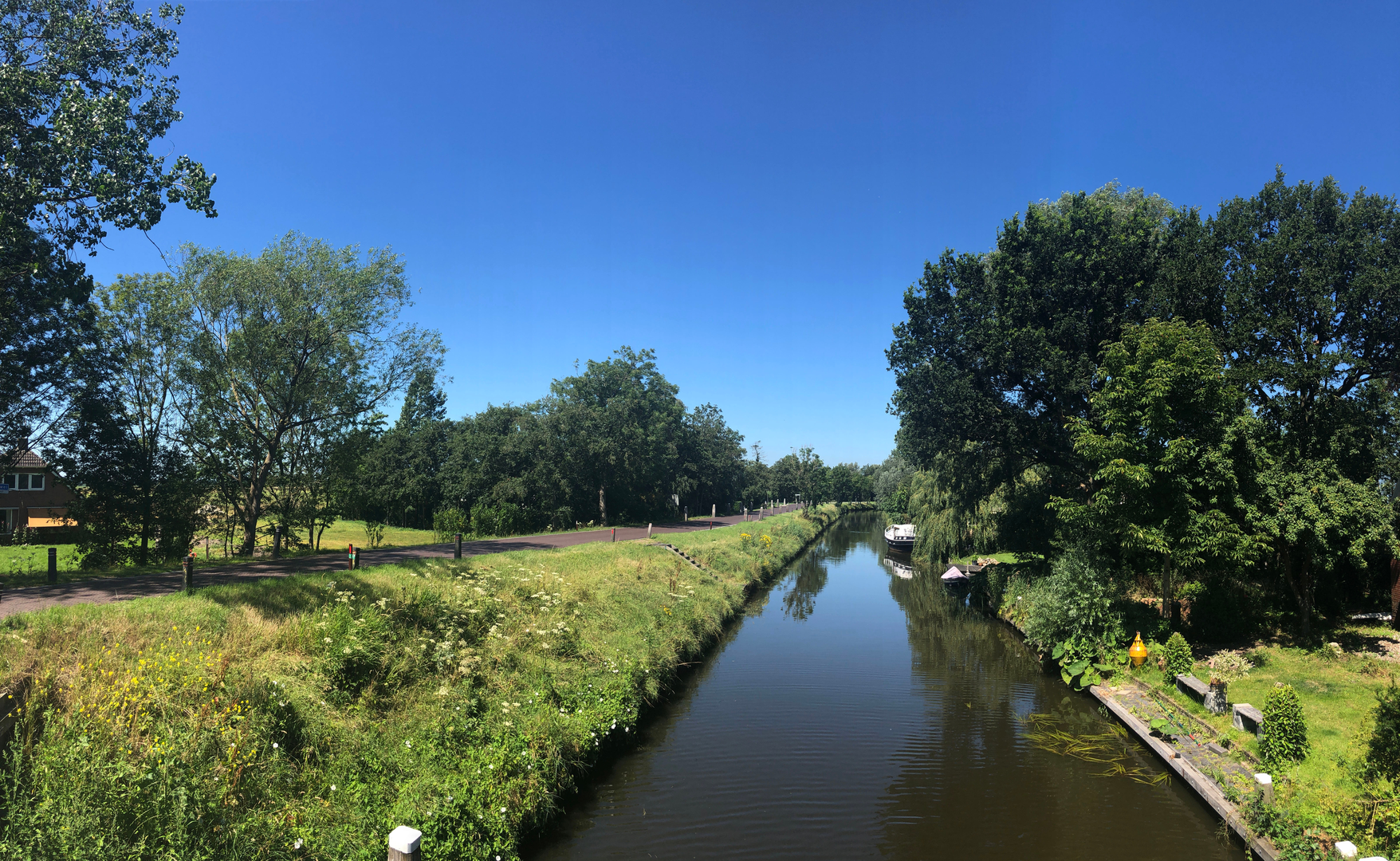
Plan on a long, level day through classic Frisian lowland scenery: village edges, open pasture, drainage canals, and small wooded “wâlden” pockets typical of the Noardlike Fryske Wâlden landscape. At ~23 km (about 14.3 miles) with roughly ~0 m / ~0 ft of climbing, the challenge here is less about elevation and more about steady distance, wind exposure across open fields, and keeping your feet comfortable on a mix of paved farm lanes, compacted paths, and grassy verges.
Where to start (nearest landmark / address) A practical, easy-to-find anchor in Westergeest is De Beintemapoldermolen (Beintemapolder Mill), Wouddijk, 9295 ZA Westergeest—a historic drainage windmill and a clear navigation reference for meeting up, parking nearby on public roads where permitted, and orienting your loop. (en.wikipedia.org)
Getting to the trailhead
By car - From the Dokkum / Leeuwarden side, you’ll approach Westergeest via regional roads through Kollum/Buitenpost area. In villages like Westergeest, parking is typically along public streets or small pull-ins—be mindful not to block farm gates, narrow lanes, or passing places used by agricultural traffic. - Use HiiKER to pinpoint the exact start marker for the loop and the closest legal parking options around the village edge.
By public transport - The most reliable approach is usually train to Buitenpost station (a key rail stop in the area), then a short bus/taxi onward to Westergeest. Bus routes and timetables can change seasonally; check the current connections for the day you’re hiking and then use HiiKER to walk the final link from the bus stop to the loop start.
What the route feels like (kilometre-by-kilometre)
0–5 km (0–3.1 mi): village lanes and polder edges
You’ll ease out of Westergeest on quiet streets and farm access roads. Expect very flat terrain with long sightlines: drainage ditches, reed fringes, and grazing land. In wet periods, the grassy margins can be slick, and narrow bridges over canals may be your first “watch your step” moments—especially if there’s algae on timber or concrete.
5–12 km (3.1–7.5 mi): open countryside, wind, and water management landmarks
This middle stretch is where Friesland’s engineered landscape becomes the main “landmark.” The route threads between canals and fields that exist because water is constantly managed here. A standout point to look for near Westergeest is De Beintemapoldermolen, built in 1870 to drain the Beintemapolder—an iconic reminder that these walks are literally across reclaimed and maintained land. (en.wikipedia.org)
Even if you don’t detour right up to it, it’s a useful mental waypoint: if you can see the mill or its surrounding polder infrastructure, you’re reading the landscape correctly.
12–18 km (7.5–11.2 mi): quieter tracks and “wâlden” character
As you arc away from the village, the scenery often alternates between exposed fields and more sheltered, tree-lined sections. These wooded strips and hedgerows are characteristic of the Noardlike Fryske Wâlden region, where the landscape feels more intimate than the wide-open coastal polders. (noardlikefryskewalden.nl)
Footing can change here: short grassy segments may be softer underfoot, while brick or asphalt farm lanes can feel repetitive—good shoes matter more than you’d think on a “flat” hike.
18–23 km (11.2–14.3 mi): return toward Westergeest and local heritage
The final leg typically brings you back onto more familiar village approaches. This is where fatigue can sneak up: flat terrain encourages a brisk pace early, so keep an eye on hotspots/blisters and take short breaks before you “need” them.
Landmarks, nature, and wildlife to watch for
- Birdlife is constant: expect geese, ducks, coots, and seasonal waders along ditches and

Surfaces
Asphalt
Unknown
Concrete
Grass
Ground
Comments and Reviews
User comments, reviews and discussions about the Fort Redoute, Westergeest and Siborsnollen Loop, Netherlands.
average rating out of 5
0 rating(s)