Download
3D Flyover
Add to list
More
6.7 km
~1 hrs 20 min
0 m
Loop
“Wander through a timeless Dutch tapestry of meadows, woodlands, and water, where nature and history entwine.”
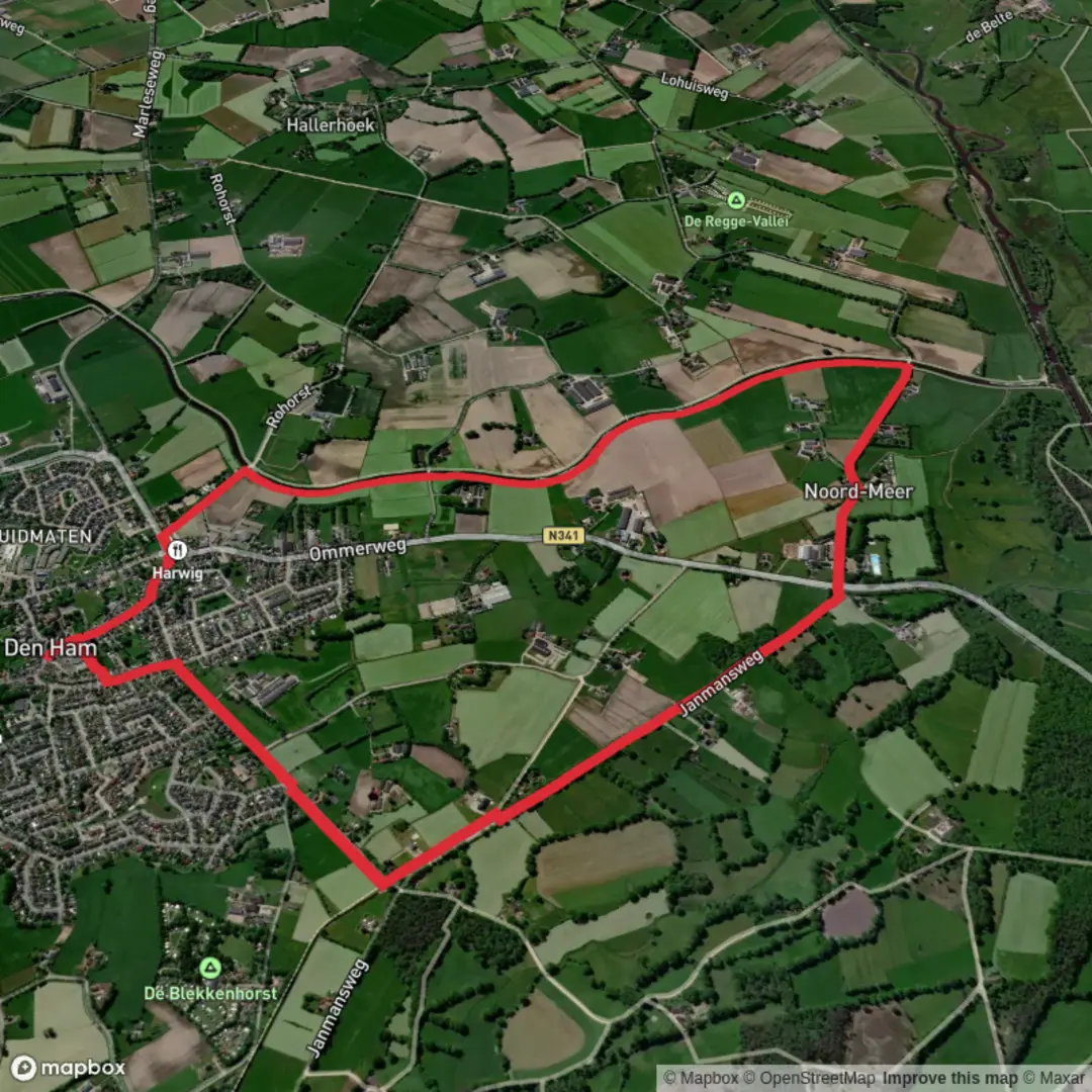
Nestled near the charming village of Den Ham in the Overijssel province of the Netherlands, this gentle 7 km (about 4.3 miles) loop offers a tranquil escape into the Dutch countryside. With virtually no elevation gain, it’s an ideal route for beginners, families, or anyone seeking a leisurely walk through a landscape shaped by both nature and history.
Getting There
The trailhead is conveniently located near the Zuiveringsinstallatie Den Ham, a water treatment facility just south of Den Ham. For those arriving by car, parking is available at the facility’s entrance on Hammerweg, a well-known road leading out of the village. If you’re using public transport, take a train to Vroomshoop or Ommen, then transfer to a local bus (such as line 81 or 83) that stops in Den Ham. From the village center, it’s a short walk south along Hammerweg to reach the starting point.
Trail Experience
Landscape and Terrain
Expect a flat, well-marked path that meanders through a patchwork of meadows, mixed woodlands, and small waterways typical of the Salland region. The route is mostly on wide, unpaved farm tracks and quiet rural lanes, making it accessible year-round and suitable for all fitness levels. The absence of significant elevation (0 metres/0 feet) means you can focus on the scenery rather than the climb.
Nature and Wildlife
The area is rich in birdlife, especially near the water treatment ponds and along the Janmans Weg, where reed beds and willow thickets provide habitat for reed warblers, herons, and the occasional kingfisher. In spring and summer, wildflowers line the ditches, attracting butterflies and bees. Keep an eye out for roe deer grazing at the woodland edges, especially in the early morning or late afternoon.
Points of Interest
- Zuiveringsinstallatie Den Ham: The hike begins and ends near this modern water treatment plant, a reminder of the Netherlands’ long-standing relationship with water management.
- Janmans Weg: This historic farm track, which forms the southern arc of the loop, has been used by local farmers for centuries. Along this stretch, you’ll pass traditional Dutch farmhouses and may spot grazing sheep or cattle.
- Old Windbreaks and Hedgerows: Remnants of centuries-old land division, these living fences are home to songbirds and small mammals. They also offer shelter from the wind and a glimpse into the region’s agricultural past.
Navigation and Safety
The loop is straightforward, but carrying a digital map on HiiKER is recommended to ensure you stay on track, especially at junctions where farm tracks intersect. The route is mostly exposed, so bring sun protection on bright days and be prepared for muddy patches after rain.
Historical Context
Den Ham and its surroundings have a rich agricultural history, with evidence of settlement dating back to the Middle Ages. The landscape you’ll traverse has been shaped by centuries of farming, drainage, and water management—an ongoing Dutch tradition. The presence of the water treatment facility at the trailhead is a modern continuation of this legacy, ensuring clean water for the region.
This loop offers a peaceful journey through a quintessential Dutch landscape, blending natural beauty with subtle reminders of the area’s deep-rooted connection to land and water.

Surfaces
Unknown
Grass
Asphalt
Concrete
Sand
Wood
Comments and Reviews
User comments, reviews and discussions about the Zuiveringsinst and Janmans Weg Loop, Netherlands.
average rating out of 5
0 rating(s)