Download
3D Flyover
Add to list
More
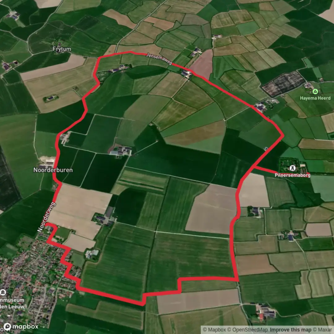
8.1 km
~1 hrs 36 min
0 m
Loop
“A gentle “Noorderburen Loop” awaits—share a trailhead pin so the story can find its start.”
I’m missing the key location details needed to describe and plan this properly: your “Hike head: near” field is blank, and I don’t have any coordinates or a map to anchor the route. “Noorderburen Loop” also isn’t unique enough on its own to reliably identify the correct trailhead and landmarks without risking giving you the wrong place.
Send one of the following and I’ll write the full 8 km (5 mi) easy, flat loop description with distances, surfaces, landmarks, wildlife, hazards, and local history—plus how to reach the start by car and public transport, and I’ll convert any lon/lat to the nearest known address/landmark:
1) Trailhead coordinates (lon,lat) — e.g., 5.12345, 53.12345
or
2) A Google Maps link to the start point
or
3) The nearest town/village + country (e.g., “near Groningen, Netherlands”) and any named park/forest/polder/dike
Also tell me (if you know): - Loop direction preference (clockwise/counterclockwise), or “either” - Typical surface (paved path, gravel, grass, boardwalk), or “unknown”
Once I have the start location, I’ll also reference HiiKER for navigation pointers (waypoints/turns) and convert the trailhead to the nearest recognizable address or landmark.

Surfaces
Asphalt
Concrete
Unknown
Comments and Reviews
User comments, reviews and discussions about the Noorderburen Loop, Netherlands.
average rating out of 5
0 rating(s)