Download
3D Flyover
Add to list
More
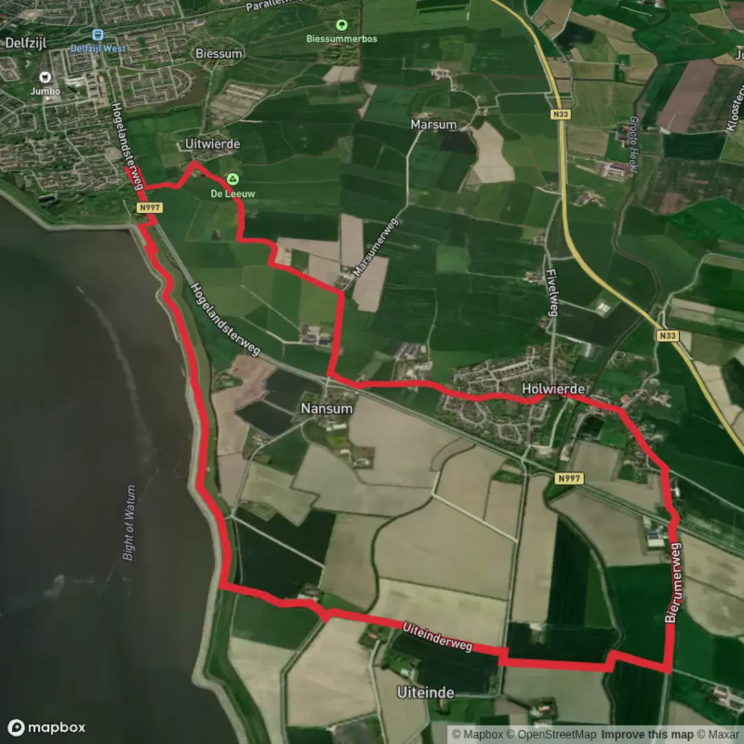
10.1 km
~2 hrs 1 min
0 m
Loop
“Stroll through blooming meadows, historic windmills, and tranquil villages on this enchanting Dutch countryside loop.”
The Uiteinder Weg and Nansumer Weg Loop is a scenic 10 km (approximately 6.2 miles) trail located in the province of Groningen, Netherlands. With virtually no elevation gain, this easy loop is ideal for hikers of all skill levels, offering a peaceful journey through the Dutch countryside.
Getting There
The trailhead is situated near the village of Uithuizen, approximately 30 km (18.6 miles) north of Groningen city. For those traveling by car, Uithuizen is accessible via the N46 highway, with parking available near the village center. If using public transport, trains run regularly from Groningen to Uithuizen station, which is a short walk from the trail's starting point.
Trail Overview
Beginning in Uithuizen, the loop combines the Uiteinder Weg and Nansumer Weg, leading hikers through a variety of landscapes characteristic of the region. The well-marked path is predominantly flat, making it suitable for families and casual walkers.
Key Sections and Landmarks
Agricultural Fields and Polder Lands (0-3 km / 0-1.9 miles): The initial segment of the trail traverses expansive agricultural fields, showcasing the Netherlands' renowned polder landscapes. These reclaimed lands are a testament to Dutch engineering and offer insights into the country's agricultural practices.
Historic Windmills and Waterways (3-6 km / 1.9-3.7 miles): As you continue, you'll encounter traditional windmills, some of which date back to the 19th century. These structures were historically used for drainage and milling grain. The trail also runs alongside serene canals, reflecting the intricate water management systems that have shaped the region.
Nansum Village and Surroundings (6-8 km / 3.7-5 miles): Approaching the village of Nansum, the path meanders through charming rural settings. The village itself is a quaint example of northern Dutch architecture, with traditional farmhouses and a peaceful atmosphere.
Return to Uithuizen (8-10 km / 5-6.2 miles): The final stretch leads back to Uithuizen, passing through mixed woodlands and open meadows. This section is particularly pleasant during spring and summer when wildflowers are in bloom.
Flora and Fauna
The trail offers opportunities to observe local wildlife, including various bird species such as lapwings and storks. The surrounding fields and wetlands provide habitats for these birds, especially during migration seasons. The flora along the path includes native grasses, wildflowers, and occasional clusters of trees, adding to the scenic beauty of the hike.
Historical Significance
The region around Uithuizen and Nansum is rich in history. The presence of windmills and the polder landscape reflect centuries of Dutch ingenuity in land reclamation and water management. Additionally, the area has archaeological sites indicating human habitation dating back to prehistoric times, offering a glimpse into the long-standing relationship between the Dutch people and their environment.
Navigation and Safety
For navigation, it's recommended to use the HiiKER app, which provides detailed maps and real-time updates. The trail is well-maintained, but it's advisable to check weather conditions before setting out, as some sections can become muddy after rain. Wearing comfortable walking shoes and carrying water is recommended, especially during warmer months.
This loop offers a delightful blend of natural beauty, historical landmarks, and cultural insights, making it a rewarding experience for those looking to explore the Dutch countryside.

Surfaces
Asphalt
Unknown
Concrete
Comments and Reviews
User comments, reviews and discussions about the Uiteinder Weg and Nansumer Weg Loop, Netherlands.
average rating out of 5
0 rating(s)