Download
3D Flyover
Add to list
More
11.6 km
~2 hrs 27 min
83 m
Loop
“A gentle Twente loop of lanes, farm tracks and muddy field-edges, with wide views and woodland pauses.”
This easy loop is a relaxed countryside walk of about 12 km (7.5 mi) with roughly 100 m (330 ft) of total climbing—mostly gentle, short rises rather than any sustained ascent. Expect a mix of quiet lanes, farm tracks, and field-edge paths with long views across the Twente landscape, plus a couple of small wooded stretches that break up the open farmland.
Getting to the start (car + public transport)
Because the start point is listed only as “near,” the most reliable way to pin it down is to use the HiiKER route page/GPX for this loop and navigate to the trailhead it specifies. In practice, loops with this name typically begin around the Hakenberg area near De Lutte (Overijssel, Netherlands)—a well-known local high point and recreation area close to the village of De Lutte.
- By car: Aim for De Lutte and then follow local signs toward Hakenberg (often signposted as a viewpoint/recreation area). Parking is usually available at small pull-ins or designated lots near the recreation/viewpoint area. If you share your HiiKER start coordinates, I can translate them to the nearest street address or named landmark precisely.
- By public transport: The usual approach is train to Oldenzaal (a regional rail hub) and then a bus/taxi onward to De Lutte. From the village, it’s commonly a short walk or quick taxi ride to the Hakenberg-side trailhead depending on where HiiKER places the start.
What the route feels like underfoot
For an “Easy” rating, the main challenge here is rarely steepness—it’s surface changes and seasonal mud. You’ll likely rotate between: - Paved or brick farm lanes (easy, fast walking) - Gravel and compacted farm tracks (generally firm, can be loose in places) - Field-edge paths (can be narrow, grassy, and muddy after rain)
After wet weather, the low-lying sections can hold water, and tractor ruts can turn short segments into slow going. Waterproof footwear is a good idea outside of dry summer spells.
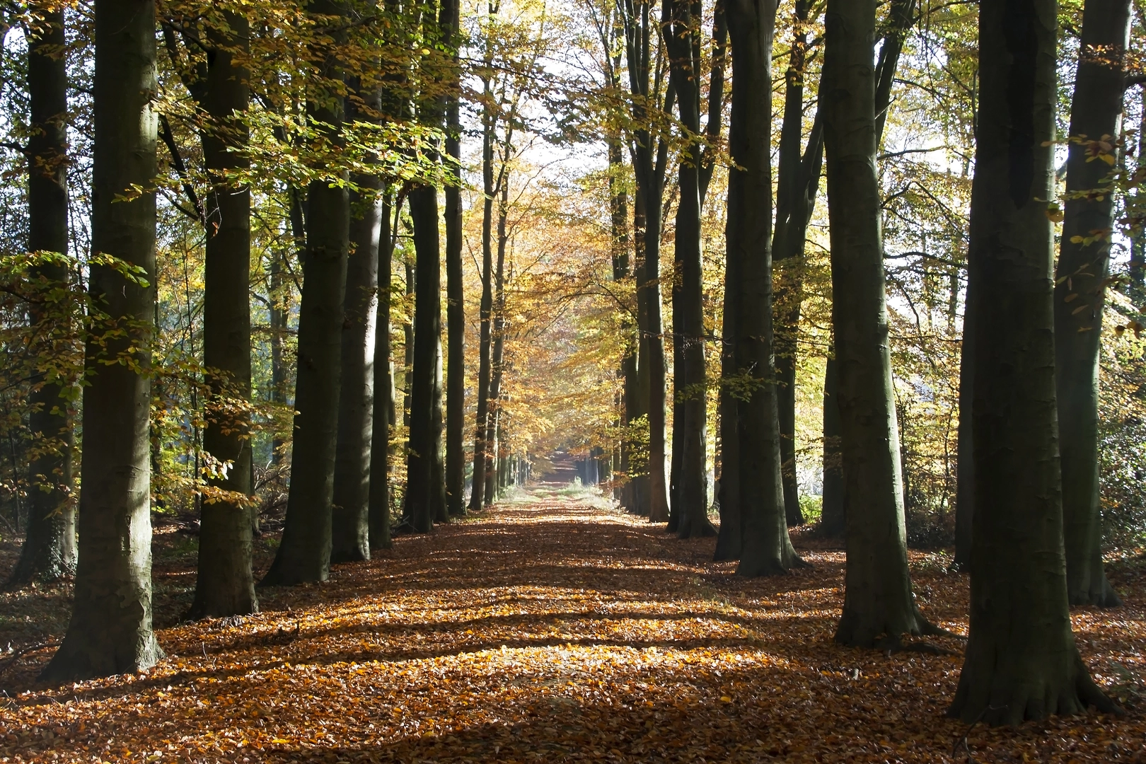
Landmarks, scenery, and the “Twente” character
This part of Overijssel is known for its patchwork farmland, hedgerows, and small woodlots—a classic Twente feel. Even without big elevation, the subtle rises around Hakenberg give you occasional slightly higher viewpoints over fields and scattered farms.
You’ll pass a rhythm of: - Farmsteads and barns set back from the track - Tree-lined lanes that feel sheltered on windy days - Open stretches where you can see far across the countryside
If the loop swings close to the village edge of De Lutte, you may also encounter small roadside chapels or wayside crosses—features that are common in the region and reflect long-standing local Catholic traditions.
Nature and wildlife to look out for
Wildlife sightings depend on time of day and season, but this landscape often rewards quiet walking: - Birdlife: skylarks and meadow birds over open fields; woodpeckers and songbirds in the wooded pockets; buzzards or kestrels hunting along field margins. - Mammals: hares and rabbits are common; roe deer are possible near dawn/dusk where fields meet woodland. - Plants: expect hedgerow blossoms in spring, tall grasses and wildflowers along verges in summer, and rich leaf color in autumn in the wooded sections.
Ticks can be present in grassy edges and low scrub in warmer months—long socks and a quick check afterward help.
Navigation and waymarking
This is the kind of route where you may see local waymarks, but they can be inconsistent at junctions with multiple farm tracks. Use HiiKER for turn-by-turn confidence, especially where: - A farm track splits into two similar-looking lanes - A field-edge path begins subtly at a corner gate - You transition from a lane onto a narrower grassy line
Mobile coverage is usually decent around villages and open farmland, but it can dip in small wooded hollows—download the map in HiiKER before you set off.
Practical planning: timing, kit, and hazards
- Time on trail: Most hikers will take 2.5–3.5 hours for 12 km (7.5 mi) at an easy pace with a few short pauses.
- Footwear: Waterproof trail shoes or light boots are ideal if it’s been wet; in dry conditions, comfortable walking shoes can work.
- Weather exposure: Open farmland can be windy and offers limited shade—bring a light wind layer and sun protection in summer.
- Farm traffic: Expect occasional tractors on shared tracks; step aside early and keep dogs close.
- Gates and livestock: If you pass grazing areas, close gates behind you and give animals space.
Historical context of the area
The De Lutte / Oldenzaal region sits in Twente, an area shaped by centuries of agriculture, small settlements, and borderland trade near Germany. The landscape’s pattern—fields, hedges, and scattered farms—reflects long-term rural land use rather than large-scale modern re-planning. Nearby Oldenzaal is one of the older towns in the region, and the broader area has a deep history tied to medieval settlement patterns and later cross-border movement, which is why you’ll often notice a mix of cultural markers (chapels, traditional farm layouts, and old lanes) even on a simple countryside loop.
If you paste the start coordinates (lon/lat) from Hii

Surfaces
Unknown
Asphalt
Unpaved
Gravel
Wood
Comments and Reviews
User comments, reviews and discussions about the Hakenberg and De Hooge Lutte Loop, Netherlands.
average rating out of 5
0 rating(s)