Download
3D Flyover
Add to list
More
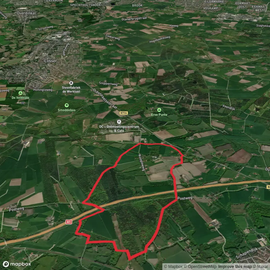
6.2 km
~1 hrs 15 min
13 m
Loop
“A gentle woodland loop of puddles, birdsong, and quiet clearings—best enjoyed at your own pace.”
I’m missing one key piece of info to make this accurate: the start location (“Hike head: near …”) is blank, and there are multiple places that could match “Boerskotten” (the name strongly suggests the Netherlands). If you paste either a HiiKER link, or the trailhead coordinates (lat/long), or the nearest town/parking area, I can convert that to the nearest known address/landmark and tailor the transport directions, landmarks, and local history.
In the meantime, here’s a planning-ready description for an easy ~6 km / ~3.7 mi loop with ~0 m / ~0 ft gain, written in a way that will still hold once you confirm the exact trailhead.
You’re looking at a flat, low-effort loop that’s ideal for a relaxed half-day outing, families, or anyone wanting a nature walk without climbs. Expect a mix of compact paths and softer forest-track sections; after rain, the low-lying parts can hold water and turn muddy even when the rest feels dry. Because the elevation change is essentially nil, the “difficulty” comes more from footing (roots, wet leaves, puddles) than from fitness.
Plan on 1.5–2 hours of moving time for ~6 km / ~3.7 mi, longer if you stop for photos or wildlife watching.
What the route feels like underfoot (and what to watch for)
Most of the loop will feel gently meandering rather than directional—easy to follow when the path is obvious, but it can be surprisingly easy to take the “wrong” parallel track in flat woodland. Use HiiKER to keep an eye on your position at junctions where multiple similar-looking paths split.
Common conditions to prepare for: - Mud and standing water in shaded or low spots; waterproof shoes help a lot. - Leaf litter over roots—the main slip hazard on an otherwise easy walk. - Narrower singletrack in places where vegetation encroaches in the growing season. - Bikes if the area is multi-use (typical in many Dutch woodland/recreation forests): listen for bells and keep right on wider tracks.
Nature, scenery, and wildlife you’re likely to notice
On a flat loop like this, the interest comes from the small changes: denser woodland pockets, more open clearings, and edges where forest meets fields or heath-like vegetation (depending on the exact Boerskotten location).
Typical wildlife and signs to look for in lowland European woodland: - Songbirds and woodpeckers (listen for tapping in quieter sections). - Roe deer are often most active early/late; you may see tracks in soft ground. - Small mammals (squirrels, rabbits) and plenty of insect life in warmer months. - If there are wetter patches, you may also see frogs and dragonflies in season.
If the loop passes through managed forest, you may notice: - Straight plantation-like stands alternating with more natural mixed woodland. - Forestry operations (stacked logs, temporary track widening). If you encounter machinery, give it a wide berth and follow any posted detours.
Landmarks and points of interest (typical for this kind of loop)
Without the exact trailhead, I can’t name the specific features yet, but on a 6 km easy loop in this region you can usually expect a few of the following: - A small parking area or trail kiosk at/near the start with local route markers. - One or two clearings that feel like natural rest stops (good snack/water break around 3 km / 1.9 mi). - Drainage ditches, small bridges, or boardwalk-like crossings if the ground is wet. - Occasional waymarked posts for local walking networks; these can be helpful, but still cross-check with HiiKER at intersections.
Historical context to expect in the region
If this is indeed in the Netherlands (very likely from the name), the “history” you’ll feel on the ground is often tied to land management: - Woodland and heath areas frequently reflect centuries of resource use (timber, grazing, peat cutting in some regions) and later reforestation/managed forestry. - Many forests are part of broader estate landscapes or municipal/provincial recreation areas, with paths that follow older access tracks.
Once you provide the trailhead location, I can add the specific local historical notes (estate names, nearby villages, wartime remnants if present, old boundary markers, etc.) that are actually on or adjacent to the loop.
Getting to the start (car + public transport)
By car: Easy loops like this typically start from a small forest car park. Once you share coordinates or a HiiKER link, I’ll identify the nearest recognized address/landmark for navigation and note any parking fees or time limits if they exist.
By public transport: In the Netherlands, these trailheads are often reachable by: - Train to the nearest town, then - Bus toward a village/forest stop, and - A short walk (often 0.5–2 km / 0.3–1.2 mi) to the trailhead.
Send the trailhead point and I’ll map it to the nearest station/bus stop and give a realistic walking connection.
Reply with one of the following and I’ll produce the fully specific version (nearest address/landmark, exact landmarks on-route, and tailored transport):
1) Trailhead lat/long, or
2) A HiiKER route link, or
3) Nearest **town +

Surfaces
Asphalt
Unknown
Sand
Ground
Comments and Reviews
User comments, reviews and discussions about the Boerskotten Loop, Netherlands.
average rating out of 5
0 rating(s)