Download
3D Flyover
Add to list
More
8.1 km
~1 hrs 37 min
8 m
Loop
“Wander windswept dunes and wild beaches, where lighthouse legends and flocks of birds paint Texel’s northern edge.”
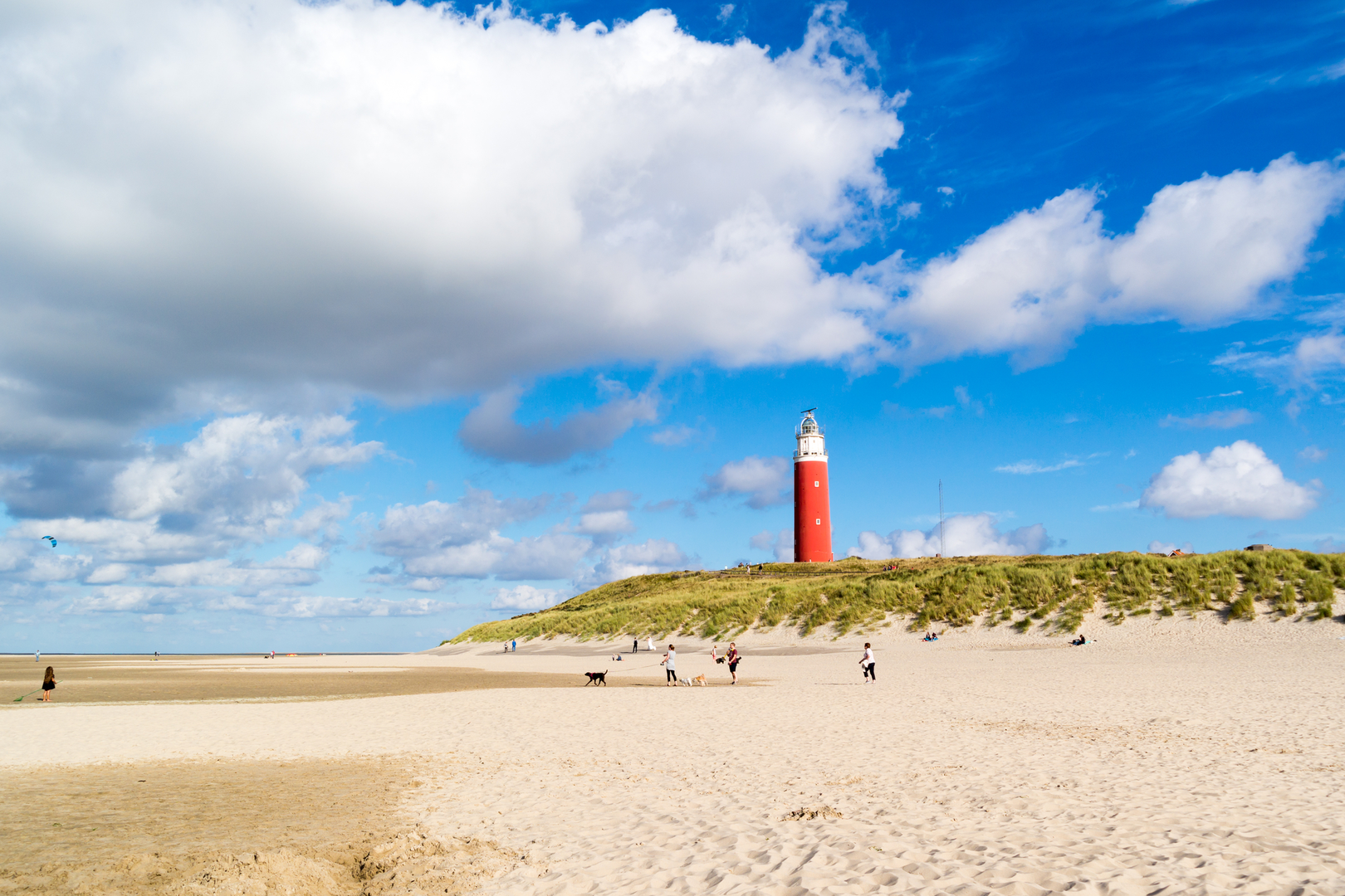
Starting from the northern tip of Texel, the Eierlandsche and De Robbenjager Loop begins near the iconic De Cocksdorp village, close to the striking red Eierland Lighthouse. This loop covers approximately 8 km (about 5 miles) with virtually no elevation gain, making it accessible for hikers of all abilities and ideal for families or those seeking a relaxed coastal walk.
Getting There
Reaching the trailhead is straightforward. If arriving by public transport, take the ferry from Den Helder to Texel, then use local buses to reach De Cocksdorp. The nearest bus stop is “De Cocksdorp, Vuurtoren,” just a short walk from the lighthouse and the start of the loop. For those driving, parking is available near the lighthouse at Vuurtorenweg, a well-known landmark on the island’s northernmost point.
Trail Experience and Navigation
The route is a gentle circuit through the windswept dunes and coastal grasslands of the Eierland and De Robbenjager nature reserves. Navigation is simple, with well-marked paths and clear signage throughout. For those who prefer digital navigation, the entire loop is mapped on HiiKER, ensuring you stay on track and don’t miss any highlights.
Landmarks and Natural Features
The Eierland Lighthouse, standing since 1864, is the most prominent landmark at the start and end of the loop. Its history as a beacon for ships navigating the treacherous North Sea is palpable, and the lighthouse itself can be visited for panoramic views of the Wadden Sea and North Sea.
As you move south and east from the lighthouse, the trail winds through the De Robbenjager reserve, a haven for birdlife. Spring and autumn bring migratory birds in large numbers, including spoonbills, avocets, and various species of geese and waders. The area is also known for its wild rabbits and, occasionally, seals basking on the sandbanks visible at low tide.
Dunes, Beaches, and Flora
The path alternates between sandy tracks, grassy dunes, and stretches along the wide, open beach. Expect to see resilient dune plants such as sea holly, marram grass, and wild orchids in summer. The shifting sands and salt-tolerant vegetation create a dynamic landscape that changes with the seasons and tides.
Historical Context
Eierland itself was once a separate island, joined to Texel by a sandbar in the 19th century. The region’s name, meaning “Egg Land,” refers to the abundance of bird eggs once collected here by locals. The De Robbenjager area, translating to “The Seal Hunter,” hints at the island’s long history of seal hunting and maritime activity.
Practical Considerations
With no significant elevation (0 metres/0 feet), the loop is suitable for all fitness levels. The exposed nature of the trail means wind and weather can change rapidly; bring layers and windproof clothing. There are no major facilities along the route, but De Cocksdorp village offers cafes, shops, and restrooms before or after your hike.
This loop provides a unique opportunity to experience Texel’s northern wilderness, rich in wildlife, history, and sweeping coastal views, all within a manageable distance for a half-day adventure.

Surfaces
Sand
Grass
Asphalt
Unknown
Gravel
Concrete
Comments and Reviews
User comments, reviews and discussions about the Eierlandsche and De Robbenjager Loop, Netherlands.
average rating out of 5
0 rating(s)