Download
3D Flyover
Add to list
More
34.7 km
~6 hrs 57 min
6 m
Multi-Day
“A wind-swept polder loop of big skies, reed-fringed canals, and dike-top rhythm beside the IJssel.”
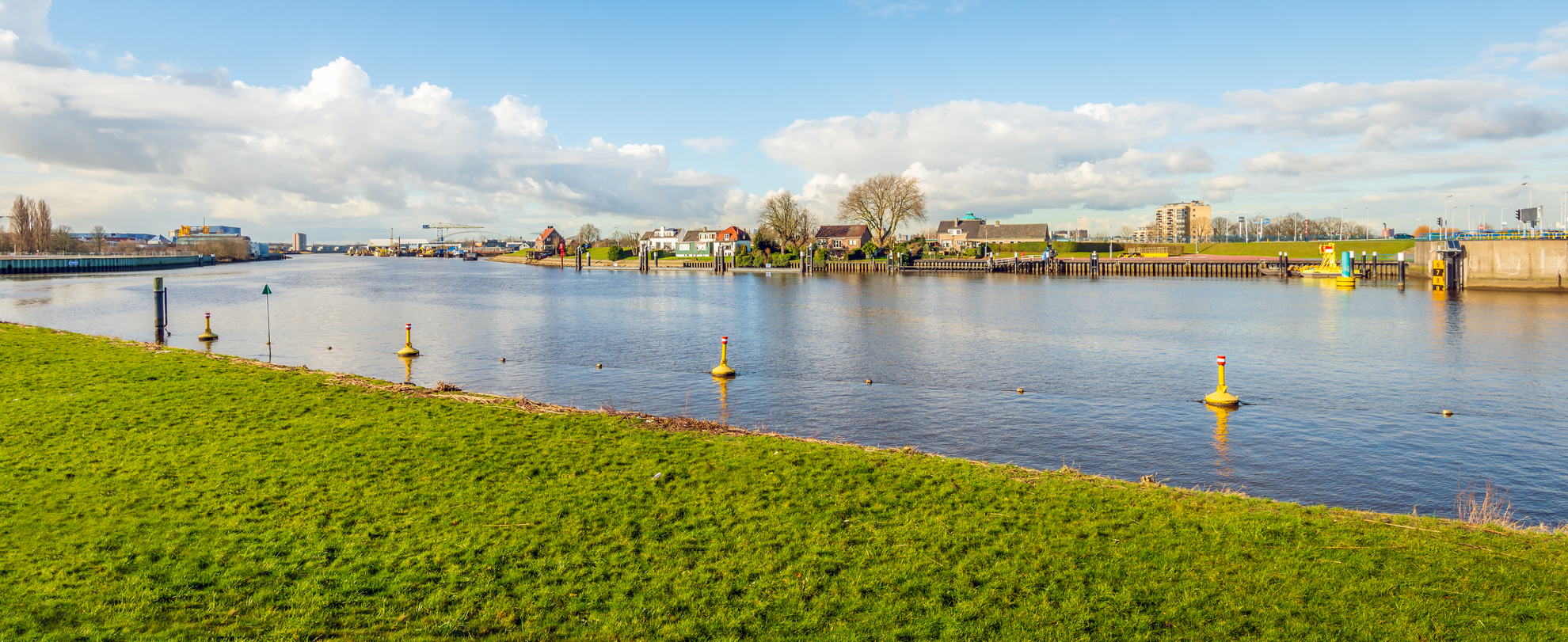
This is a long, low-lying loop through the Green Heart landscape between Rotterdam and Gouda: a classic Dutch polder walk with big skies, straight drainage canals, reed-fringed ditches, and long stretches on dikes beside the Hollandsche IJssel. At roughly 35 km (21.7 mi) with about 0 m (0 ft) of climbing, it’s physically “easy” in terms of elevation, but it’s still a full-day outing because of the distance and exposure to wind and weather.
Getting to the start (public transport + car)
Because the start point is listed only as “near,” the most practical way to pin it down is to aim for the Kortland / Kleinpolder area on the north side of the Hollandsche IJssel, between Nieuwerkerk aan den IJssel and Moordrecht. A reliable, well-known access point for this landscape is around Nieuwerkerk aan den IJssel station (NS), which sits close to the river corridor and polder paths and is commonly used as a gateway to the IJssel dikes.
- By public transport: Take the train to Nieuwerkerk aan den IJssel (NS) (on the Rotterdam–Gouda corridor). From the station area, you can walk a short connector to the dike paths and settle into the loop. Use HiiKER to confirm the exact trailhead spur and any temporary diversions.
- By car: Park near Nieuwerkerk aan den IJssel station or at signed public parking near the river/dike access points in town. In this region, parking rules can be strict in residential streets and near farm access lanes—look for designated lots and avoid blocking narrow polder roads.
Expect the route to be almost entirely on paved cycle paths, farm access roads, and compacted dike-top tracks. Mud is usually limited to short unpaved connectors, but after rain the grassy edges and field-side paths can be slick.
What the terrain feels like over 35 km (21.7 mi)
The “flat” profile doesn’t mean effortless: the main challenge is time on feet and wind. Dikes and open fields offer little shelter, so a moderate breeze can feel like a headwind for hours. Underfoot, the surfaces are generally firm and fast, which helps you keep a steady pace—just watch for: - Cyclists (often fast e-bikes) on shared paths - Narrow dike crests where passing requires care - Slippery algae on canal-side concrete edges - Livestock gates and farm driveways where tractors may appear suddenly
Plan your day like a marathon walk: steady pacing, short breaks, and consistent fueling. For most hikers, 6.5–9 hours moving time is typical depending on pace and stops.
Route flow and key sections (approximate)
Because loops here often stitch together dikes, polders, and small hamlets, the experience tends to come in “bands” rather than dramatic waypoints.
0–10 km (0–6.2 mi): Polder lanes and drainage canals
You’ll likely begin on straight, ruler-flat paths bordered by ditches, reed beds, and grazing fields. This is classic reclaimed-land geometry: long sightlines, scattered farmsteads, and the constant presence of water management infrastructure—culverts, pumping stations, and sluice-like controls. Even when you’re not right on the river, you’ll feel the polder logic: land kept dry by an engineered network.
10–22 km (6.2–13.7 mi): Hollandsche IJssel dike walking
This is usually the most distinctive part: a raised dike with the river on one side and lower polder land on the other. The walking is easy and rhythmic, but exposed. You’ll pass:
- Small marinas/boat moorings and riverside homes in places
- Willow and alder along wetter margins
- Occasional ferry crossings or bridges depending on the exact loop alignment (verify on HiiKER so you don’t arrive at a seasonal/limited-service crossing unexpectedly)
Keep an eye out for waterfowl: mute swans, coots, moorhens, and various ducks are common, and in migration seasons you may see larger flocks using the river corridor as a navigation line.
22–35 km (13.7–21.7 mi): Molenplaats area and return through open farmland
“Molenplaats” strongly suggests a mill-associated place-name, and in this region that typically ties back to the Netherlands’ long history of windmills and pumping used to drain and manage polders. Even if the original mill is gone or modernized, the landscape still reflects that heritage: straight canals, controlled water levels, and settlement patterns aligned with dikes and waterways. The final third often alternates between quiet farm roads and long, straight cycleways—mentally easier if you break it into small goals (next bridge, next hamlet, next dike bend).
Landmarks, nature, and what to look out for
- Water management features: The entire walk is a living lesson in Dutch hydraulic engineering. Look for pumping stations (gemalen), sluices, and reinforced canal banks—these are the reason the “elevation gain” is effectively zero yet the land remains usable.
- Birdlife: Expect geese, herons, cormorants, and raptors such as kestrels hovering over fields. In reedier stretches, you may hear (more than see

Surfaces
Asphalt
Unknown
Paved
Comments and Reviews
User comments, reviews and discussions about the Kortland Kleinpolder, Hollandsche Ijssel and Molenplaats Loop, Netherlands.
average rating out of 5
0 rating(s)