Download
3D Flyover
Add to list
More
23.0 km
~4 hrs 35 min
0 m
Point-to-Point
“From Spakenburg’s harbour hush to Eemmeer’s wind-brushed reeds, a flat, sky-wide wander.”
You’re looking at a classic Dutch “big-sky, big-water” day: roughly 23 km / 14.3 mi with essentially 0 m / 0 ft of climbing, linking the built-up edges of Bunschoten‑Spakenburg to the open shorelines and dike-top panoramas around Eemmeer. The walking is straightforward and physically easy, but it’s a long, exposed distance where wind, weather, and wet ground are the real factors.
For a practical start point, “Broerswetering” is best treated as the Broerswetering neighborhood in Bunschoten‑Spakenburg (Utrecht)—near the village center and a short walk from the historic harbor area. (funda.nl)
Getting to the start (car + public transport)
- By car: Aim for central Bunschoten‑Spakenburg (near the old village/harbor area) and park in public lots or street parking where permitted. From there, you can walk a few minutes to the Broerswetering area to begin.
- By public transport: The most common approach is to travel by train to Amersfoort Centraal, then take a regional bus toward Bunschoten‑Spakenburg. From the bus stop in town, it’s typically a short walk to the Broerswetering neighborhood.
(Exact bus lines and stop names change over time—check the day-of schedule and then load the route into HiiKER so you can match the start point precisely.)
What the route feels like underfoot
Expect a mix of: - Paved village paths leaving town - Dike-top or lakeside paths with long sightlines - Farm tracks and polder edges where surfaces can be firm in dry spells and slick after rain
Because the elevation is flat, the “difficulty” comes from distance + exposure: headwinds off the water can make a 14-mile day feel much longer.
Segment-by-segment expectations (approximate)
0–4 km / 0–2.5 mi: Leaving Broerswetering and the village edge
You’ll transition from residential streets into quieter lanes and drainage-ditch country. This is where it’s easiest to top up water or grab snacks before the landscape opens up.
4–12 km / 2.5–7.5 mi: Open polder and the first big water views
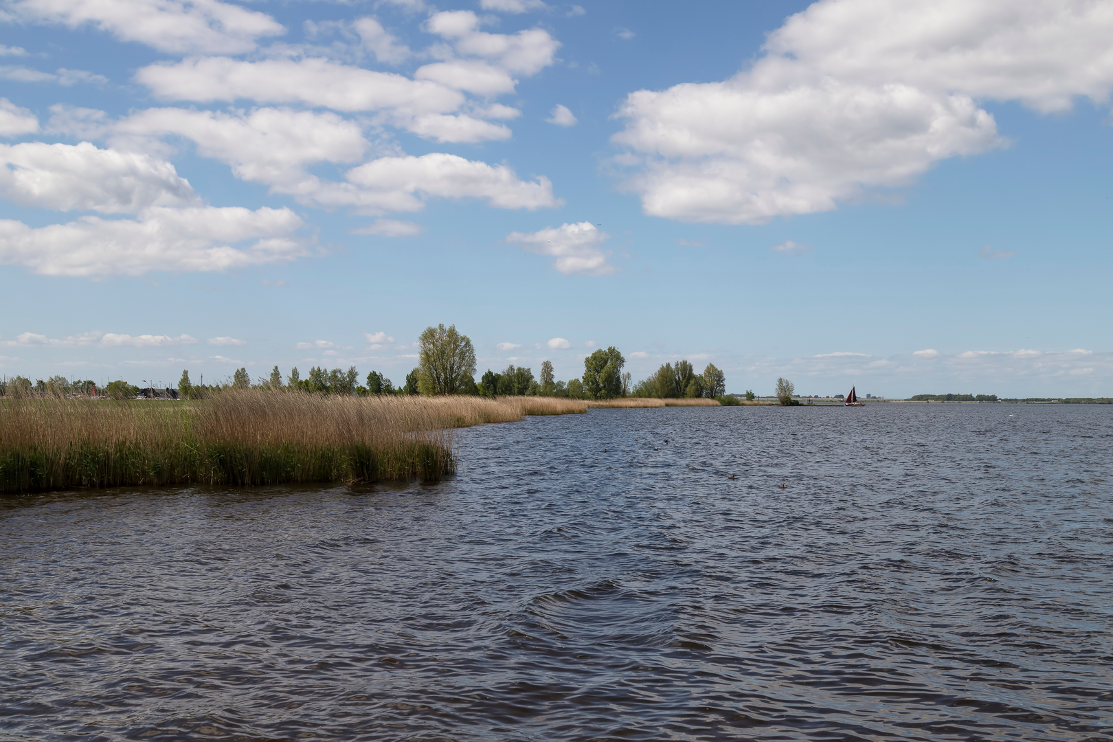
As you approach the Eemmeer side of the landscape, the horizon widens and you start getting that “peripheral lake” feel—broad water, reeds, and long linear dikes. Eemmeer itself sits at about sea level (0 m) and is part of the chain of border lakes that separate Flevoland’s polders from the older mainland. (en.wikipedia.org)
This middle stretch is where wind is most noticeable; plan your pacing so you don’t burn energy fighting gusts early.
12–18 km / 7.5–11.2 mi: Along Eemmeer—birds, reeds, and big-sky walking
This is the most “nature-forward” portion: reed beds, open water, and wet margins that attract birdlife. Even without entering a formal reserve, the Eemmeer region is strongly shaped by Dutch water engineering and wetland ecology—expect to see waterfowl and meadow birds and to hear constant movement in the reeds, especially in spring and early summer. (en.wikipedia.org)
If it has rained recently, watch for muddy pinch points where farm traffic has churned the track edges.
18–23 km / 11.2–14.3 mi: Turning toward Groot Kievitsdal and finishing
The final kilometers typically feel more sheltered as you angle away from the most exposed lakeside line. Fatigue tends to show up here because the terrain is so uniform—keep an eye on foot comfort and hotspots, and use HiiKER to stay on the intended line when multiple parallel farm tracks appear.
Landmarks and landscape character
- Eemmeer is the defining landmark: a broad, shallow border lake with a distinctly engineered origin and purpose—part of the system designed to manage groundwater differences between reclaimed polders and the higher old land. (en.wikipedia.org)
- Bunschoten‑Spakenburg adds cultural texture at the start/finish area: it’s a historic village north of Bunschoten, close to the IJsselmeer region, with a strong maritime/fishing identity in the wider area.

Surfaces
Unknown
Asphalt
Grass
Concrete
Sand
Paved
Dirt
Comments and Reviews
User comments, reviews and discussions about the Broerswetering to Groot Kievitsdal via Eemeer, Netherlands.
average rating out of 5
0 rating(s)