Download
3D Flyover
Add to list
More
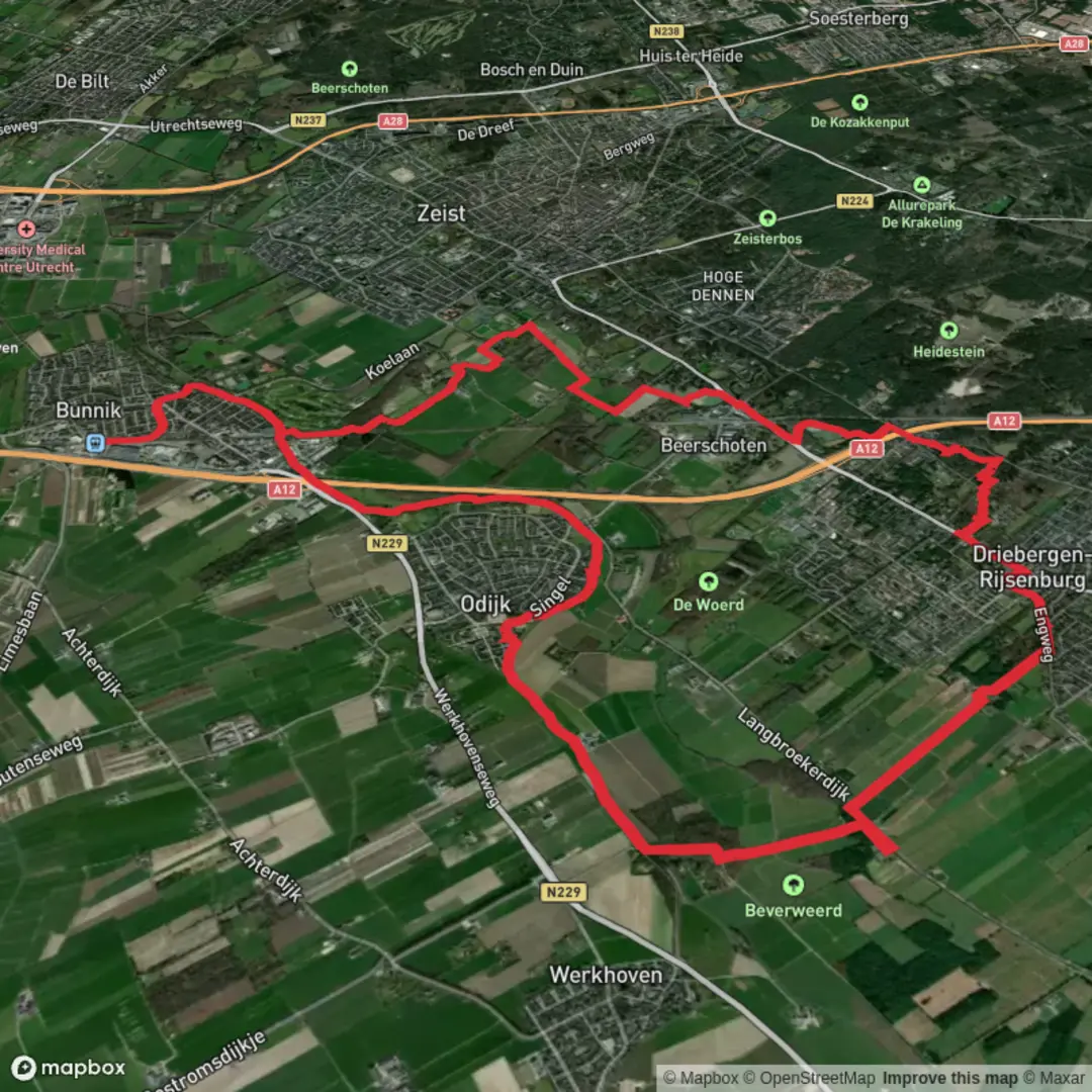
23.3 km
~4 hrs 40 min
15 m
Loop
“Wander past stately estates, wildflower meadows, and winding rivers on this charming Dutch countryside loop.”
Embarking on the combined Stoetwegenpad and Aderwinkelpad loop offers a delightful journey through the picturesque countryside of the Utrecht province in the Netherlands. This approximately 23-kilometer (14.3-mile) trail, with minimal elevation gain, is well-suited for hikers seeking an easy yet immersive experience in Dutch rural landscapes.
Getting to the Trailhead
The hike begins near Driebergen-Rijsenburg, a town conveniently accessible by both public transport and car. If traveling by train, disembark at Driebergen-Zeist Station. From there, it's a short walk to the starting point. For those driving, parking is available at Pannenkoekenhuis Princenhof, located at Hoofdstraat 1, Driebergen-Rijsenburg. (klompenpaden.nl)
Trail Overview
The loop combines two Klompenpaden (traditional Dutch clog trails): the Stoetwegenpad and the Aderwinkelpad. These trails are marked with red and blue clog symbols, respectively, guiding hikers through a diverse array of environments, including agricultural fields, historic estates, and serene forests.
Stoetwegenpad Segment
- Distance: Approximately 11 kilometers (6.8 miles)
- Highlights:
- Historic Estates: Traverse the Stichtse Lustwarande, a series of country estates and manor houses. Notable estates include Blikkenburg, Wulperhorst, and Rijnwijck, each offering a glimpse into the region's aristocratic past. (klompenpaden.nl)
- Kromme Rijn River: Follow the meandering path along the Kromme Rijn, a river that has played a significant role in the area's history and development.
- Natural Beauty: Enjoy the lush park forests and the tranquility of the countryside, with opportunities to spot local wildlife and seasonal wildflowers.
Aderwinkelpad Segment
- Distance: Approximately 10 kilometers (6.2 miles)
- Highlights:
- Agricultural Landscapes: Walk through traditional Dutch farmland, characterized by rows of pollard willows and open fields.
- Landgoed Broekbergen: Pass through this historic estate, featuring well-preserved architecture and scenic surroundings.
- Local Produce: Along the route, you'll find opportunities to purchase regional products at estate shops, enhancing the cultural experience of the hike. (klompenpaden.nl)
Navigation and Trail Conditions
The trails are well-marked with their respective clog symbols. For enhanced navigation, consider using the HiiKER app, which provides detailed maps and route information. Be aware that during wet seasons, certain sections, particularly on the Aderwinkelpad, can become muddy. Waterproof footwear is recommended to ensure comfort throughout the hike. (klompenpaden.nl)
Historical Significance
The region is steeped in history, with the Stichtse Lustwarande estates reflecting the wealth and architectural styles of the Dutch elite from the 17th and 18th centuries. The Kromme Rijn area has been integral to trade and agriculture, shaping the cultural landscape you experience along the trail.
Nature and Wildlife
Hikers can expect to encounter a variety of bird species, especially near the river and in forested areas. The diverse habitats support a range of flora and fauna, making it a rewarding experience for nature enthusiasts.
Amenities and Points of Interest
- Pannenkoekenhuis Princenhof: Located at the trailhead, this pancake house offers a delightful spot to start or conclude your hike with traditional Dutch pancakes. (klompenpaden.nl)
- Landwinkel de Hondspol: Along the Aderwinkelpad, this farm shop provides an opportunity to purchase organic dairy products and other local goods. (klompenpaden.nl)
Additional Tips
- Seasonal Considerations: The trail is accessible year-round, but spring and autumn offer particularly pleasant weather and vibrant landscapes.
- Trail Etiquette: Dogs are not permitted on certain sections of the trail to prevent disturbance to livestock and wildlife. Please adhere to local guidelines and signage. (klompenpaden.nl)
By combining the Stoetwegenpad and Aderwinkelpad, hikers are treated to a comprehensive exploration of the Utrechtse Heuvelrug's natural beauty, historical landmarks, and cultural heritage, all within a manageable and enjoyable day hike.

Surfaces
Unknown
Gravel
Asphalt
Grass
Dirt
Ground
Unpaved
Concrete
Wood
Sand
Comments and Reviews
User comments, reviews and discussions about the StoetWegenpad and Aderwinkelpad Loop, Netherlands.
average rating out of 5
0 rating(s)